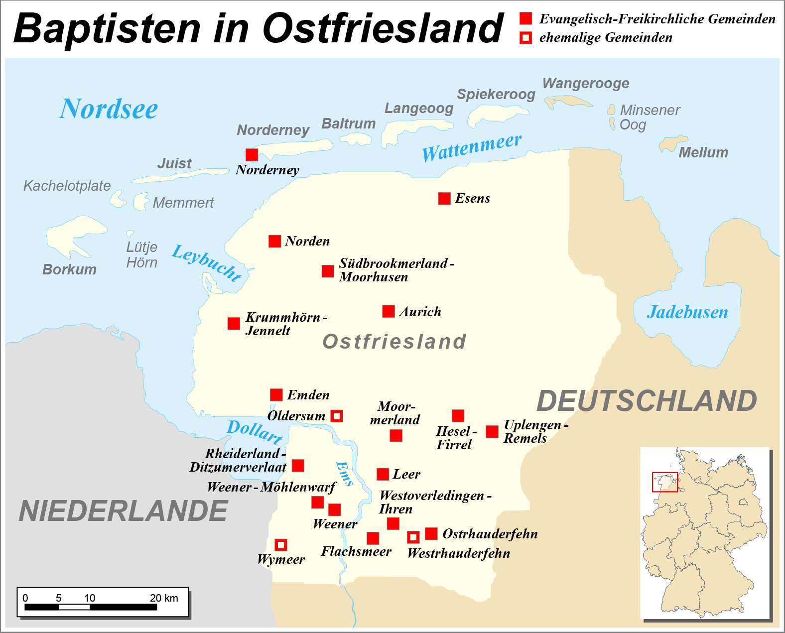
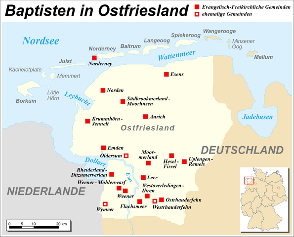
File:Karte der Baptistengemeinden in Ostfriesland.png
Jump to navigation
Jump to search
Size of this preview: 743 × 599 pixels. Other resolutions: 298 × 240 pixels | 595 × 480 pixels | 952 × 768 pixels | 1,270 × 1,024 pixels | 1,576 × 1,271 pixels.
Original file (1,576 × 1,271 pixels, file size: 216 KB, MIME type: image/png)
Captions
Captions
Add a one-line explanation of what this file represents
| Description |
|
| Date | |
| Source | Self made, using this base map created by Enricopedia |
| Author | Maximilian Dörrbecker (Chumwa) |
| Permission (Reusing this file) |
I, the copyright holder of this work, hereby publish it under the following license: This file is licensed under the Creative Commons Attribution-Share Alike 2.5 Generic license.
Sie dürfen das Bild zu den folgenden Bedingungen nutzen:
|
| Other versions |
|


File history
Click on a date/time to view the file as it appeared at that time.
| Date/Time | Thumbnail | Dimensions | User | Comment | |
|---|---|---|---|---|---|
| current | 21:08, 29 August 2018 | | 1,576 × 1,271 (216 KB) | Chumwa (talk | contribs) | Eine Korrekturbitte zu der von dir erstellten Karte "File:Karte der Baptistengemeinden in Ostfriesland.png". Könntest du Wymeer in "Ehemalige Gemeinde ..." umwandeln?! |
| 08:51, 13 September 2014 |  | 1,576 × 1,271 (216 KB) | Chumwa (talk | contribs) | "Hallo Chumwa, könntest Du bei Gelegenheit die og Karte korrigieren: "Hesel-Bagband" raus; "Flachsmeer" rein? Dank im Voraus!" mfg,GregorHelms (talk) 03:03, 8 April 2013 (UTC) | |
| 19:54, 27 March 2012 |  | 2,101 × 1,694 (328 KB) | Chumwa (talk | contribs) | {{Information |Description= *{{ de }} Karte der Baptisten in Ostfiriesland |Source=Self made, using this base map created by Enricopedia |Date=2012-03 |Author= [[:de:User:Chumwa|Maximilian Dörrbecker]... |
You cannot overwrite this file.
File usage on Commons
The following 4 pages use this file:
File usage on other wikis
The following other wikis use this file: