File:Karte Villgratner Berge.png
Jump to navigation
Jump to search
Size of this preview: 799 × 382 pixels. Other resolutions: 320 × 153 pixels | 640 × 306 pixels | 1,024 × 490 pixels | 1,280 × 612 pixels | 2,560 × 1,224 pixels | 5,325 × 2,546 pixels.
Original file (5,325 × 2,546 pixels, file size: 2.51 MB, MIME type: image/png)
Captions
Captions
Add a one-line explanation of what this file represents
Summary[edit]
| Description |
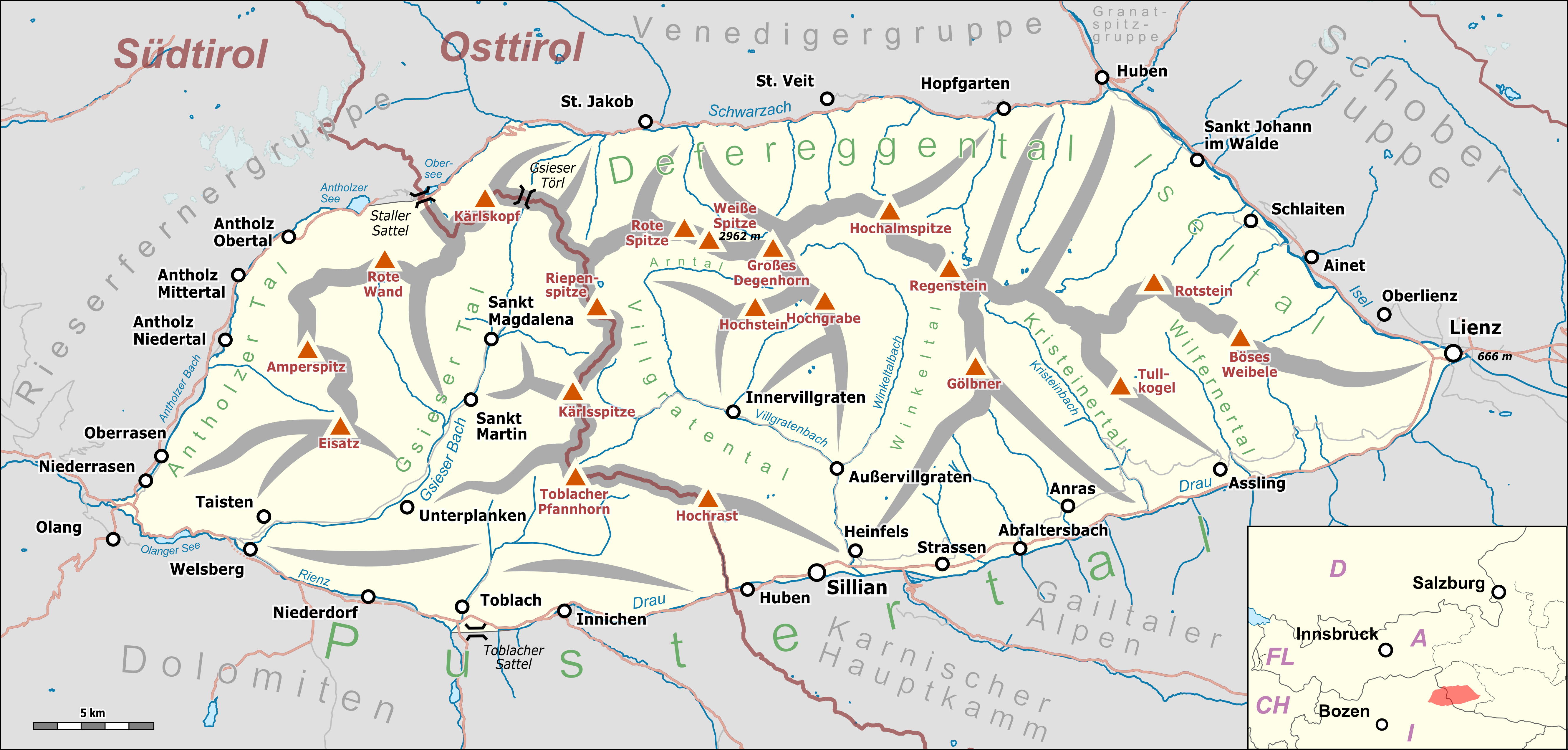
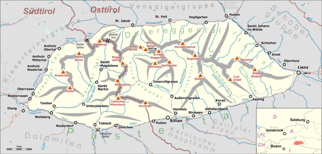
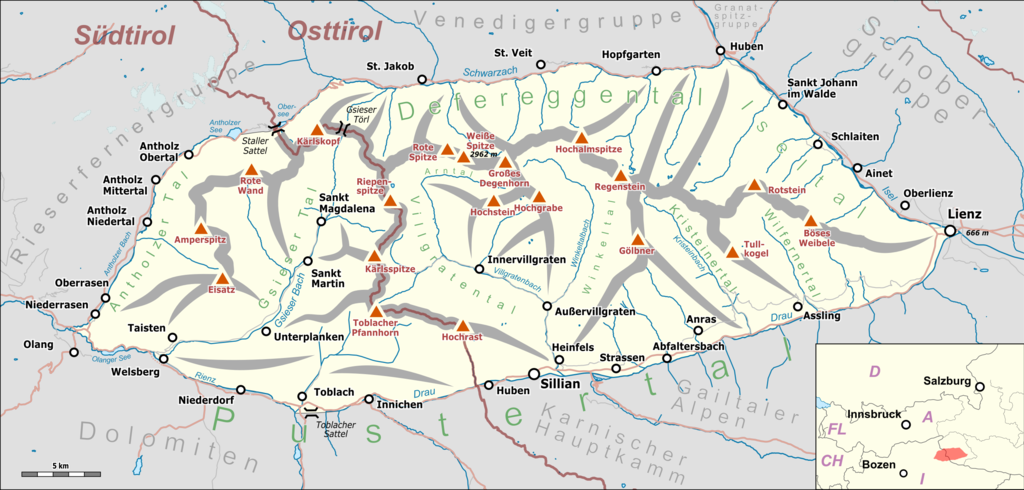
Deutsch: Übersichtskarte der Villgratner Berge. |
|||||||||
| Date | ||||||||||
| Source |
Map was created using:
|
|||||||||
| Creator |
|
|||||||||
| Permission (Reusing this file) |
Map data (c) OpenStreetMap (and) contributors, CC-BY-SA | |||||||||
| Geotemporal data | ||||||||||
| Bounding box |
|
|||||||||
| Georeferencing | ||||||||||
| This work is licensed under the Open Database License (summary). |
File history
Click on a date/time to view the file as it appeared at that time.
| Date/Time | Thumbnail | Dimensions | User | Comment | |
|---|---|---|---|---|---|
| current | 22:44, 22 February 2019 | | 5,325 × 2,546 (2.51 MB) | Pechristener (talk | contribs) | korr gemäss Disk |
| 18:33, 31 January 2019 |  | 5,325 × 2,546 (2.5 MB) | Pechristener (talk | contribs) | korr gemäss Disk | |
| 22:11, 30 January 2019 |  | 5,325 × 2,546 (2.52 MB) | Pechristener (talk | contribs) | == {{int:filedesc}} == {{Map |Description={{de|1=Übersichtskarte der {{w|Villgratner Berge||de}}. }} |Source = Map was created using: *[http://www.openstreetmap.org/ Open Street Map] Data *{{w|Austria location map.svg}} for location map |Author = *Hauptkarte: Pechristener *{{w|Austria location map.svg}} : NordNordWest, {{u|Lencer}} |Date =2017-07-13 |Permission =Map data (c) OpenStreetMap (and) contributors, CC-BY-S... |
You cannot overwrite this file.
File usage on Commons
The following 8 pages use this file:
- Alps
- User:Anton-kurt/Tyrol new files/2019 February 19-28
- User:Anton-kurt/Tyrol new files/2019 January 21-31
- User:J budissin/Uploads/BiH/2019 February 19-28
- User:J budissin/Uploads/BiH/2019 January 21-31
- User:Mai-Sachme/South Tyrol/2019 February 19-28
- User:Mai-Sachme/South Tyrol/2019 January 21-31
- Category:Villgratner Mountains
File usage on other wikis
The following other wikis use this file:
- Usage on arz.wikipedia.org
- Usage on de.wikipedia.org
- Usage on it.wikipedia.org
- Usage on www.wikidata.org