File:Karte Südliche Berliner Vorortbahn (SBV).jpg
Jump to navigation
Jump to search
Size of this preview: 540 × 599 pixels. Other resolutions: 216 × 240 pixels | 432 × 480 pixels | 692 × 768 pixels | 922 × 1,024 pixels | 1,818 × 2,018 pixels.
Original file (1,818 × 2,018 pixels, file size: 5.06 MB, MIME type: image/jpeg)
Captions
Captions
Add a one-line explanation of what this file represents
Summary[edit]
.jpg&action=edit§ion=1)
| Description |
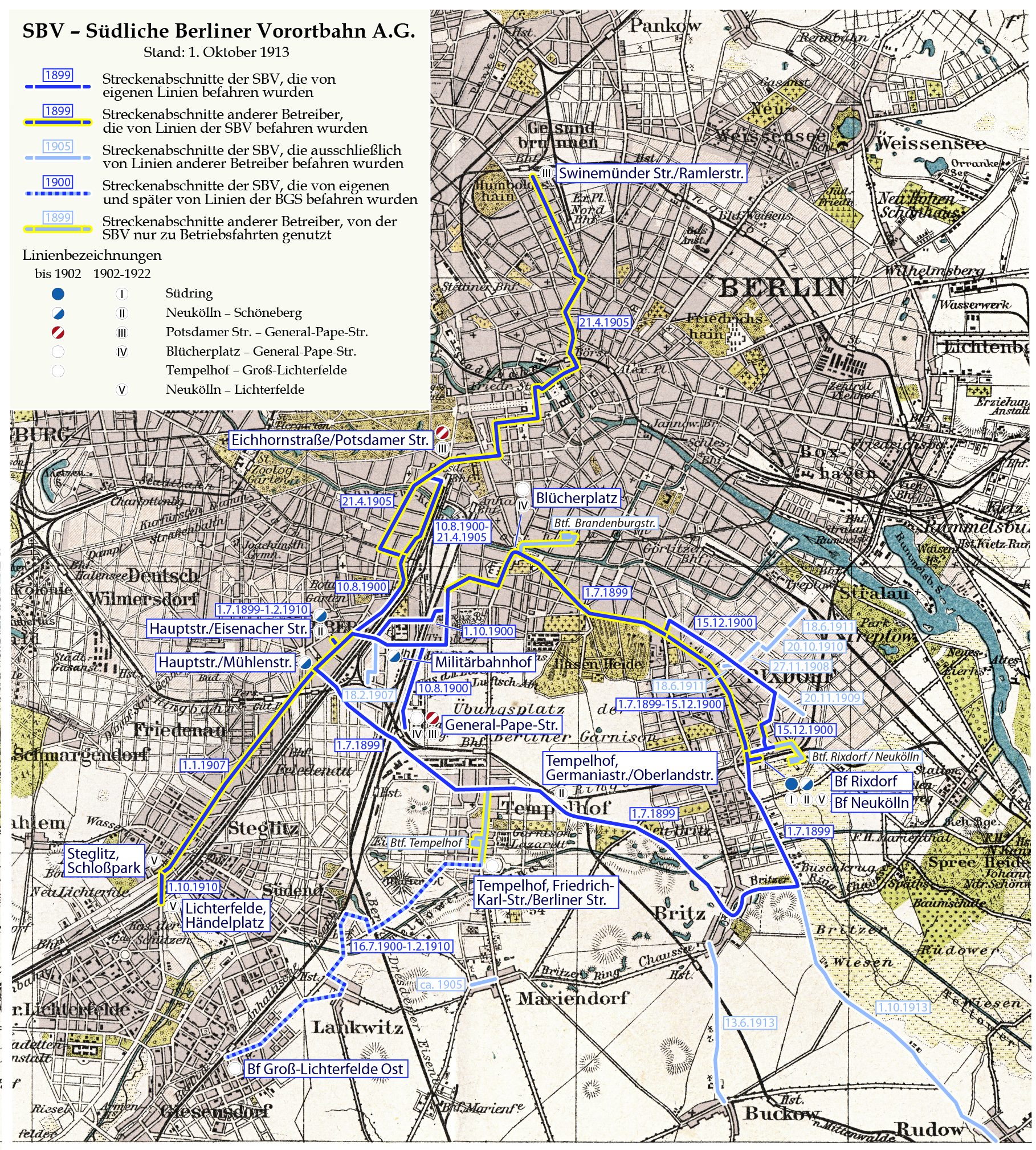
Deutsch: Karte der Südlichen Berliner Vorortbahn (SBV) |
| Date | see file history |
| Source | Own work, using a 1905 map from Meyers Konversationslexikon as background |
| Author | Maximilian Dörrbecker (Chumwa) |
| Permission (Reusing this file) |
I, the copyright holder of this work, hereby publish it under the following license: This file is licensed under the Creative Commons Attribution-Share Alike 2.5 Generic license.
Sie dürfen das Bild zu den folgenden Bedingungen nutzen:
|
File history
Click on a date/time to view the file as it appeared at that time.
| Date/Time | Thumbnail | Dimensions | User | Comment | |
|---|---|---|---|---|---|
| current | 19:58, 15 December 2015 | | 1,818 × 2,018 (5.06 MB) | Chumwa (talk | contribs) | |
| 21:54, 14 December 2015 |  | 1,818 × 2,018 (5.06 MB) | Chumwa (talk | contribs) | ||
| 18:27, 13 December 2015 |  | 1,818 × 2,018 (5.06 MB) | Chumwa (talk | contribs) | ||
| 08:26, 13 December 2015 |  | 1,818 × 1,840 (4.73 MB) | Chumwa (talk | contribs) | ||
| 20:08, 10 December 2015 |  | 1,530 × 1,815 (3.95 MB) | Chumwa (talk | contribs) | == {{int:filedesc}} == {{Information | Description = {{de|1=Karte der Südlichen Berliner Vorortbahn (SBV)}} |Source = {{own}}, using a 1905 map from Meyers Konversationslexikon a... |
You cannot overwrite this file.
File usage on Commons
The following 7 pages use this file:
- User:Chumwa/Gallery
- User:Chumwa/OgreBot/Public transport information/2015 December 1-10
- User:Chumwa/OgreBot/Public transport information/2015 December 11-20
- User:Chumwa/OgreBot/Transport Maps/2015 December 1-10
- User:Chumwa/OgreBot/Transport Maps/2015 December 11-20
- User:Nordlicht8/Rail Germany/2015 December 1-10
- User:Nordlicht8/Rail Germany/2015 December 11-20
File usage on other wikis
The following other wikis use this file:
- Usage on de.wikipedia.org
.jpg&oldid=454964272)