File:Karte Nordwestpassage und Nordostpassage.png
Jump to navigation
Jump to search
Size of this preview: 600 × 600 pixels. Other resolutions: 240 × 240 pixels | 480 × 480 pixels | 768 × 768 pixels | 1,152 × 1,152 pixels.
Original file (1,152 × 1,152 pixels, file size: 469 KB, MIME type: image/png)
Captions
Captions
Add a one-line explanation of what this file represents
Summary[edit]
| Description |
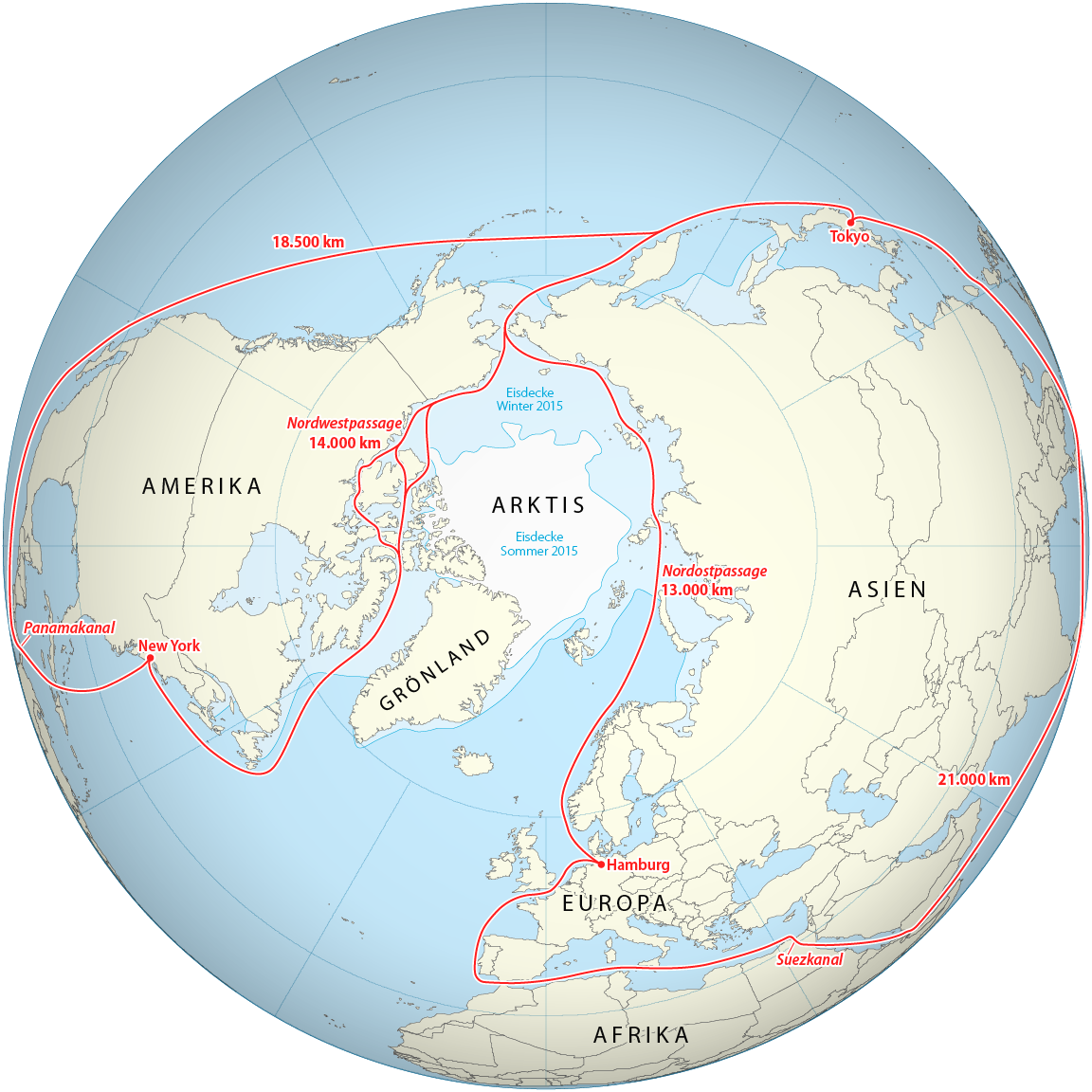
Deutsch: Karte der Nordwestpassage und der Nordostpassage sowie der alternativen Routen über den Panamakanal bzw. den Suezkanal |
| Date | see file history |
| Source | this map of the northern hemisphere |
| Author | Maximilian Dörrbecker (Chumwa) |
| Permission (Reusing this file) |
I, the copyright holder of this work, hereby publish it under the following license: This file is licensed under the Creative Commons Attribution-Share Alike 2.5 Generic license.
Sie dürfen das Bild zu den folgenden Bedingungen nutzen:
|
File history
Click on a date/time to view the file as it appeared at that time.
| Date/Time | Thumbnail | Dimensions | User | Comment | |
|---|---|---|---|---|---|
| current | 05:28, 20 October 2017 | | 1,152 × 1,152 (469 KB) | Chumwa (talk | contribs) | |
| 20:26, 19 October 2017 |  | 1,152 × 1,152 (469 KB) | Chumwa (talk | contribs) | ||
| 18:58, 19 October 2017 |  | 1,152 × 1,152 (471 KB) | Chumwa (talk | contribs) | ||
| 17:15, 17 October 2017 |  | 1,152 × 1,152 (472 KB) | Chumwa (talk | contribs) | ||
| 04:57, 17 October 2017 |  | 1,152 × 1,152 (422 KB) | Chumwa (talk | contribs) | ||
| 17:33, 16 October 2017 |  | 1,152 × 1,152 (414 KB) | Chumwa (talk | contribs) | == {{int:filedesc}} == {{Information | Description = {{de|1=Karte der Norwestpassage und der Nordostpassage sowie der alternativen Routen über dan Panamakanal bzw. den Suezkanal}} |Source = this map of the [[:File:Worldmap_northern.svg|norther... |
You cannot overwrite this file.
File usage on Commons
The following 2 pages use this file:
- User:Chumwa/Gallery
- File:Karte Norwestpassage und Nordostpassage.png (file redirect)
File usage on other wikis
The following other wikis use this file:
- Usage on de.wikipedia.org
- Usage on uk.wikipedia.org