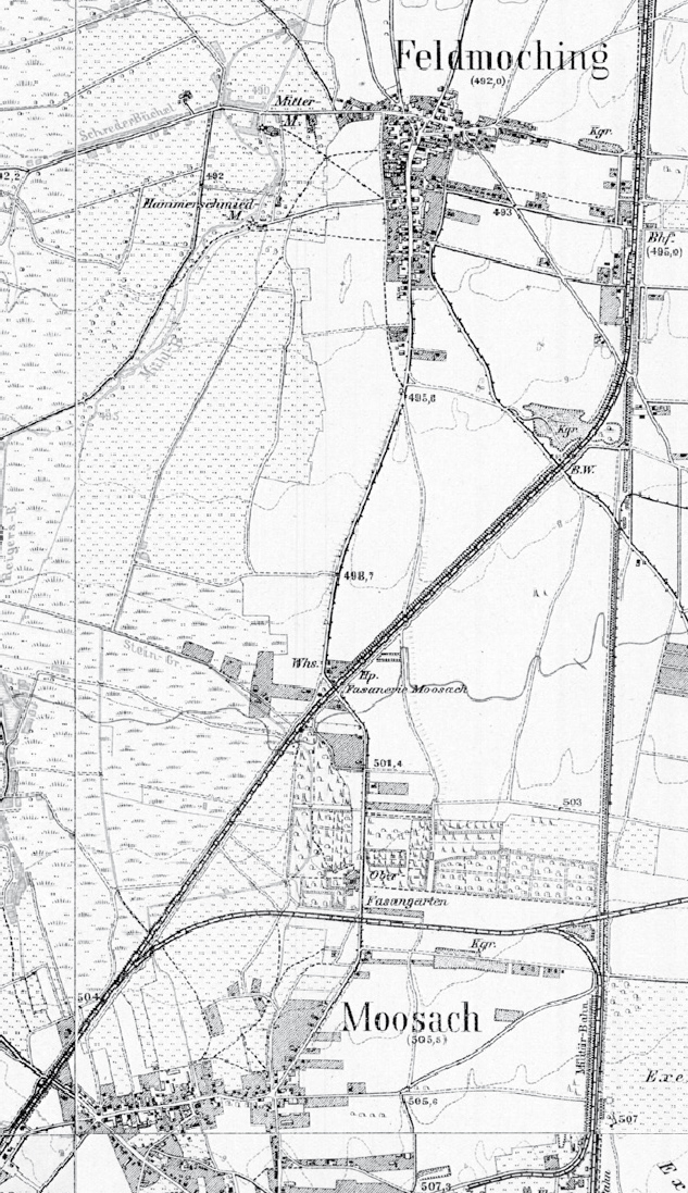
File:Karte München und Vororte um 1910 Fasanerie-Nord.jpg
Jump to navigation
Jump to search
Size of this preview: 346 × 600 pixels. Other resolutions: 138 × 240 pixels | 633 × 1,097 pixels.
Original file (633 × 1,097 pixels, file size: 505 KB, MIME type: image/jpeg)
Captions
Captions
Add a one-line explanation of what this file represents
| Description |
|
|||||
| Date | see file history | |||||
| Source |
Own work, using these pages from the Topographische Karte Bayern:
|
|||||
| Author | Maximilian Dörrbecker (Chumwa) | |||||
| Permission (Reusing this file) |
This file is licensed under the Creative Commons Attribution-Share Alike 2.0 Generic license.
The Topographische Karte Bayern 1:25.000 sheets from 1907-1914 are in the Public Domain:
|
|||||
| Other versions |
|


File history
Click on a date/time to view the file as it appeared at that time.
| Date/Time | Thumbnail | Dimensions | User | Comment | |
|---|---|---|---|---|---|
| current | 18:43, 20 June 2020 | | 633 × 1,097 (505 KB) | VanGore (talk | contribs) | File:Karte München und Vororte um 1910.jpg cropped 90 % horizontally, 83 % vertically using CropTool with lossless mode. |
You cannot overwrite this file.
File usage on Commons
The following page uses this file:
File usage on other wikis
The following other wikis use this file:
- Usage on de.wikipedia.org