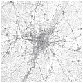
File:Karte München und Vororte um 1910.jpg

Original file (6,384 × 6,379 pixels, file size: 25.58 MB, MIME type: image/jpeg)
Captions
Captions
| DescriptionKarte München und Vororte um 1910.jpg |
|
|||||||
| Date | see file history | |||||||
| Source |
Own work, using these pages from the Topographische Karte Bayern:
|
|||||||
| Author | Maximilian Dörrbecker (Chumwa) | |||||||
| Permission (Reusing this file) |
This file is licensed under the Creative Commons Attribution-Share Alike 2.0 Generic license.
The Topographische Karte Bayern 1:25.000 sheets from 1907-1914 are in the Public Domain:
|
|||||||
| Other versions |
|
File history
Click on a date/time to view the file as it appeared at that time.
| Date/Time | Thumbnail | Dimensions | User | Comment | |
|---|---|---|---|---|---|
| current | 19:23, 29 December 2022 |  | 6,384 × 6,379 (25.58 MB) | Ricardalovesmonuments (talk | contribs) | Reverted to version as of 18:39, 24 August 2015 (UTC) leider keine wirkliche Verbesserung |
| 18:39, 29 December 2022 |  | 11,969 × 11,961 (83.62 MB) | Georgfotoart (talk | contribs) | Schärfe, Kotrast, Größe | |
| 18:39, 24 August 2015 |  | 6,384 × 6,379 (25.58 MB) | Chumwa (talk | contribs) | {{Information |Description= *{{de|Karte von München und seinen Vororten. Zusammengesetzt aus diversen Blättern der Topographischen Karte Bayern 1:25.000 aus den Jahren 1907-1914}} *{{en|Map of Munich and its suburbs. Compiled from some sheets of the... |
You cannot overwrite this file.
File usage on Commons
The following 10 pages use this file:
- Old city maps of Munich
- User:Chumwa/Gallery
- User:Chumwa/OgreBot/München/2015 August 21-31
- File:Karte Centralwerkstätte Aubing um 1910.jpg
- File:Karte München und Vororte um 1910.jpg
- File:Karte München und Vororte um 1910 Fasanerie-Nord.jpg
- File:Karte München und Vororte um 1910 Feldmoching mit Bahnhof.jpg
- File:Karte München und Vororte um 1910 Hasen-Berg mit Feldmoching.jpg
- File:Karte Straßenbahn München - Generallinienplan 1928.jpg
- File:Karte Straßenbahn München - Generallinienplan 1928.png
File usage on other wikis
The following other wikis use this file:
- Usage on de.wikipedia.org
Metadata
This file contains additional information such as Exif metadata which may have been added by the digital camera, scanner, or software program used to create or digitize it. If the file has been modified from its original state, some details such as the timestamp may not fully reflect those of the original file. The timestamp is only as accurate as the clock in the camera, and it may be completely wrong.
| Unique ID of original document | adobe:docid:photoshop:326b50f2-9995-11dc-a478-fd318150a41b |
|---|---|
| Software used | Adobe Illustrator CS5.1 |
| Date and time of digitizing | 22:09, 24 August 2015 |
| File change date and time | 18:10, 24 August 2015 |
| Date metadata was last modified | 22:09, 24 August 2015 |


