File:Karte Kitzbüheler Alpen.png
Jump to navigation
Jump to search
Size of this preview: 800 × 476 pixels. Other resolutions: 320 × 191 pixels | 640 × 381 pixels | 1,024 × 610 pixels | 1,280 × 762 pixels | 2,560 × 1,524 pixels | 3,937 × 2,344 pixels.
Original file (3,937 × 2,344 pixels, file size: 2.34 MB, MIME type: image/png)
Captions
Captions
Add a one-line explanation of what this file represents
Summary[edit]
| Description |
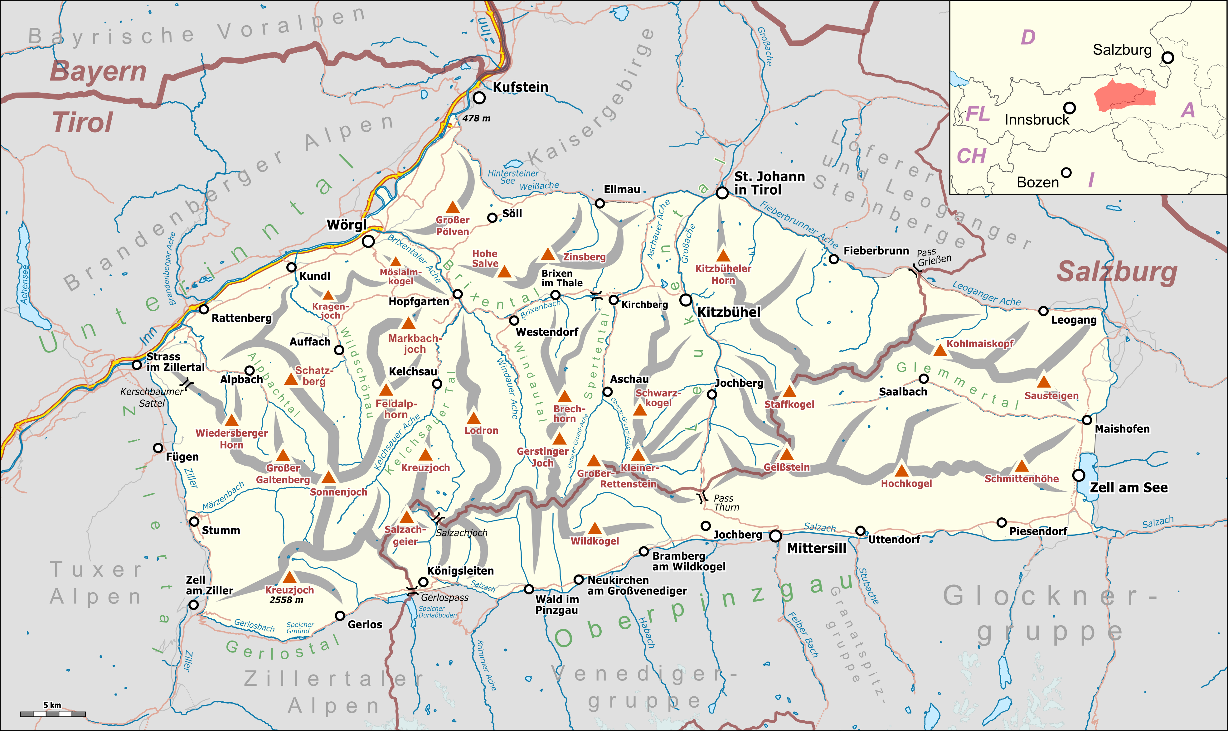
Deutsch: Übersichtskarte der Kitzbüheler Alpen. |
|||||||||
| Date | ||||||||||
| Source |
Own work Map was created using:
|
|||||||||
| Creator |
|
|||||||||
| Permission (Reusing this file) |
Map data (c) OpenStreetMap (and) contributors, CC-BY-SA | |||||||||
| Geotemporal data | ||||||||||
| Bounding box |
|
|||||||||
| Georeferencing | ||||||||||
| This work is licensed under the Open Database License (summary). |
File history
Click on a date/time to view the file as it appeared at that time.
| Date/Time | Thumbnail | Dimensions | User | Comment | |
|---|---|---|---|---|---|
| current | 17:31, 28 January 2019 | | 3,937 × 2,344 (2.34 MB) | Pechristener (talk | contribs) | einige Korrekturen gemäss Disk |
| 23:06, 27 January 2019 |  | 3,937 × 2,344 (2.32 MB) | Pechristener (talk | contribs) | diverse Korrekturen gemäss Disk | |
| 19:41, 27 January 2019 |  | 3,937 × 2,344 (2.32 MB) | Pechristener (talk | contribs) | == {{int:filedesc}} == {{Map |Description={{de|1=Übersichtskarte des {{w|Kitzbüheler Alpen|Kitzbüheler Alpen|de}}. }} |Source ={{own}} Map was created using: *[http://www.openstreetmap.org/ Open Street Map] Data *{{f|Austria, administrative divisions - de-.svg}} for location map |Author = *Hauptkarte: Pechristener *{{f|Austria, administrative divisions - de-.svg}} : TUBS |Date =2019-01-22 |Permission =Map data (c) OpenStre... |
You cannot overwrite this file.
File usage on Commons
The following 5 pages use this file:
File usage on other wikis
The following other wikis use this file:
- Usage on arz.wikipedia.org
- Usage on bg.wikipedia.org
- Usage on de.wikipedia.org
- Kitzbüheler Alpen
- Liste der Gebirgsgruppen in den Ostalpen (nach AVE)
- Bochumer Hütte
- Bürglhütte
- Benutzer Diskussion:Pechristener/Archiv/1
- Vorlage:Positionskarte Kitzbüheler Alpen
- Benutzer Diskussion:Pechristener/Alpenkarten
- Sonnleitnerhütte (Kitzbüheler Alpen)
- Dr.-Erich-Berger-Hütte
- Neue Bubenreuther Hütte
- Usage on it.wikipedia.org
- Usage on lv.wikipedia.org
- Usage on nl.wikipedia.org
- Usage on pl.wikivoyage.org
- Usage on sl.wikipedia.org
- Usage on uk.wikipedia.org
- Usage on www.wikidata.org