File:Karte Geologische Strukturen des Rheinischen Schiefergebirges.png
Jump to navigation
Jump to search
Size of this preview: 800 × 454 pixels. Other resolutions: 320 × 182 pixels | 640 × 363 pixels | 1,024 × 581 pixels | 1,280 × 727 pixels | 2,341 × 1,329 pixels.
Original file (2,341 × 1,329 pixels, file size: 5.14 MB, MIME type: image/png)
Captions
Captions
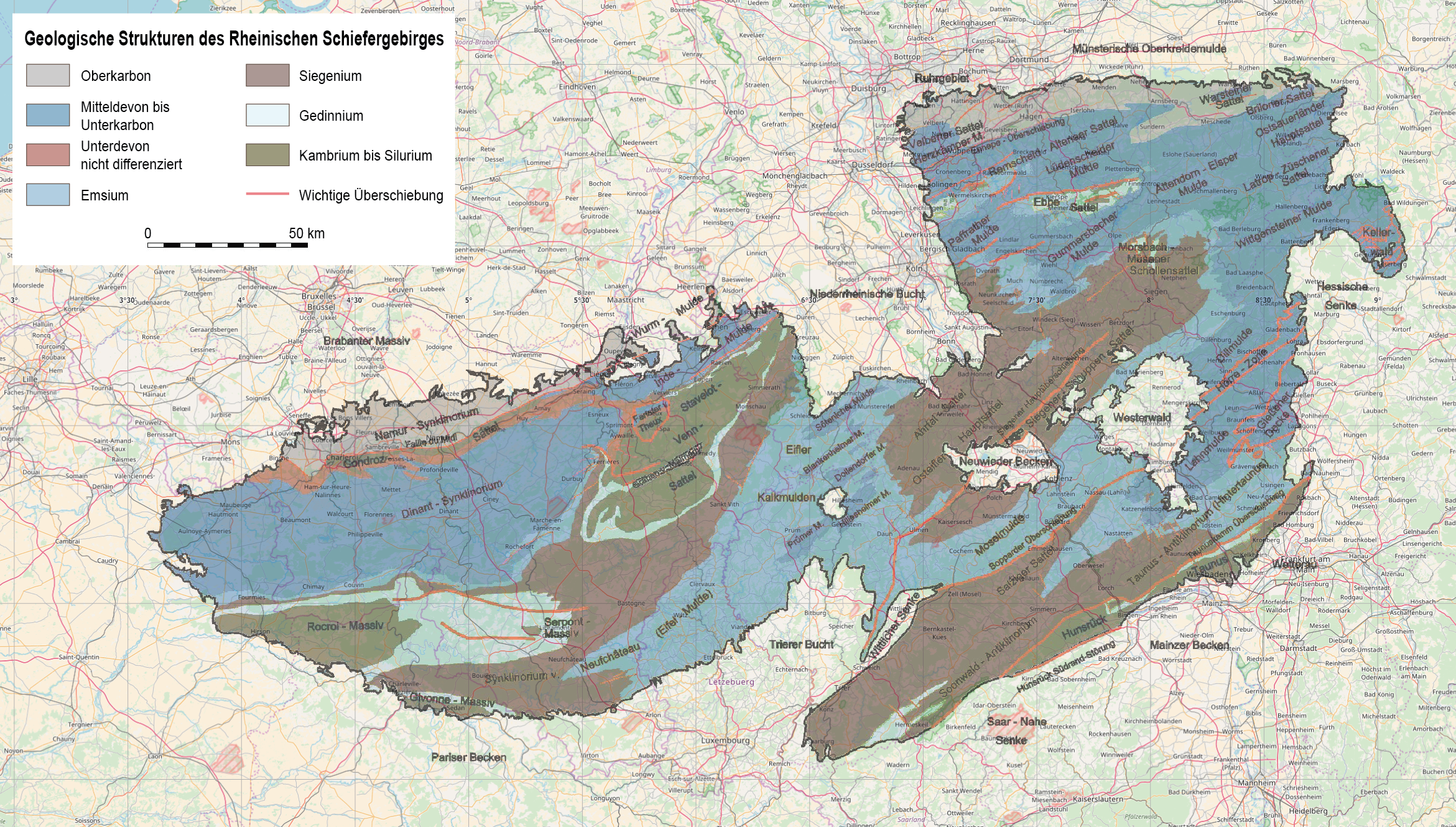
Map of the geological structures of the Rhein Slate Mountains
| Description |
Deutsch: Karte der geologischen Strukturen des Rheinischen Schiefergebirges |
|||
| Date | see file history | |||
| Source |
Own work using:
|
|||
| Author | Maximilian Dörrbecker (Chumwa) | |||
| Permission (Reusing this file) |
|
File history
Click on a date/time to view the file as it appeared at that time.
| Date/Time | Thumbnail | Dimensions | User | Comment | |
|---|---|---|---|---|---|
| current | 06:38, 30 October 2017 | | 2,341 × 1,329 (5.14 MB) | Chumwa (talk | contribs) | |
| 06:30, 30 October 2017 |  | 2,341 × 1,329 (5.12 MB) | Chumwa (talk | contribs) | ||
| 21:41, 29 October 2017 |  | 2,341 × 1,329 (5.13 MB) | Chumwa (talk | contribs) | {{Information |Description={{de|Karte der geologischen Strukturen des Rheinischen Schiefergebirges}} |Author=Maximilian Dörrbecker (Chumwa) |Source={{own using}} * [[:File:Geologische Strukturen des Rheinischen... |
You cannot overwrite this file.
File usage on Commons
The following page uses this file:
File usage on other wikis
The following other wikis use this file:
- Usage on de.wikipedia.org