File:Karte Eifelkalkmulden in der Kalkeifel.png
Jump to navigation
Jump to search
Size of this preview: 604 × 599 pixels. Other resolutions: 242 × 240 pixels | 484 × 480 pixels | 774 × 768 pixels | 1,027 × 1,019 pixels.
Original file (1,027 × 1,019 pixels, file size: 1.39 MB, MIME type: image/png)
Captions
Captions
Add a one-line explanation of what this file represents
| Description |
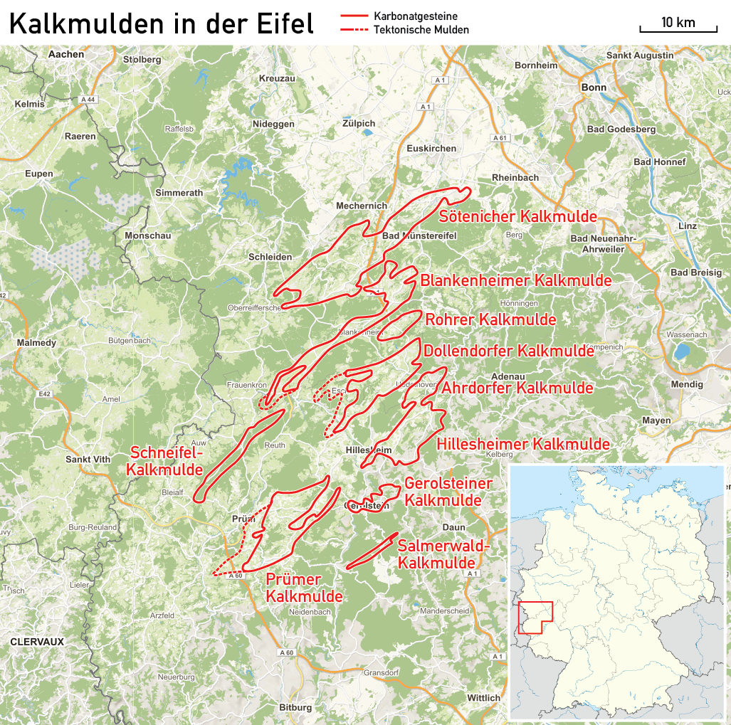
Deutsch: Karte der Eifelkalkmulden in der Kalkeifel |
|||
| Date | see file history | |||
| Source |
Own work using:
|
|||
| Author | Maximilian Dörrbecker (Chumwa) | |||
| Permission (Reusing this file) |
|
File history
Click on a date/time to view the file as it appeared at that time.
| Date/Time | Thumbnail | Dimensions | User | Comment | |
|---|---|---|---|---|---|
| current | 06:13, 7 November 2017 | | 1,027 × 1,019 (1.39 MB) | Chumwa (talk | contribs) | |
| 22:31, 4 November 2017 |  | 1,069 × 1,062 (1.41 MB) | Chumwa (talk | contribs) | ||
| 21:47, 29 October 2017 |  | 1,034 × 1,026 (1.39 MB) | Chumwa (talk | contribs) | {{Information |Description={{de|Karte der Eifelkalkmulden in der Kalkeifel}} |Author=Maximilian Dörrbecker (Chumwa) |Source={{own using}} * this file by {{U|NordNordWest}} for... |
You cannot overwrite this file.
File usage on Commons
The following page uses this file:
File usage on other wikis
The following other wikis use this file:
- Usage on de.wikipedia.org
- Usage on de.wikivoyage.org
- Usage on www.wikidata.org