File:Karte-Haus-Burgund 5-es.svg
Jump to navigation
Jump to search

Size of this PNG preview of this SVG file: 459 × 599 pixels. Other resolutions: 184 × 240 pixels | 368 × 480 pixels | 589 × 768 pixels | 785 × 1,024 pixels | 1,570 × 2,048 pixels | 5,442 × 7,100 pixels.
Original file (SVG file, nominally 5,442 × 7,100 pixels, file size: 2.12 MB)
Captions
Captions
Add a one-line explanation of what this file represents
Summary[edit]
| Description |
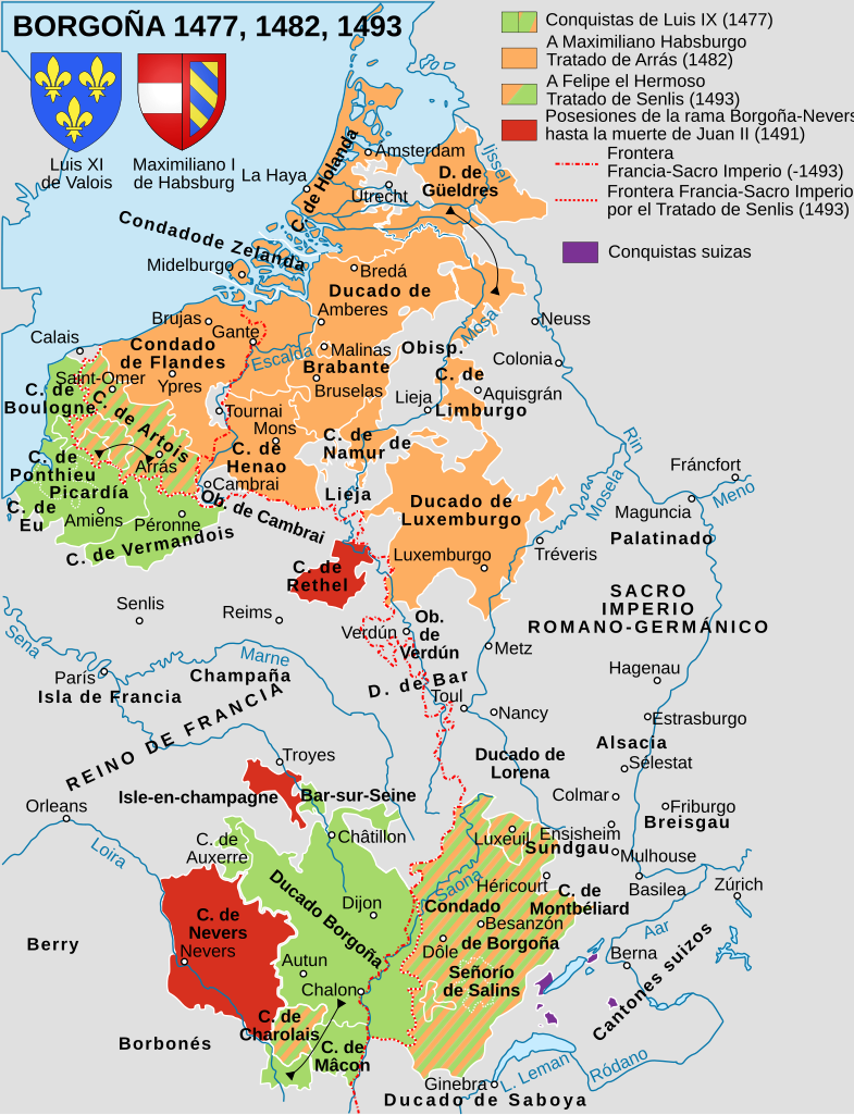
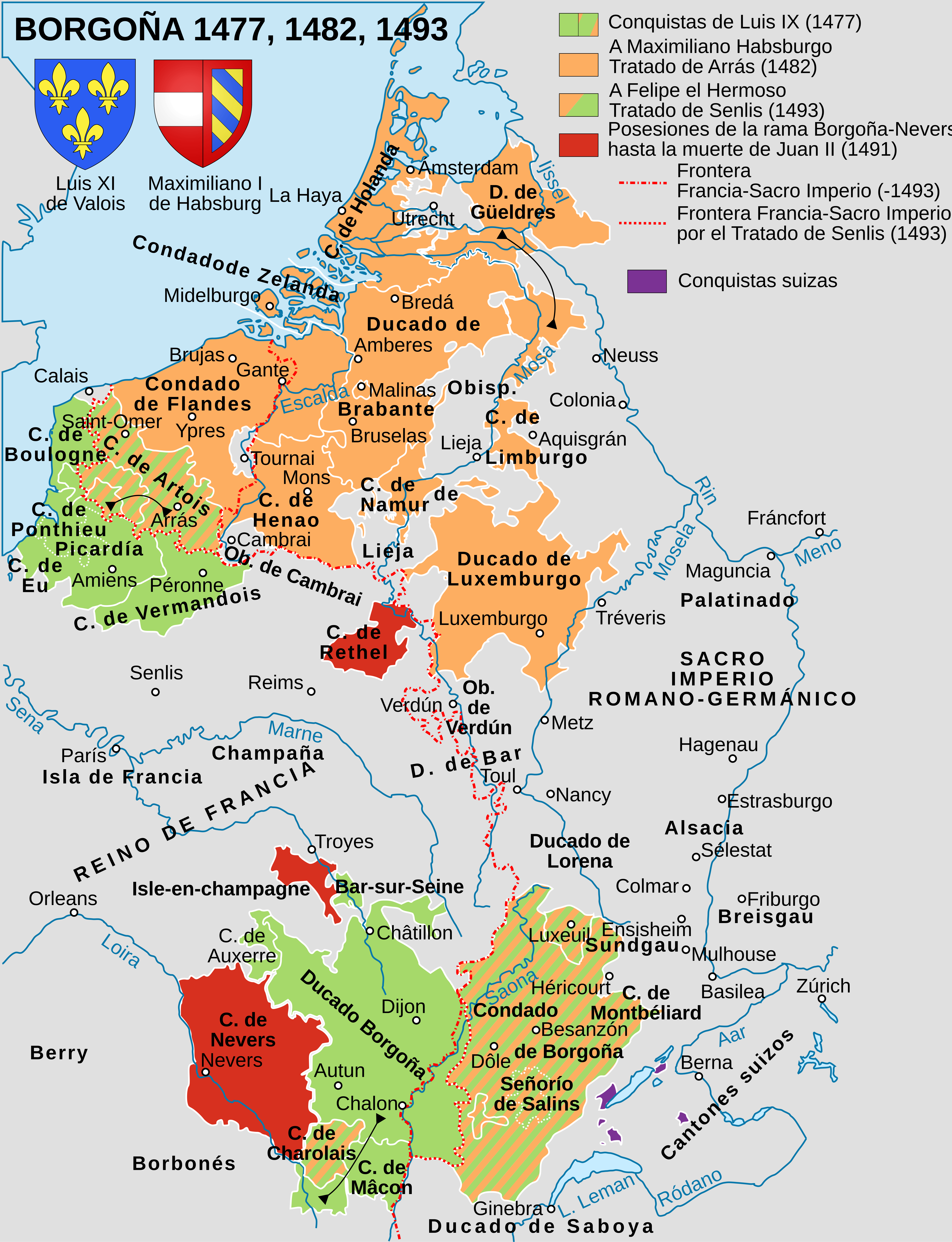
Español: La división de las tierras borgoñonas entre Francia y los Habsburgo entre 1477 y 1493. |
| Date | |
| Source | Karte-Haus-Burgund 4-es.svg |
| Author |
Karte Haus Burgund 5.png: Sidonius (talk · contribs) Karte-Haus-Burgund 4-es.svg: Sidonius (talk · contribs)
|
Licensing[edit]
You may use my work outside wikipedia for free as long as you name me as the author. If you would like to use my work in a print medium, please send me a specimen copy.
Contact me if you have questions regarding the license or if you want individual changes to the map (marco.zanoli at hotmail.ch). This file is licensed under the Creative Commons Attribution-Share Alike 4.0 International license. Attribution: Marco Zanoli
|
File history
Click on a date/time to view the file as it appeared at that time.
| Date/Time | Thumbnail | Dimensions | User | Comment | |
|---|---|---|---|---|---|
| current | 11:36, 29 April 2017 | | 5,442 × 7,100 (2.12 MB) | Rowanwindwhistler (talk | contribs) | User created page with UploadWizard |
You cannot overwrite this file.
File usage on Commons
The following 3 pages use this file:
File usage on other wikis
The following other wikis use this file:
- Usage on ast.wikipedia.org
- Usage on es.wikipedia.org
- Usage on fi.wikipedia.org
- Usage on uz.wikipedia.org