File:Karst peaks and green paddy fields under a stormy sky, South view from Mount Nam Xay, Vang Vieng, Laos.jpg
Jump to navigation
Jump to search
Size of this preview: 800 × 450 pixels. Other resolutions: 320 × 180 pixels | 640 × 360 pixels | 1,024 × 576 pixels | 1,280 × 720 pixels | 2,560 × 1,440 pixels | 6,494 × 3,653 pixels.
Original file (6,494 × 3,653 pixels, file size: 10.1 MB, MIME type: image/jpeg)
Captions
Captions
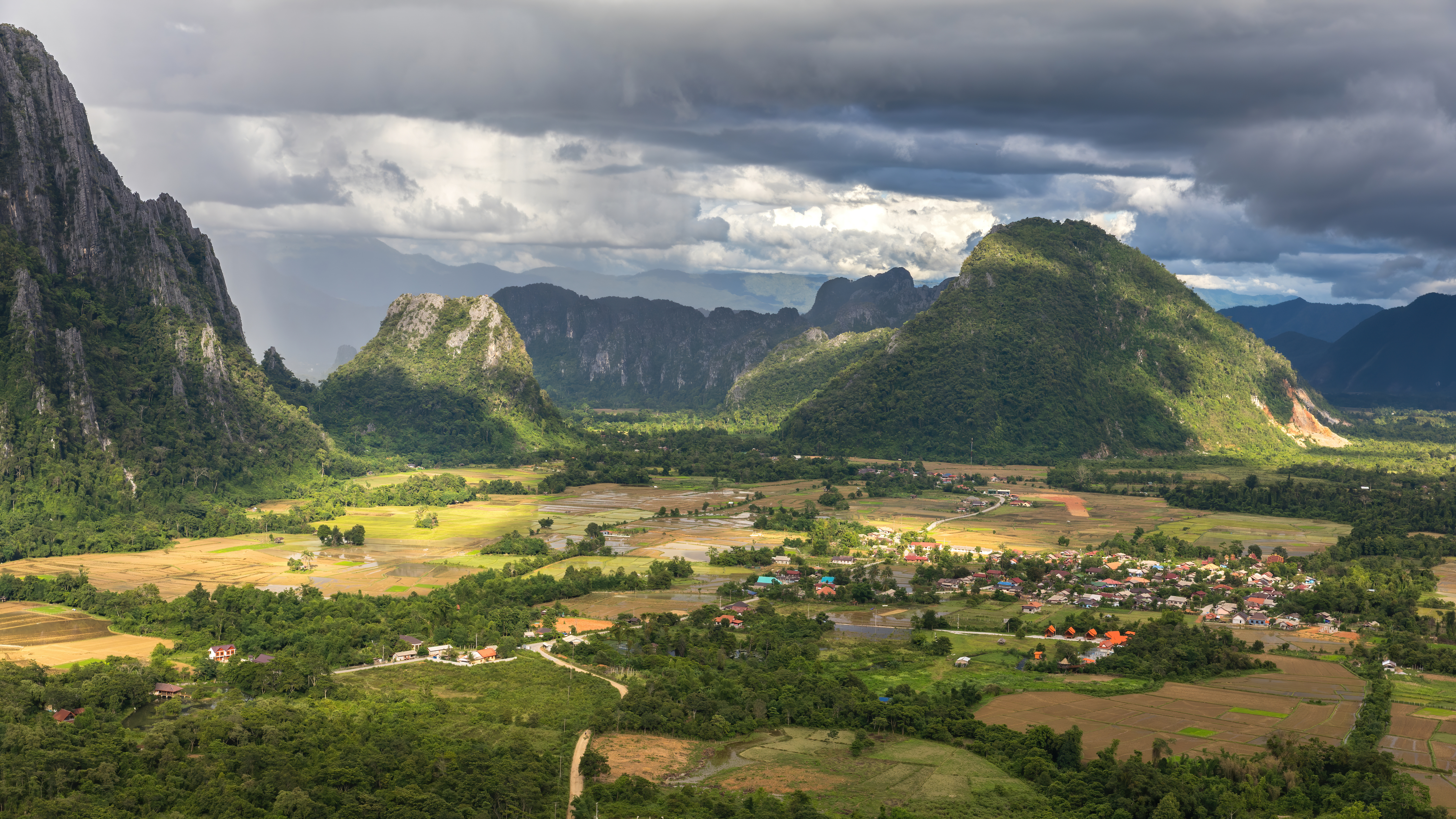
Karst peaks and green paddy fields under a stormy sky, South view from Mount Nam Xay, Vang Vieng, Laos
Summary[edit]
| Description |
English: Karst peaks and green paddy fields under a stormy sky, South view from the top of Mount Nam Xay, during the monsoon, in Vang Vieng, Vientiane Province, Laos.
Français : Pitons karstiques et rizières vertes sous un ciel orageux, vue sud depuis le sommet du Mont Nam Xay, durant la mousson, à Vang Vieng, Province de Vientiane, Laos. |
| Date | |
| Source | Own work |
| Author | Basile Morin |
| Other versions |
 |
| Camera location | | View this and other nearby images on: OpenStreetMap |
|---|
Assessment[edit]
This image was selected as picture of the day on Vietnamese Wikipedia for 26 March 2023.
|
|
Licensing[edit]
I, the copyright holder of this work, hereby publish it under the following license:
This file is licensed under the Creative Commons Attribution-Share Alike 4.0 International license.
- You are free:
- to share – to copy, distribute and transmit the work
- to remix – to adapt the work
- Under the following conditions:
- attribution – You must give appropriate credit, provide a link to the license, and indicate if changes were made. You may do so in any reasonable manner, but not in any way that suggests the licensor endorses you or your use.
- share alike – If you remix, transform, or build upon the material, you must distribute your contributions under the same or compatible license as the original.
File history
Click on a date/time to view the file as it appeared at that time.
| Date/Time | Thumbnail | Dimensions | User | Comment | |
|---|---|---|---|---|---|
| current | 00:47, 26 July 2020 | | 6,494 × 3,653 (10.1 MB) | Basile Morin (talk | contribs) | Uploaded own work with UploadWizard |
You cannot overwrite this file.
File usage on Commons
The following 20 pages use this file:
- ປະເທດລາວ
- User:Basile Morin
- User:Firefly/2020-B
- User:Meiræ/21
- User talk:Basile Morin/Archive 7 (2020)
- Commons:Featured picture candidates/File:Karst peaks and green paddy fields under a stormy sky, South view from Mount Nam Xay, Vang Vieng, Laos.jpg
- Commons:Featured picture candidates/Log/July 2020
- Commons:Featured pictures/Places/Natural
- Commons:Featured pictures/chronological/2020-B
- Commons:Featured pictures/chronological/July 2020
- Commons:Picture of the Year/2020/Candidates
- Commons:Picture of the Year/2020/R1/Gallery/2020-B
- Commons:Picture of the Year/2020/R1/Gallery/ALL
- Commons:Picture of the Year/2020/R1/Gallery/M07
- Commons:Picture of the Year/2020/R1/Gallery/Settlements
- Commons:Picture of the Year/2020/R1/v/Karst peaks and green paddy fields under a stormy sky, South view from Mount Nam Xay, Vang Vieng, Laos.jpg
- Commons:Quality images/Subject/Places/Mixed/Archive4
- Commons:Quality images candidates/Archives July 28 2020
- File:Karst peaks and green paddy fields under a stormy sky view from Mount Nam Xay Vang Vieng Laos.jpg
- Category:Laos
File usage on other wikis
The following other wikis use this file:
- Usage on arz.wikipedia.org
- Usage on ast.wikipedia.org
- Usage on ca.wikipedia.org
- Usage on cy.wikipedia.org
- Usage on dag.wikipedia.org
- Usage on de.wikivoyage.org
- Usage on diq.wikipedia.org
- Usage on en.wikipedia.org
- Usage on fa.wikipedia.org
- Usage on fr.wikinews.org
- Usage on fr.wikivoyage.org
- Usage on ga.wikipedia.org
- Usage on gl.wikipedia.org
- Usage on ha.wikipedia.org
- Usage on ia.wikipedia.org
- Usage on ku.wikipedia.org
- Usage on oc.wikipedia.org
- Usage on ru.wikinews.org
- Usage on uk.wikipedia.org
- Usage on vec.wikipedia.org
- Usage on vi.wikipedia.org
- Usage on www.wikidata.org