File:Karnataka divisions.svg
Jump to navigation
Jump to search

Size of this PNG preview of this SVG file: 481 × 600 pixels. Other resolutions: 192 × 240 pixels | 385 × 480 pixels | 616 × 768 pixels | 821 × 1,024 pixels | 1,643 × 2,048 pixels | 1,890 × 2,356 pixels.
Original file (SVG file, nominally 1,890 × 2,356 pixels, file size: 212 KB)
Captions
Captions
Add a one-line explanation of what this file represents
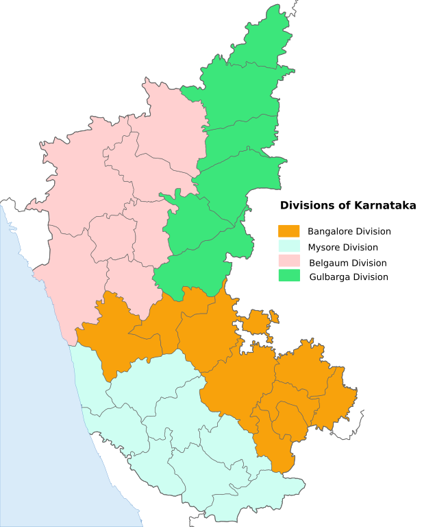
| Description | Karnataka map with the 4 administrative divisions shaded. |
| Date | (UTC) |
| Source | |
| Author |
|
| This is a retouched picture, which means that it has been digitally altered from its original version. Modifications: Shaded the divisions of Karnataka. The original can be viewed here: India Karnataka location map.svg:
|
This file is licensed under the Creative Commons Attribution-Share Alike 3.0 Unported license.
- You are free:
- to share – to copy, distribute and transmit the work
- to remix – to adapt the work
- Under the following conditions:
- attribution – You must give appropriate credit, provide a link to the license, and indicate if changes were made. You may do so in any reasonable manner, but not in any way that suggests the licensor endorses you or your use.
- share alike – If you remix, transform, or build upon the material, you must distribute your contributions under the same or compatible license as the original.
Original upload log[edit]
This image is a derivative work of the following images:
- File:India_Karnataka_location_map.svg licensed with Cc-by-sa-3.0
- 2010-11-15T15:50:48Z Nayvik 1630x2356 (211689 Bytes) Changed background color
- 2010-11-15T15:34:13Z Nayvik 1630x2356 (211293 Bytes) {{Information |Description=Location map of [[:en:Karnataka|Karnataka]] Geographic limits of the map: * 18.5°N * 11.0°N * 73.6°E * 78.7°E |Source=*[[:File:Karnataka_locator_map.svg|]], [http://www.censusindia.gov.in/2011-I
Uploaded with derivativeFX
File history
Click on a date/time to view the file as it appeared at that time.
| Date/Time | Thumbnail | Dimensions | User | Comment | |
|---|---|---|---|---|---|
| current | 11:48, 20 November 2010 | | 1,890 × 2,356 (212 KB) | Nayvik (talk | contribs) | Corrected fonts |
| 11:09, 20 November 2010 |  | 1,630 × 2,356 (211 KB) | Nayvik (talk | contribs) | {{Information |Description=Karnataka map with the 4 administrative divisions shaded. |Source=*File:India_Karnataka_location_map.svg |Date=2010-11-20 11:08 (UTC) |Author=*File:India_Karnataka_location_map.svg: *[[:File:Karnataka_locator_map.svg |
You cannot overwrite this file.
File usage on Commons
There are no pages that use this file.
File usage on other wikis
The following other wikis use this file:
- Usage on en.wikipedia.org
- Usage on ja.wikipedia.org
- Usage on ml.wikipedia.org