File:Kapıdağ Peninsula - 9 - Marmara Meer, Lesbos; Scheda-Karte europ Türkei (cropped).jpg
Jump to navigation
Jump to search

Size of this preview: 800 × 531 pixels. Other resolutions: 320 × 213 pixels | 640 × 425 pixels | 867 × 576 pixels.
Original file (867 × 576 pixels, file size: 775 KB, MIME type: image/jpeg)
Captions
Captions
Add a one-line explanation of what this file represents
Summary[edit]
| Description |
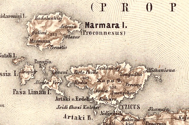
Deutsch: Marmara-Meer, Dardanellen, nordöstliche türkische Mittelmeerküste aus der Generalkarte der europäischen Türkei und Griechenlands |
| Date | between 1860 and 1870 |
| Source | Militärgeographisches Institut der österreichisch-ungarischen Monarchie aus den Jahren 1860-70 |
| Author | Aufnahmeteam des Militärgeographischen Institutes der österreichisch-ungarischen Monarchie unter der Leitung von Josef Scheda um 1860-70 |
| Other versions |

.jpg&action=edit§ion=1)
Licensing[edit]
.jpg&action=edit§ion=2)
This media file is in the public domain in the United States. This applies to U.S. works where the copyright has expired, often because its first publication occurred prior to January 1, 1929, and if not then due to lack of notice or renewal. See this page for further explanation.
|
 | |
 |
This image might not be in the public domain outside of the United States; this especially applies in the countries and areas that do not apply the rule of the shorter term for US works, such as Canada, Mainland China (not Hong Kong or Macao), Germany, Mexico, and Switzerland. The creator and year of publication are essential information and must be provided. See Wikipedia:Public domain and Wikipedia:Copyrights for more details.
|
File history
Click on a date/time to view the file as it appeared at that time.
| Date/Time | Thumbnail | Dimensions | User | Comment | |
|---|---|---|---|---|---|
| current | 17:54, 21 June 2020 | | 867 × 576 (775 KB) | Balkanique (talk | contribs) | File:9 - Marmara Meer, Lesbos; Scheda-Karte europ Türkei.jpg cropped 86 % horizontally, 87 % vertically using CropTool with lossless mode. |
You cannot overwrite this file.
File usage on Commons
The following page uses this file:
.jpg&oldid=804152847)