File:Kanton Graubünden Burgen und Schlösser.png
Jump to navigation
Jump to search

Size of this preview: 779 × 600 pixels. Other resolutions: 312 × 240 pixels | 624 × 480 pixels | 998 × 768 pixels | 1,280 × 985 pixels | 2,560 × 1,971 pixels | 3,497 × 2,692 pixels.
Original file (3,497 × 2,692 pixels, file size: 11.4 MB, MIME type: image/png)
Captions
Captions
Add a one-line explanation of what this file represents
| Description |
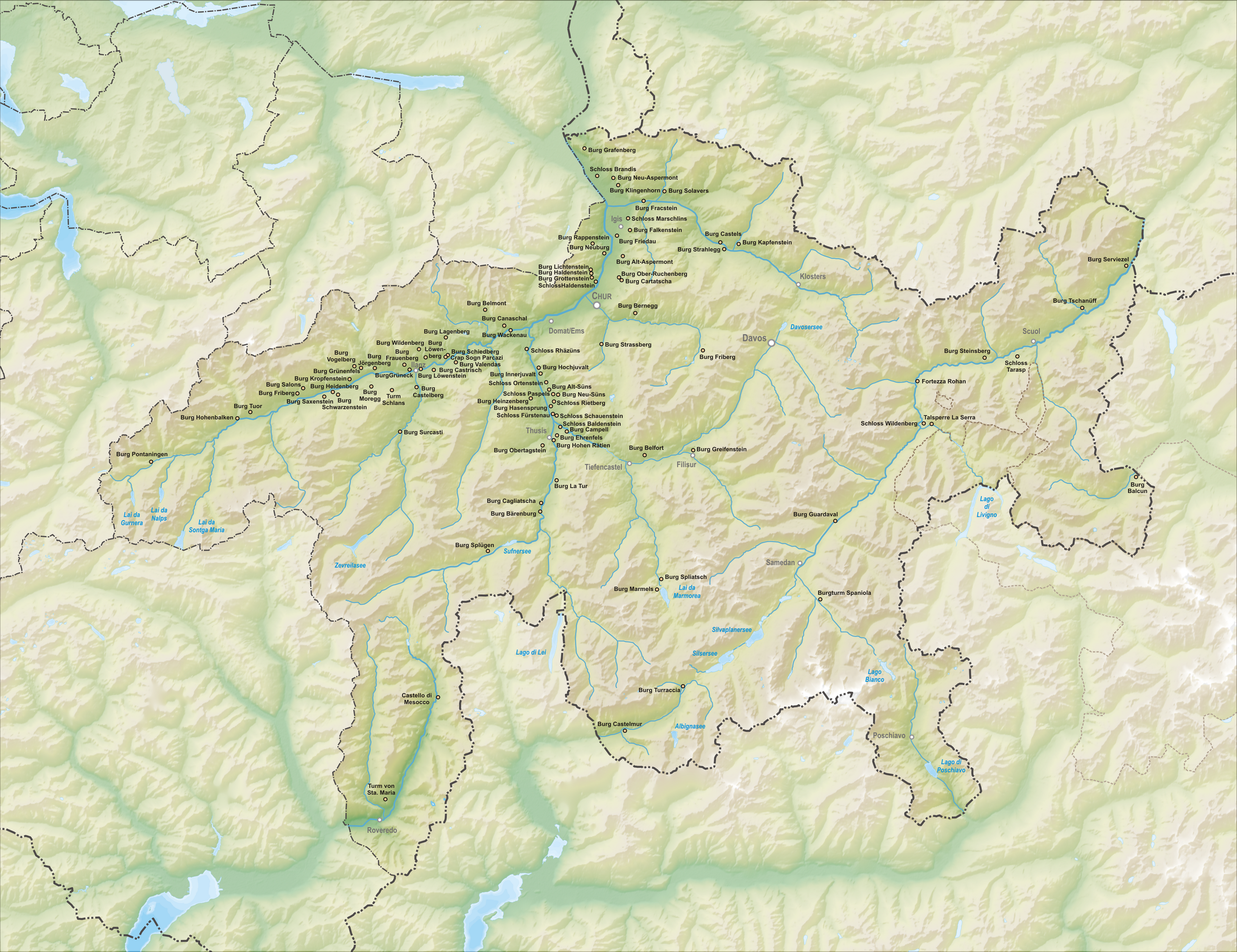
Deutsch: Karte der Burgen und Schlösser des Kanton Graubünden.
Topographischer Hintergrund: NASA Shuttle Radar Topography Mission (public domain). SRTM3 v.2. |
||
| Date | |||
| Source | Own work | ||
| Author | Tschubby | ||
| Permission (Reusing this file) |
I, the copyright holder of this work, hereby publish it under the following licenses:
This file is licensed under the Creative Commons Attribution-Share Alike 3.0 Unported, 2.5 Generic, 2.0 Generic and 1.0 Generic license.
You may select the license of your choice. |

File history
Click on a date/time to view the file as it appeared at that time.
| Date/Time | Thumbnail | Dimensions | User | Comment | |
|---|---|---|---|---|---|
| current | 16:54, 25 April 2011 | | 3,497 × 2,692 (11.4 MB) | Tschubby (talk | contribs) | {{Information |Description= |Source= |Date= |Author= |Permission= |other_versions= }} |
| 16:05, 25 April 2011 |  | 3,497 × 2,691 (11.4 MB) | Tschubby (talk | contribs) | {{Information |Description= {{de| Karte der Burgen und Schlösser des Kanton Graubünden.}} Topographischer Hintergrund: [http://www2.jpl.nasa.gov/srtm NASA Shuttle Radar Topography Mission] (public domain). SRTM3 v.2. |Source={ |
You cannot overwrite this file.
File usage on Commons
There are no pages that use this file.
File usage on other wikis
The following other wikis use this file:
- Usage on af.wikipedia.org
- Usage on de.wikipedia.org
- Usage on fr.wikipedia.org
- Usage on ru.wikipedia.org