File:Kalorama Triangle map.jpg
Jump to navigation
Jump to search
No higher resolution available.
Kalorama_Triangle_map.jpg (525 × 508 pixels, file size: 62 KB, MIME type: image/jpeg)
Captions
Captions
Kalorama Triangle map
| Description |
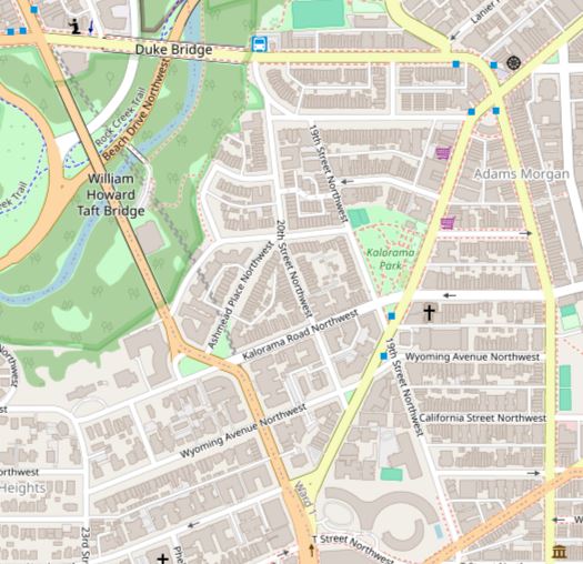
English: Map showing the boundaries of the Kalorama Triangle Historic District in Washington, D.C. The historic district is listed on the National Register of Historic Places. Boundaries are derived from the map provided by the District of Columbia's Office of Planning. |
| Date | |
| Source | Screenshot of OpenStreetMap's map of the Kalorama Triangle Historic District vicinity |
| Author | OpenStreetMap editors (map) |
| Permission (Reusing this file) |
My work is public domain, and the original map is This file is licensed under the Creative Commons Attribution 2.0 Generic license.
|
File history
Click on a date/time to view the file as it appeared at that time.
| Date/Time | Thumbnail | Dimensions | User | Comment | |
|---|---|---|---|---|---|
| current | 08:33, 14 February 2024 | | 525 × 508 (62 KB) | APK (talk | contribs) | Uploaded a work by {{Unknown|author}} from [https://www.openstreetmap.org/?mlat=38.920556&mlon=-77.046389&zoom=15#map=16/38.9196/-77.0464 OpenStreetMap] with UploadWizard |
You cannot overwrite this file.
File usage on Commons
There are no pages that use this file.
File usage on other wikis
The following other wikis use this file:
- Usage on en.wikipedia.org