File:Kali Gandaki riverbed in Nepal's Upper Mustang.jpg
Jump to navigation
Jump to search

Size of this preview: 800 × 451 pixels. Other resolutions: 320 × 180 pixels | 640 × 361 pixels | 1,024 × 577 pixels | 1,280 × 721 pixels | 2,560 × 1,442 pixels | 4,910 × 2,766 pixels.
Original file (4,910 × 2,766 pixels, file size: 7.18 MB, MIME type: image/jpeg)
Captions
Captions
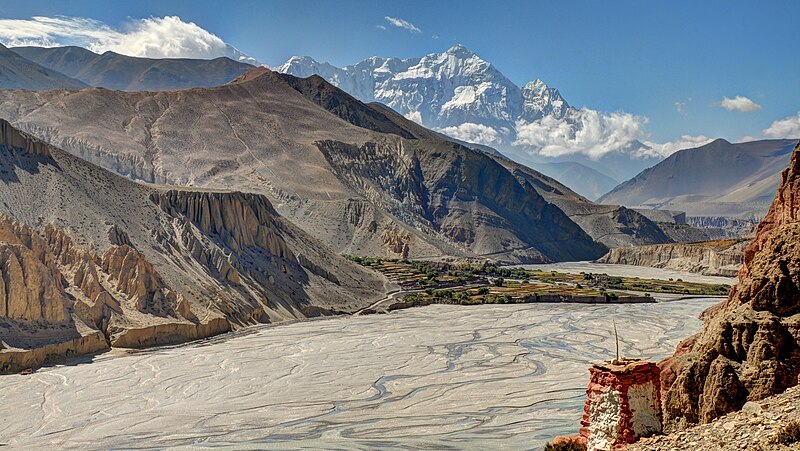
Kali Gandaki riverbed in Nepal's Upper Mustang. View from Thsele down to the Kali Gandaki river and the fields of Chusang village, with Nilgiri's steep north face.
Summary
[edit]
| Description |
English: Great views from Thsele down to the fields of Chusang village and Nilgiri with its steep north face. |
| Date | |
| Source | Own work |
| Author | Carsten.nebel |
| Camera location | | View this and other nearby images on: OpenStreetMap |
|---|
Licensing
[edit]
I, the copyright holder of this work, hereby publish it under the following license:
This file is licensed under the Creative Commons Attribution-Share Alike 4.0 International license.
- You are free:
- to share – to copy, distribute and transmit the work
- to remix – to adapt the work
- Under the following conditions:
- attribution – You must give appropriate credit, provide a link to the license, and indicate if changes were made. You may do so in any reasonable manner, but not in any way that suggests the licensor endorses you or your use.
- share alike – If you remix, transform, or build upon the material, you must distribute your contributions under the same or compatible license as the original.
File history
Click on a date/time to view the file as it appeared at that time.
| Date/Time | Thumbnail | Dimensions | User | Comment | |
|---|---|---|---|---|---|
| current | 14:18, 29 September 2016 | | 4,910 × 2,766 (7.18 MB) | Carsten.nebel (talk | contribs) | User created page with UploadWizard |
You cannot overwrite this file.
File usage on Commons
There are no pages that use this file.
File usage on other wikis
The following other wikis use this file:
- Usage on en.wikipedia.org
- Usage on it.wikiquote.org
- Usage on ml.wikipedia.org
- Usage on ne.wikipedia.org
- Usage on no.wikipedia.org