File:KRHI FAA Airport Diagram.svg
Jump to navigation
Jump to search

Size of this PNG preview of this SVG file: 390 × 599 pixels. Other resolutions: 156 × 240 pixels | 313 × 480 pixels | 500 × 768 pixels | 667 × 1,024 pixels | 1,334 × 2,048 pixels | 516 × 792 pixels.
Original file (SVG file, nominally 516 × 792 pixels, file size: 342 KB)
Captions
Captions
Add a one-line explanation of what this file represents
Summary[edit]
| Description |
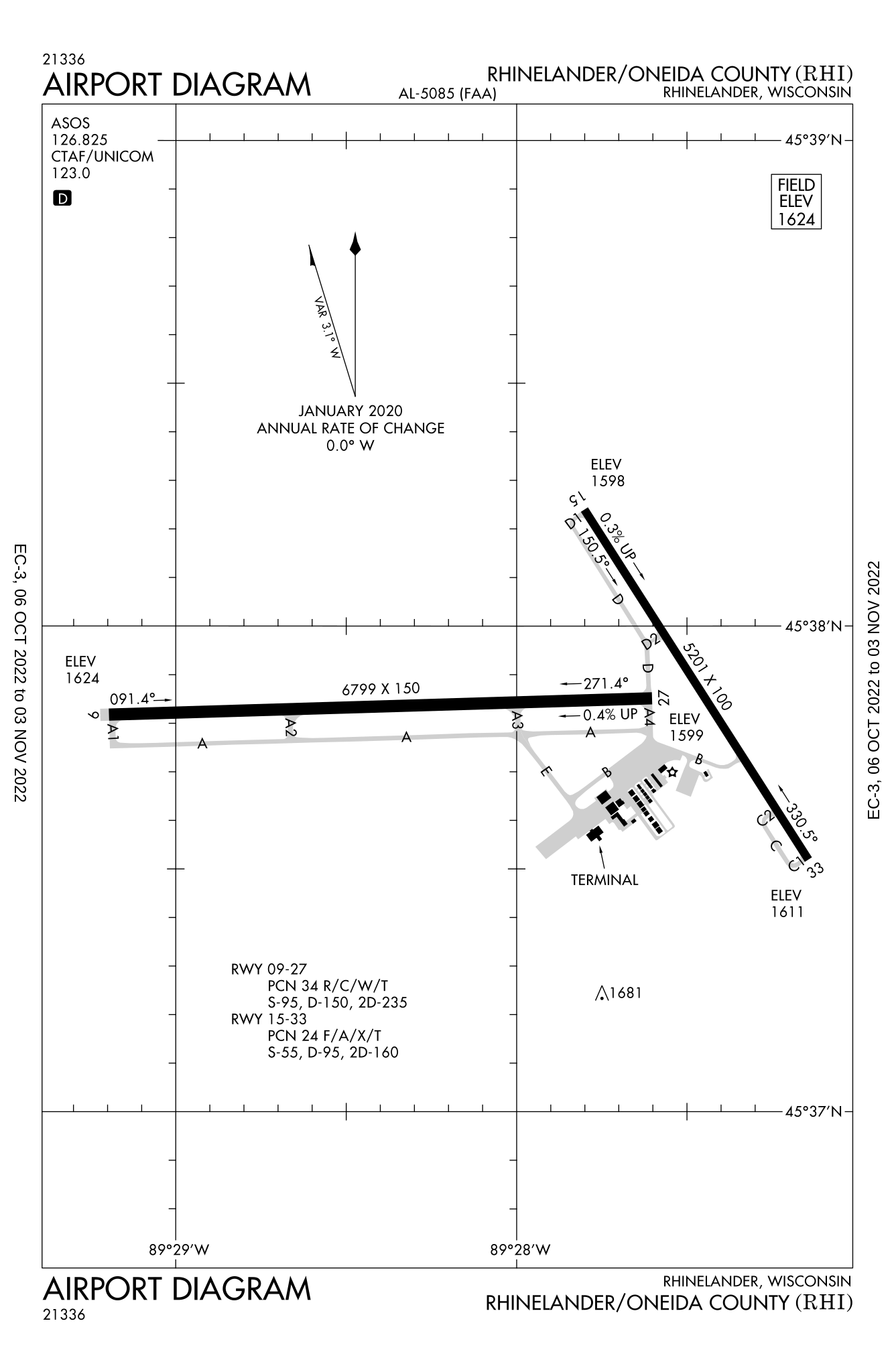
English: Airport diagram for Rhinelander–Oneida County Airport |
| Date | |
| Source | https://aeronav.faa.gov/d-tpp/2210/05085AD.PDF |
| Author | FAA |
Licensing[edit]
This image or file is a work of a Federal Aviation Administration employee, taken or made as part of that person's official duties. As a work of the U.S. federal government, the image is in the public domain in the United States.
|
 |
File history
Click on a date/time to view the file as it appeared at that time.
| Date/Time | Thumbnail | Dimensions | User | Comment | |
|---|---|---|---|---|---|
| current | 18:22, 1 November 2022 | | 516 × 792 (342 KB) | KDTW Flyer (talk | contribs) | Update for 2022 |
| 16:58, 31 March 2018 |  | 484 × 743 (556 KB) | KDTW Flyer (talk | contribs) | User created page with UploadWizard |
You cannot overwrite this file.
File usage on Commons
The following 6 pages use this file:
- User:Chumwa/OgreBot/Potential transport maps/2018 March 21-31
- User:Chumwa/OgreBot/Transport Maps/2018 March 21-31
- User:Chumwa/OgreBot/Transport Maps/2022 November 1-10
- User:Chumwa/OgreBot/Travel and communication maps/2018 March 21-31
- Commons:WikiProject Aviation/recent uploads/2018 March 31
- File:KRHI Airport Diagram.jpg
File usage on other wikis
The following other wikis use this file:
- Usage on de.wikipedia.org
- Usage on en.wikipedia.org
- Usage on es.wikipedia.org