File:Jetstar Airbus A321neo VH-OFE Denpasar 2023 (05).jpg
Jump to navigation
Jump to search

Size of this preview: 800 × 449 pixels. Other resolutions: 320 × 180 pixels | 640 × 360 pixels | 1,024 × 575 pixels | 1,280 × 719 pixels | 2,560 × 1,438 pixels | 5,968 × 3,353 pixels.
Original file (5,968 × 3,353 pixels, file size: 6.88 MB, MIME type: image/jpeg)
Captions
Captions
Add a one-line explanation of what this file represents
Summary[edit]
.jpg&action=edit§ion=1)
| Photographer | |
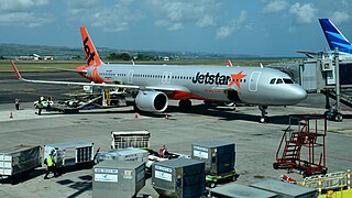
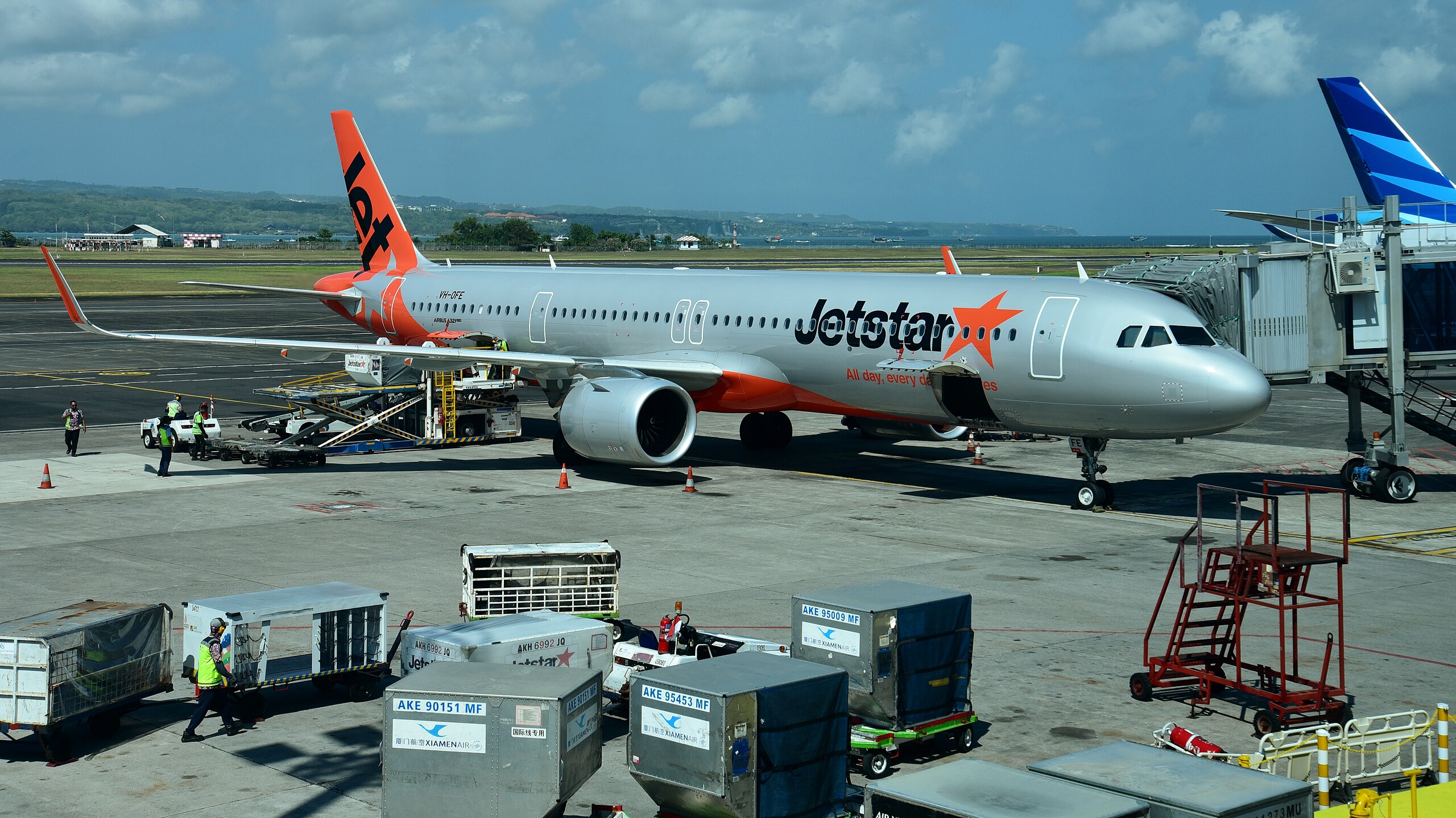
| Location | English: Ngurah Rai International Airport (DPS/WADD), Denpasar, Indonesia |
| Aircraft type | A321-251NX |
| Operator | Jetstar Airways |
| Registration | VH-OFE |
| Activity | landing |
| Type | photograph |
| Description |
English: Jetstar Airways Airbus A321-251NX VH-OFE at Ngurah Rai International Airport (DPS/WADD), Denpasar, Bali, Indonesia. Photo taken from an adjacent airbridge at the International Terminal. |
| Date | Taken on 21 August 2023, 10:20:14 |
| Source | Own work |
| Camera location | | View this and other nearby images on: OpenStreetMap |
|---|
.jpg¶ms=-08.745333_N_0115.165889_E_globe:Earth_type:camera_heading:247.50&language=en)
Licensing[edit]
.jpg&action=edit§ion=2)
I, the copyright holder of this work, hereby publish it under the following license:
This file is licensed under the Creative Commons Attribution-Share Alike 4.0 International license.
- You are free:
- to share – to copy, distribute and transmit the work
- to remix – to adapt the work
- Under the following conditions:
- attribution – You must give appropriate credit, provide a link to the license, and indicate if changes were made. You may do so in any reasonable manner, but not in any way that suggests the licensor endorses you or your use.
- share alike – If you remix, transform, or build upon the material, you must distribute your contributions under the same or compatible license as the original.
File history
Click on a date/time to view the file as it appeared at that time.
| Date/Time | Thumbnail | Dimensions | User | Comment | |
|---|---|---|---|---|---|
| current | 22:28, 23 September 2023 | | 5,968 × 3,353 (6.88 MB) | Bahnfrend (talk | contribs) | Uploaded own work with UploadWizard |
You cannot overwrite this file.
File usage on Commons
The following 2 pages use this file:
.jpg&redirect=no)
.jpg)
.jpg&oldid=865658824)