File:Jesusland.png
Jump to navigation
Jump to search
Size of this preview: 661 × 600 pixels. Other resolutions: 264 × 240 pixels | 529 × 480 pixels | 846 × 768 pixels | 1,128 × 1,024 pixels | 1,753 × 1,591 pixels.
Original file (1,753 × 1,591 pixels, file size: 45 KB, MIME type: image/png)
Captions
Captions
Add a one-line explanation of what this file represents
Summary[edit]
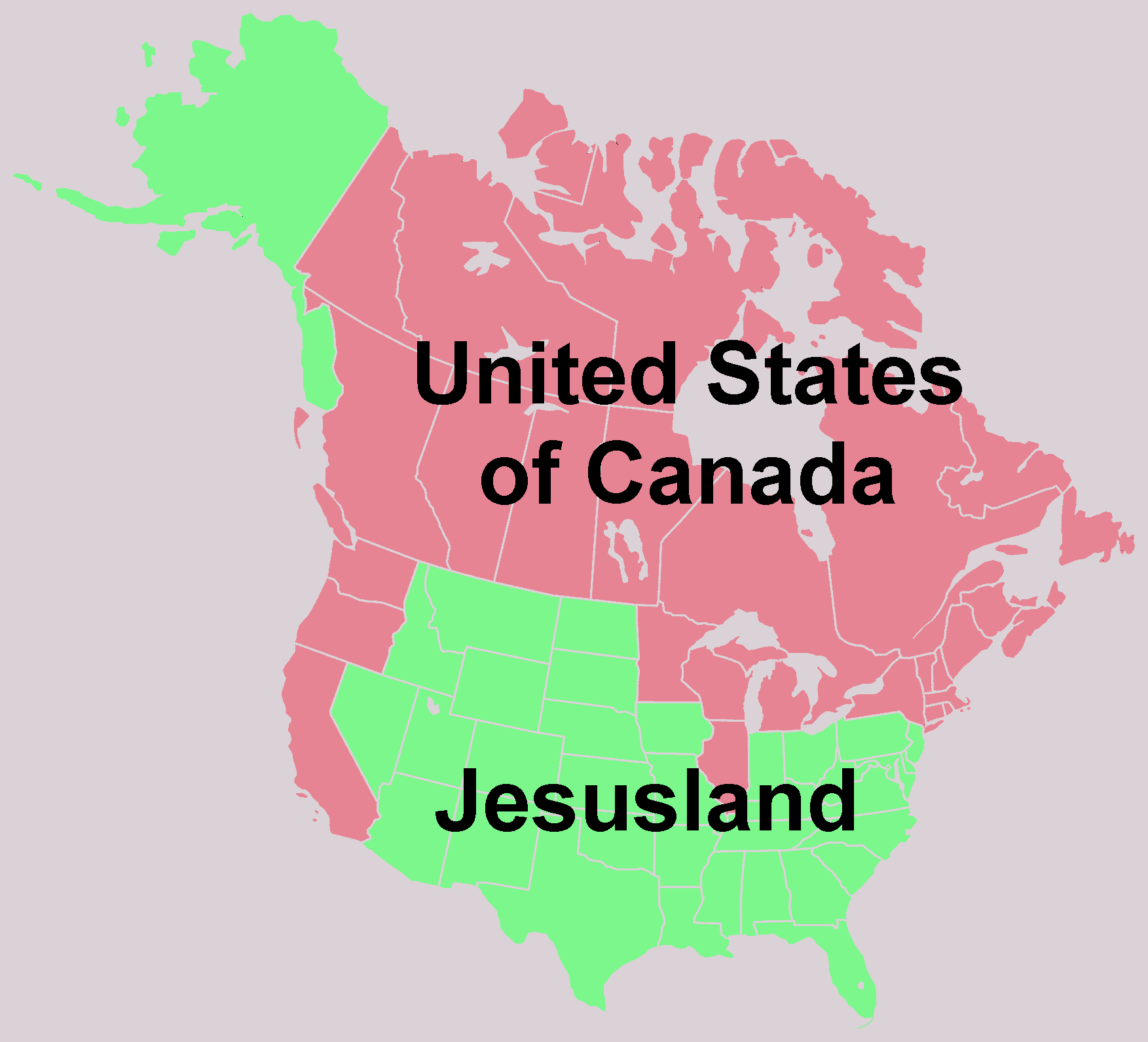
| Description | The Jesusland map, an Internet meme from 2004 | ||||||||
| Date | |||||||||
| Source | Based on Image:North america blank range map.png | ||||||||
| Author | Liftarn | ||||||||
| Permission (Reusing this file) |
|
||||||||
| Other versions |
 |


|
This map, as well as other fictitious maps, is fictitious or too incorrect (i.e. due to anachronism) to be used in real-life contexts (contemporary or historic). It may have some visual elements that are similar to official maps such as colors or certain layout features, but they are NOT official and don't have any official recognition. |
[[Category:]]

|
File:Jesusland map.svg is a vector version of this file. It should be used in place of this PNG file when not inferior.
File:Jesusland.png → File:Jesusland map.svg
For more information, see Help:SVG. |
|
File history
Click on a date/time to view the file as it appeared at that time.
| Date/Time | Thumbnail | Dimensions | User | Comment | |
|---|---|---|---|---|---|
| current | 12:33, 20 May 2007 | | 1,753 × 1,591 (45 KB) | Liftarn (talk | contribs) | {{Information |Description=The Jesusland map, an Internet meme from 2004 |Source=Based on Image:North america blank range map.png |Date=2007 |Author=~~~ |Permission={{GFDL}} |other_versions= }} Category:Maps of North America |
You cannot overwrite this file.
File usage on Commons
The following 3 pages use this file:
File usage on other wikis
The following other wikis use this file:
- Usage on da.wikipedia.org
- Usage on www.wikidata.org