File:Jean-François Pescheux (Tour de l'Avenir 2013).JPG
Jump to navigation
Jump to search

Size of this preview: 487 × 599 pixels. Other resolutions: 195 × 240 pixels | 390 × 480 pixels | 624 × 768 pixels | 832 × 1,024 pixels | 1,665 × 2,048 pixels | 2,634 × 3,240 pixels.
Original file (2,634 × 3,240 pixels, file size: 3.88 MB, MIME type: image/jpeg)
Captions
Captions
Add a one-line explanation of what this file represents
Summary[edit]
| Description |
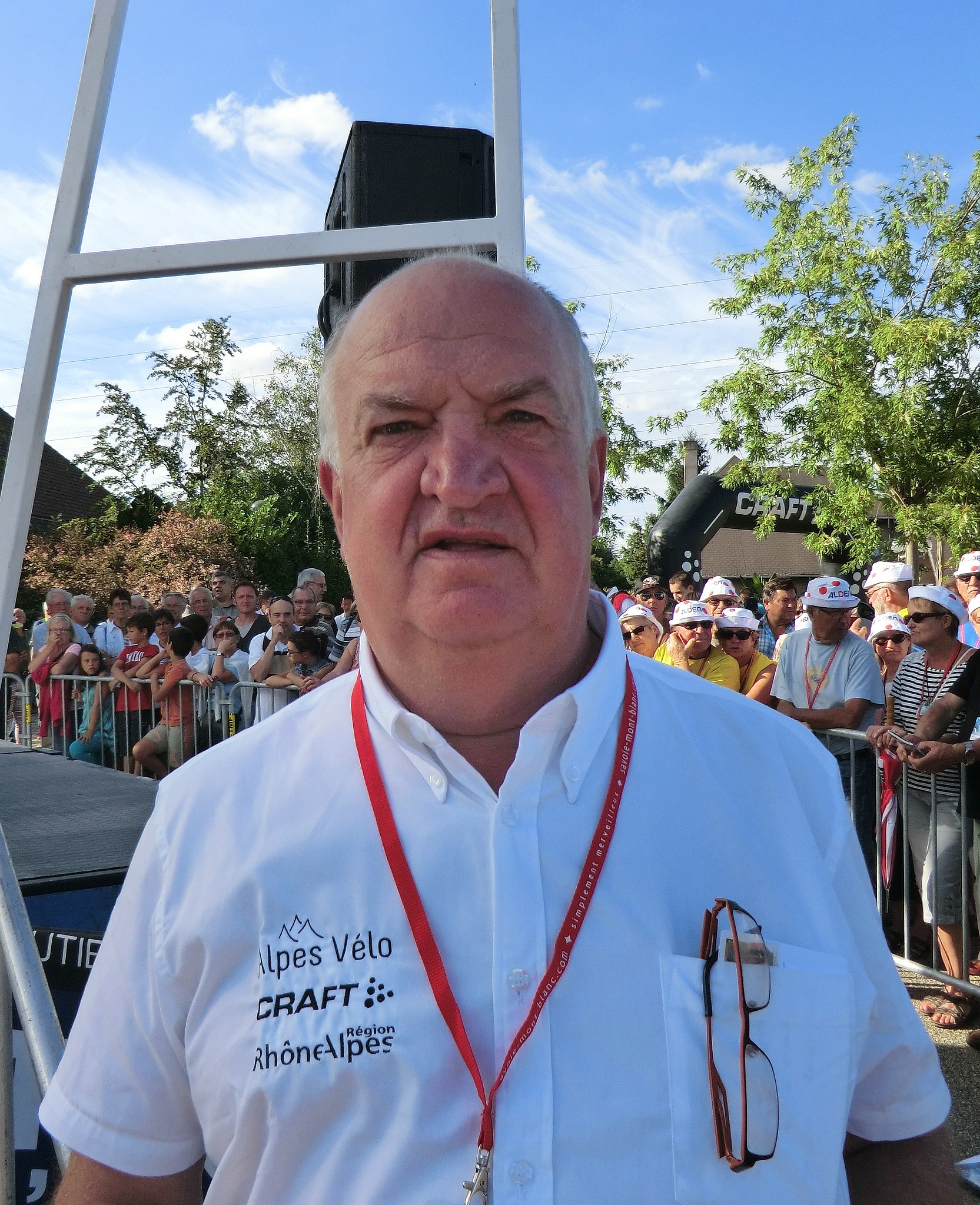
Français : Jean-François Pescheux (directeur technique des épreuves d'ASO qui participe à l'organisation du Tour de l'Avenir) à Saint-Vulbas pour l'arrivée de la seconde étape du Tour de l'Avenir 2013.
English: Jean-François Pescheux (technical manager for ASO races. ASO is involved to the organization of Tour de l'Avenir) in Saint-Vulbas for attending to the second stage of Tour de l'Avenir 2013. |
|||||||||||||||||
| Date | ||||||||||||||||||
| Source | Own work | |||||||||||||||||
| Author |
|
|||||||||||||||||
| Permission (Reusing this file) |
|
|||||||||||||||||
_en_juillet_2021.jpg)
.JPG&action=edit§ion=1)
| Camera location | | View this and other nearby images on: OpenStreetMap |
|---|
.JPG¶ms=045.826548_N_0005.286182_E_globe:Earth_type:camera__&language=en)

|
Although this work is freely licensed or in the public domain, the person(s) shown may have rights that legally restrict certain re-uses unless those depicted consent to such uses. In these cases, a model release or other evidence of consent could protect you from infringement claims. Though not obliged to do so, the uploader may be able to help you to obtain such evidence. See our general disclaimer for more information. |

|
This image has been assessed under the valued image criteria and is considered the most valued image on Commons within the scope: Jean-François Pescheux. You can see its nomination here. |
.JPG)
File history
Click on a date/time to view the file as it appeared at that time.
| Date/Time | Thumbnail | Dimensions | User | Comment | |
|---|---|---|---|---|---|
| current | 19:21, 26 August 2013 | | 2,634 × 3,240 (3.88 MB) | Benoît Prieur (talk | contribs) |
You cannot overwrite this file.
File usage on Commons
The following 3 pages use this file:
File usage on other wikis
The following other wikis use this file:
- Usage on fr.wikipedia.org
- Usage on fr.wikinews.org
.JPG&oldid=837890758)