File:JWP-Karte-Deutschland.svg
Jump to navigation
Jump to search

Size of this PNG preview of this SVG file: 501 × 595 pixels. Other resolutions: 202 × 240 pixels | 404 × 480 pixels | 647 × 768 pixels | 862 × 1,024 pixels | 1,724 × 2,048 pixels.
Original file (SVG file, nominally 501 × 595 pixels, file size: 863 KB)
Captions
Captions
Add a one-line explanation of what this file represents
Summary[edit]
| Description |
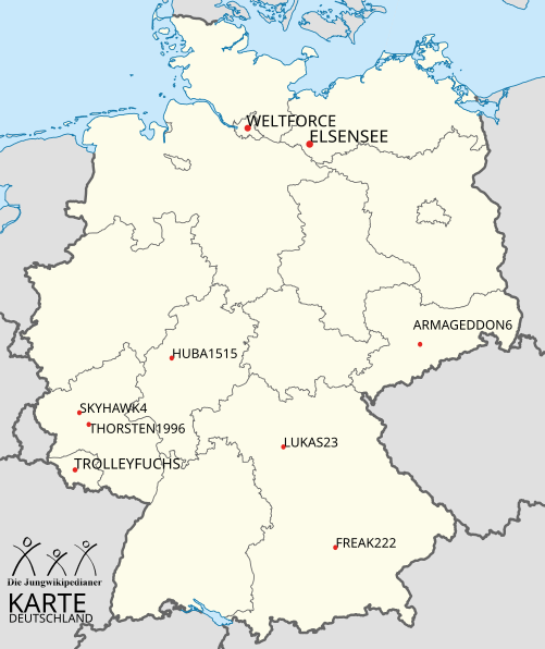
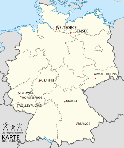
Deutsch: Karte der Wohnorte der Jungwikipedianer |
| Date | (UTC) |
| Source |
This file was derived from: |
| Author |
|

Licensing[edit]
This file is licensed under the Creative Commons Attribution-Share Alike 3.0 Unported license.
- You are free:
- to share – to copy, distribute and transmit the work
- to remix – to adapt the work
- Under the following conditions:
- attribution – You must give appropriate credit, provide a link to the license, and indicate if changes were made. You may do so in any reasonable manner, but not in any way that suggests the licensor endorses you or your use.
- share alike – If you remix, transform, or build upon the material, you must distribute your contributions under the same or compatible license as the original.
Original upload log[edit]
This image is a derivative work of the following images:
- File:JWP-Logo-2010.svg licensed with PD-ineligible
- 2012-01-09T23:08:34Z OgreBot 1000x600 (597555 Bytes) (BOT): Reverting to most recent version before archival
- 2012-01-09T23:08:08Z OgreBot 808x495 (566694 Bytes) (BOT): Uploading old version of file from de.wikipedia; originally uploaded on 2010-05-06 18:08:05 by [[:de:User:Garver|Garver]]
- 2011-12-30T00:19:31Z Der Buckesfelder 1000x600 (597555 Bytes) {{Information |Description={{de|Offizielles Logo der [[:de:Benutzer:JWP|Jungwikipedianer]] [[:de:Kategorie:Datei:Wikipedia:|]]}} |Source=Transferred from [http://de.wikipedia.org de.wikipedia]; transfer was stated to be made
- File:Germany_location_map.svg licensed with Cc-by-sa-3.0, GFDL
- 2010-01-19T10:03:29Z NordNordWest 1073x1272 (502104 Bytes) update
- 2009-07-22T08:33:33Z NordNordWest 1075x1273 (623082 Bytes) c
- 2008-10-13T14:36:44Z NordNordWest 1075x1273 (620685 Bytes)
- 2008-10-09T21:13:47Z NordNordWest 1075x1273 (627868 Bytes) smaller file, data optimized
- 2008-06-30T20:25:05Z NordNordWest 1076x1274 (899543 Bytes) {{Information |Description= {{de|Positionskarte von [[:de:Deutschland|Deutschland]]}} Quadratische Plattkarte, N-S-Streckung 150 %. Geographische Begrenzung der Karte: * N: 55.1° N * S: 47.2° N * W: 5.5° O * O: 15.5° O {{
Uploaded with derivativeFX
File history
Click on a date/time to view the file as it appeared at that time.
| Date/Time | Thumbnail | Dimensions | User | Comment | |
|---|---|---|---|---|---|
| current | 20:32, 13 April 2012 | | 501 × 595 (863 KB) | StG1990 (talk | contribs) | Fehler im Quellcode behoben |
| 16:26, 12 April 2012 |  | 501 × 595 (884 KB) | Freak222 (talk | contribs) | Schrift | |
| 16:24, 12 April 2012 |  | 501 × 595 (884 KB) | Freak222 (talk | contribs) | {{Information |Description=Karte der Wohnorte der Jungwikipedianer |Source=Merge aus File:JWP-Logo.svg und File:Germany location map.svg |Date= |Author=Freak222 |Permission= |other_versions= }} {{PD-ineligible}} |
You cannot overwrite this file.
File usage on Commons
There are no pages that use this file.
File usage on other wikis
The following other wikis use this file:
- Usage on de.wikipedia.org