File:Jägala juga (panoraam) 22-03-2013.jpg
Jump to navigation
Jump to search

Size of this preview: 800 × 232 pixels. Other resolutions: 320 × 93 pixels | 640 × 185 pixels | 1,024 × 296 pixels | 1,280 × 370 pixels | 2,560 × 741 pixels | 13,112 × 3,795 pixels.
Original file (13,112 × 3,795 pixels, file size: 19.09 MB, MIME type: image/jpeg)
Captions
Captions
Add a one-line explanation of what this file represents
Summary[edit]
_22-03-2013.jpg&action=edit§ion=1)
| Description |
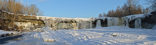
Eesti: Jägala juga English: Jägala waterfall |
| Date | |
| Source | Own work |
| Author | Ivar Leidus |
| Camera location | | View this and other nearby images on: OpenStreetMap |
|---|
_22-03-2013.jpg¶ms=059.450046_N_0025.177896_E_globe:Earth_type:camera__&language=en)
| Camera Model | Nikon 5200 |
|---|---|
| Shutter speed | 1/160; |
| Aperture | f/9; |
| Film speed (ISO) | 100; |

|
NOTE: This image is a panorama consisting of multiple frames that were merged or stitched in software. As a result, this image necessarily underwent some form of digital manipulation. These manipulations may include blending, blurring, cloning, and colour and perspective adjustments. As a result of these adjustments, the image content may be slightly different from reality at the points where multiple images were combined. This manipulation is often required due to lens, perspective, and parallax distortions.
|
This image was created with Hugin.
Licensing[edit]
_22-03-2013.jpg&action=edit§ion=2)
I, the copyright holder of this work, hereby publish it under the following license:
This file is licensed under the Creative Commons Attribution-ShareAlike 3.0 Estonia license.
- You are free:
- to share – to copy, distribute and transmit the work
- to remix – to adapt the work
- Under the following conditions:
- attribution – You must give appropriate credit, provide a link to the license, and indicate if changes were made. You may do so in any reasonable manner, but not in any way that suggests the licensor endorses you or your use.
- share alike – If you remix, transform, or build upon the material, you must distribute your contributions under the same or compatible license as the original.

This image has been assessed using the Quality image guidelines and is considered a Quality image.
|
File history
Click on a date/time to view the file as it appeared at that time.
| Date/Time | Thumbnail | Dimensions | User | Comment | |
|---|---|---|---|---|---|
| current | 20:50, 22 March 2013 | 13,112 × 3,795 (19.09 MB) | Iifar (talk | contribs) | User created page with UploadWizard |
You cannot overwrite this file.
File usage on Commons
The following 6 pages use this file:
- User:Iifar/Panoramas
- User talk:Iifar/archive 2012-2013
- Commons:Featured picture candidates/File:Jägala juga (panoraam) 22-03-2013.jpg
- Commons:Featured picture candidates/Log/March 2013
- Commons:Quality images/Subject/Places/Natural structures/archive 2013 to 2014
- Commons:Quality images candidates/Archives March 2013
_22-03-2013.jpg)
File usage on other wikis
The following other wikis use this file:
- Usage on en.wikipedia.org
- Usage on et.wikipedia.org
- Usage on fi.wikipedia.org
- Usage on hy.wikipedia.org
- Usage on lt.wikipedia.org
- Usage on mk.wikipedia.org
- Usage on uk.wikipedia.org
_22-03-2013.jpg&oldid=822670170)