File:Italy Bassa padana map-fr.svg
Jump to navigation
Jump to search

Size of this PNG preview of this SVG file: 736 × 482 pixels. Other resolutions: 320 × 210 pixels | 640 × 419 pixels | 1,024 × 671 pixels | 1,280 × 838 pixels | 2,560 × 1,677 pixels.
Original file (SVG file, nominally 736 × 482 pixels, file size: 1.66 MB)
Captions
Captions
Add a one-line explanation of what this file represents
| Description |
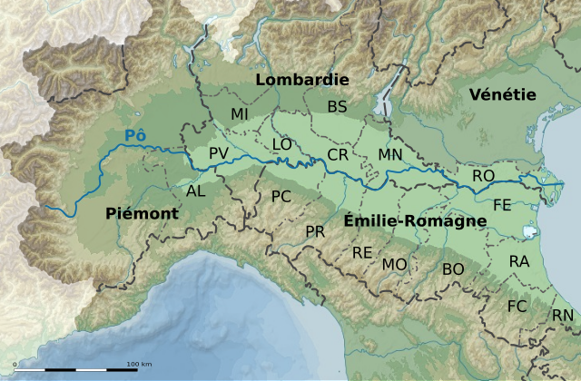
English: Map of Italy with Bassa padana highlithed
Français : Carte topographique du nord de l'Italie avec, en surbrillance, la Bassa padana, partie centrale et orientale de la plaine du Pô constituée par les territoires de plaine des provinces suivantes :
|
| Date | (UTC) |
| Source | |
| Author |
|
| Other versions | Derivative works of this file: Italy bassa parmense on bassa padana map.svg |
Français : Cette carte a été créée par Pethrus d'après les sources mentionnés ci-dessus. Il s'agit d'un travail d'amateur, même s'il a été réalisé avec soin ; il peut comporter des inexactitudes ou des erreurs. Cette carte a donc un rôle d'illustration et non de référence. N'hésitez pas à me signaler toute erreur que vous constateriez ou à effectuer vous-même la correction. English: This map was drawn by Pethrus from sources mentionned above. Even if it was done with care, this is an amateur work ; there might be some inaccuracies or errors. As such, it should not be considered authoritative. Please contact me if you notice any mistake, and feel free to correct it yourself.
|

|
This SVG file contains embedded text that can be translated into your language, using any capable SVG editor, text editor or the SVG Translate tool. For more information see: About translating SVG files. |
I, the copyright holder of this work, hereby publish it under the following licenses:

|
Permission is granted to copy, distribute and/or modify this document under the terms of the GNU Free Documentation License, Version 1.2 or any later version published by the Free Software Foundation; with no Invariant Sections, no Front-Cover Texts, and no Back-Cover Texts. A copy of the license is included in the section entitled GNU Free Documentation License. |
This file is licensed under the Creative Commons Attribution-Share Alike 3.0 Unported license.
- You are free:
- to share – to copy, distribute and transmit the work
- to remix – to adapt the work
- Under the following conditions:
- attribution – You must give appropriate credit, provide a link to the license, and indicate if changes were made. You may do so in any reasonable manner, but not in any way that suggests the licensor endorses you or your use.
- share alike – If you remix, transform, or build upon the material, you must distribute your contributions under the same or compatible license as the original.
You may select the license of your choice.
File history
Click on a date/time to view the file as it appeared at that time.
| Date/Time | Thumbnail | Dimensions | User | Comment | |
|---|---|---|---|---|---|
| current | 08:10, 20 May 2010 | | 736 × 482 (1.66 MB) | Pethrus (talk | contribs) | Modène code fixed (MP -> MO) |
| 10:15, 8 May 2010 |  | 736 × 482 (1.66 MB) | Pethrus (talk | contribs) | Transparent layer fixed | |
| 21:21, 7 May 2010 |  | 736 × 482 (1.65 MB) | Pethrus (talk | contribs) | Added provinces names | |
| 09:01, 5 May 2010 |  | 736 × 482 (1.64 MB) | Pethrus (talk | contribs) | Framing fixed | |
| 08:59, 5 May 2010 |  | 1,066 × 778 (1.64 MB) | Pethrus (talk | contribs) | Changed font size, added names, highlithed the Po, lots of changes | |
| 12:37, 4 May 2010 |  | 1,066 × 778 (1.68 MB) | Pethrus (talk | contribs) | {{Information |Description={{en|Map of Italy with Bassa padana highlithed}} {{fr|Carte de l'Italie avec la ''Bassa padana'' en surbrillance}} |Source=*File:Map_Province_of_Rovigo.svg *File:Italy_topographic_map-blank.svg |Date=2010-05-04 12:30 |
You cannot overwrite this file.
File usage on Commons
The following 4 pages use this file:
File usage on other wikis
The following other wikis use this file:
- Usage on fr.wikipedia.org
- Usage on fr.wiktionary.org
- Usage on it.wikipedia.org