File:Islands 112-01, 112-02, and 112-03 (49f853f2-7710-4e7f-973f-bd8d43ce2323).jpg
Jump to navigation
Jump to search

Size of this preview: 463 × 599 pixels. Other resolutions: 185 × 240 pixels | 371 × 480 pixels | 593 × 768 pixels | 791 × 1,024 pixels | 1,582 × 2,048 pixels | 4,250 × 5,500 pixels.
Original file (4,250 × 5,500 pixels, file size: 2.98 MB, MIME type: image/jpeg)
Captions
Captions
Add a one-line explanation of what this file represents

|
The categories of this image need checking. You can do so here.
|
.jpg&action=edit&withJS=MediaWiki:Catcheck.js)
Summary[edit]
.jpg&action=edit§ion=1)
| English: Islands 112-01, 112-02, and 112-03 | ||||
|---|---|---|---|---|
| Photographer |
English: NPS |
|||
| Title |
English: Islands 112-01, 112-02, and 112-03 |
|||
| Description |
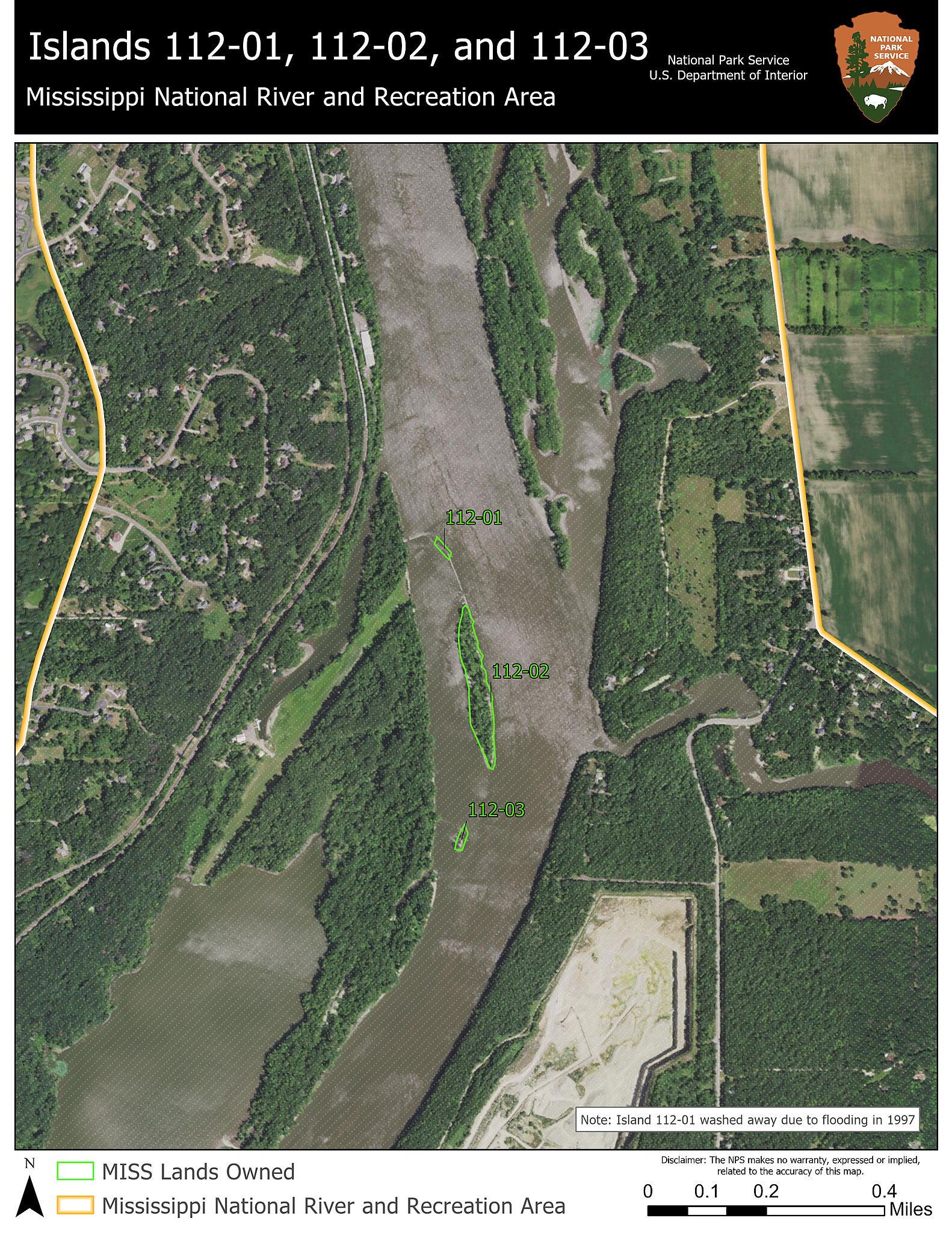
English: Islands 112-02 and 112-03 are located near Inver Grove Heights, MN to the west, and Saint Paul Park, MN to the east of the Mississippi River. The northern entrance to the back-channel that forms Upper Grey Cloud Island is located just east of these islands. Island 112-01 washed away in 1997 due to flooding. Mississippi National River and Recreation Area boundary highlighted on both sides of the Mississippi River. Islands 112-01, 112-02, and 112-03 General Location Near St. Paul Park, MN
|
|||
| Depicted place |
English: Mississippi National River and Recreation Area, Minnesota |
|||
| Accession number | ||||
| Source |
English: NPGallery |
|||
| Permission (Reusing this file) |
|
|||
| NPS Unit Code | MISS | |||
File history
Click on a date/time to view the file as it appeared at that time.
| Date/Time | Thumbnail | Dimensions | User | Comment | |
|---|---|---|---|---|---|
| current | 08:41, 14 January 2022 | | 4,250 × 5,500 (2.98 MB) | BMacZeroBot (talk | contribs) | Batch upload (Commons:Batch uploading/NPGallery) |
You cannot overwrite this file.
File usage on Commons
The following page uses this file:
.jpg)
.jpg&oldid=621730547)