File:Is-map-no.PNG
Jump to navigation
Jump to search

Size of this preview: 276 × 598 pixels. Other resolutions: 110 × 240 pixels | 329 × 713 pixels.
Original file (329 × 713 pixels, file size: 22 KB, MIME type: image/png)
Captions
Captions
Add a one-line explanation of what this file represents
| Description |
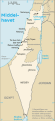
Norsk bokmål: Israel med naboområder |
| Date | |
| Source | File:Is-map.PNG |
| Author | CIA |
| Other versions | English labels |
This image is in the public domain because it contains materials that originally came from the United States Central Intelligence Agency's World Factbook.
|
 |
File history
Click on a date/time to view the file as it appeared at that time.
| Date/Time | Thumbnail | Dimensions | User | Comment | |
|---|---|---|---|---|---|
| current | 14:28, 18 April 2008 | | 329 × 713 (22 KB) | Kjetil r (talk | contribs) | {{Information |Description={{no|Israel med naboområder}} |Source=Image:Is-map.PNG |Date=2004 |Author=CIA |Permission= |other_versions=English labels }} {{PD-USGov-CIA-WF}} Category:Maps of Israel [[Category:Maps of the |
You cannot overwrite this file.
File usage on Commons
There are no pages that use this file.
File usage on other wikis
The following other wikis use this file:
- Usage on fy.wikipedia.org
- Usage on no.wikipedia.org