File:IranQom.png
Jump to navigation
Jump to search
Size of this preview: 648 × 599 pixels. Other resolutions: 260 × 240 pixels | 519 × 480 pixels | 879 × 813 pixels.
Original file (879 × 813 pixels, file size: 25 KB, MIME type: image/png)
Captions
Captions
Add a one-line explanation of what this file represents
Summary[edit]

|
File:IranQom.svg is a vector version of this file. It should be used in place of this PNG file.
File:IranQom.png → File:IranQom.svg
For more information, see Help:SVG. |
 |
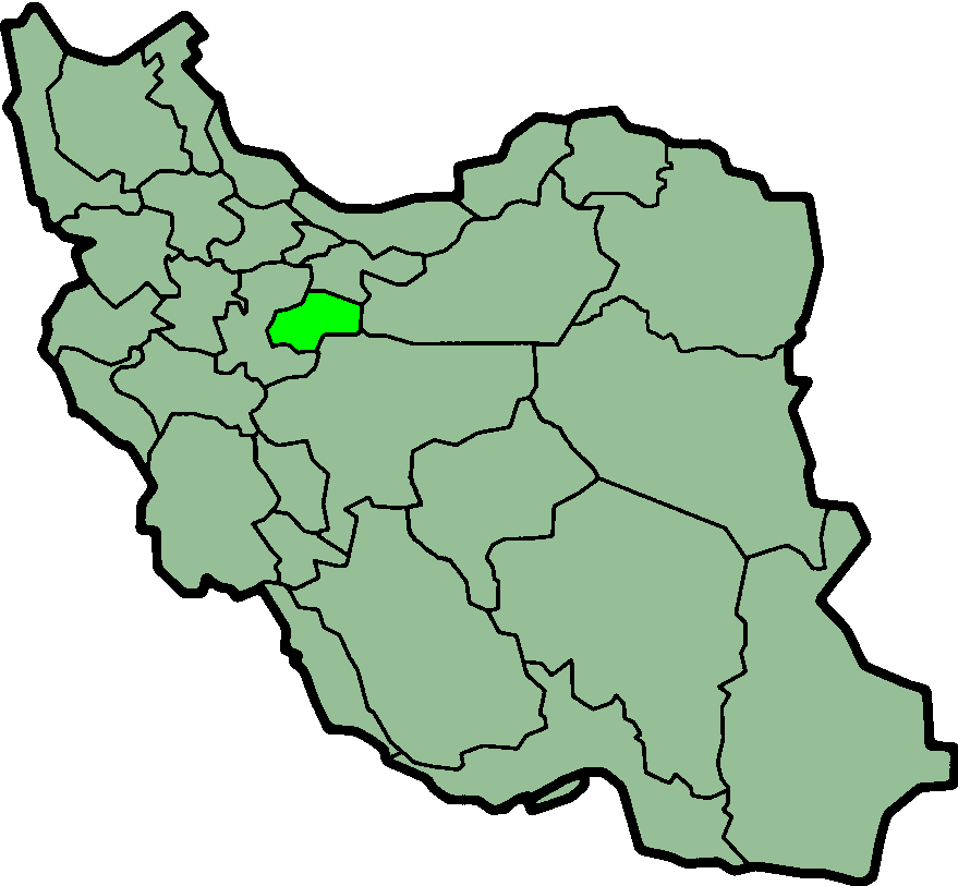
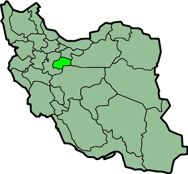
Qom, Province of Iran. Image created by en:User:Morwen.
Licensing[edit]
| This file is licensed under the Creative Commons Attribution-Share Alike 3.0 Unported license. Subject to disclaimers. | ||
| ||
| This licensing tag was added to this file as part of the GFDL licensing update. |

|
Permission is granted to copy, distribute and/or modify this document under the terms of the GNU Free Documentation License, Version 1.2 or any later version published by the Free Software Foundation; with no Invariant Sections, no Front-Cover Texts, and no Back-Cover Texts. A copy of the license is included in the section entitled GNU Free Documentation License. Subject to disclaimers. |
| Description |
Province of Qom, Iran Deutsch: Lage der Provinz Qom im Iran
Nederlands: Ligging van Qom in Iran |
| Date | (UTC) |
| Source | http://en.wikipedia.org/wiki/Image:IranQom.png |
| Author | Morven |
| Permission (Reusing this file) |
GFDL |
File history
Click on a date/time to view the file as it appeared at that time.
| Date/Time | Thumbnail | Dimensions | User | Comment | |
|---|---|---|---|---|---|
| current | 00:13, 24 June 2013 | | 879 × 813 (25 KB) | BasilLeaf (talk | contribs) | بروزرسانی مرز بین استانهای یزد و خراسان جنوبی، تهران و البرز، فارس و یزد و اصفهان |
| 11:59, 12 November 2010 |  | 879 × 813 (41 KB) | M samadi (talk | contribs) | Quality improved, Border of some provinces updated. | |
| 13:03, 13 October 2010 |  | 200 × 185 (13 KB) | Amin19850 (talk | contribs) | Tehran & Alborz Province is divided | |
| 18:33, 8 November 2006 |  | 200 × 185 (11 KB) | Raymond (talk | contribs) | transparent background, improved color palette | |
| 06:06, 6 September 2005 |  | 200 × 185 (22 KB) | Roozbeh (talk | contribs) | updated with new Khorasan(s) and expandion of Yazd | |
| 19:45, 29 August 2005 |  | 200 × 185 (20 KB) | Kotoito (talk | contribs) | Qom, Province of Iran. Image created by en:User:Morwen. |
You cannot overwrite this file.
File usage on Commons
There are no pages that use this file.
File usage on other wikis
The following other wikis use this file:
- Usage on bn.wikipedia.org
- Usage on ca.wikipedia.org
- Usage on ckb.wikipedia.org
- Usage on cy.wikipedia.org
- Usage on da.wikipedia.org
- Usage on el.wikipedia.org
- Usage on en.wikipedia.org
- Venan
- Veshareh, Qom
- Qom County
- Template:Qom-geo-stub
- Namak Lake
- User:AlexNebraska/Images of Iran
- Dastjerd
- Jafariyeh
- Kahak, Qom
- Qanavat
- Salafchegan
- Kasva
- Jafarabad County
- Khalajestan District
- Central District (Qom County)
- Kahak County
- Salafchegan District
- Qomrud Rural District
- Mohammadabad, Qomrud
- Qanavat Rural District
- Dastjerd Rural District (Qom County)
- Qobad Bazn
- Sarm, Iran
- Nevis, Iran
- Jafarabad Rural District
- Fordo Rural District
- Kahak Rural District
- Qahan Rural District
- Neyzar Rural District
- Rahjerd-e Sharqi Rural District
- Aliabad, Qom
- Ilikhi Bolaghi
- Alborz, Qom
- Anjirli
- Bagh-e Now, Qom
- Baghak, Qom
- Baqerabad, Qom
- Abbasabad, Qom
- Cheshmeh Palang-e Pain
- Cheshmeh Shur, Qom
- Dulay Qarqi
- Feyzabad, Qom
- Farajabad, Qom
View more global usage of this file.