File:Inflow from Meavy below aq.JPG
Jump to navigation
Jump to search
Size of this preview: 450 × 600 pixels. Other resolutions: 180 × 240 pixels | 360 × 480 pixels | 576 × 768 pixels | 768 × 1,024 pixels | 1,536 × 2,048 pixels.
Original file (1,536 × 2,048 pixels, file size: 1.39 MB, MIME type: image/jpeg)
Captions
Captions
Add a one-line explanation of what this file represents
Summary[edit]
| Description |
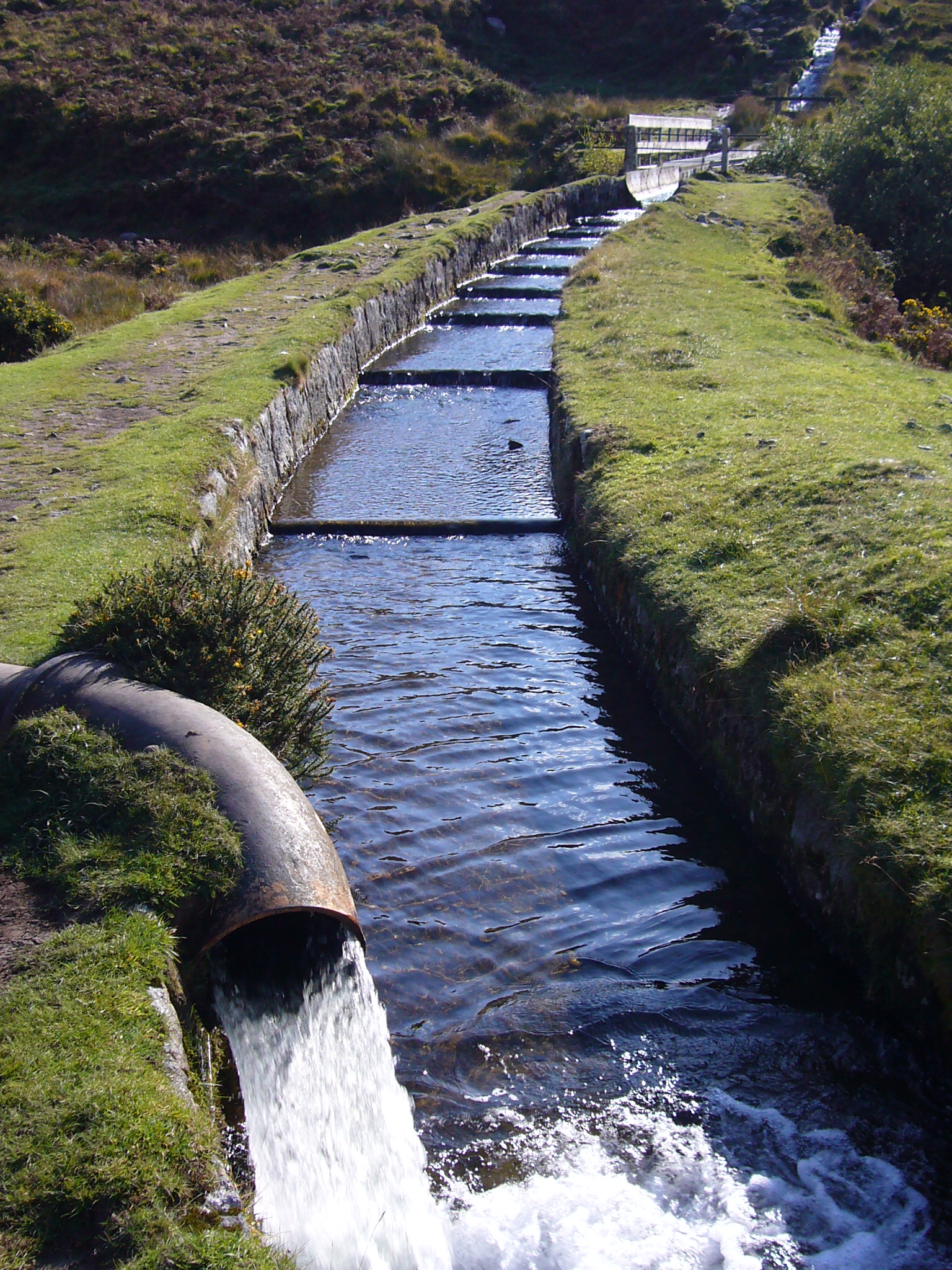
English: Just below the aqueduct carrying the leat this shows the inflow from the river Meavy (or Mewy) which was constructed C1915 (see this image) when the leat was ended at Burrator reservoir rather than Devonport. The aqueduct can be seen in the mid distance.
Also see this image which looks to where this image was taken. |
| Date | |
| Source | Own work |
| Author | Herby talk thyme |
| Camera location | | View this and other nearby images on: OpenStreetMap |
|---|
Licensing[edit]
I, the copyright holder of this work, hereby publish it under the following licenses:

|
Permission is granted to copy, distribute and/or modify this document under the terms of the GNU Free Documentation License, Version 1.2 or any later version published by the Free Software Foundation; with no Invariant Sections, no Front-Cover Texts, and no Back-Cover Texts. A copy of the license is included in the section entitled GNU Free Documentation License. |
This file is licensed under the Creative Commons Attribution-Share Alike 4.0 International, 3.0 Unported, 2.5 Generic, 2.0 Generic and 1.0 Generic license.
- You are free:
- to share – to copy, distribute and transmit the work
- to remix – to adapt the work
- Under the following conditions:
- attribution – You must give appropriate credit, provide a link to the license, and indicate if changes were made. You may do so in any reasonable manner, but not in any way that suggests the licensor endorses you or your use.
- share alike – If you remix, transform, or build upon the material, you must distribute your contributions under the same or compatible license as the original.
You may select the license of your choice.
| Annotations | This image is annotated: View the annotations at Commons |

File history
Click on a date/time to view the file as it appeared at that time.
| Date/Time | Thumbnail | Dimensions | User | Comment | |
|---|---|---|---|---|---|
| current | 15:12, 1 October 2008 | | 1,536 × 2,048 (1.39 MB) | Herbythyme (talk | contribs) | {{Information| |Description = Just below the aquaduct carrying the leat this shows the inflow from the river Meavy (or Mewy) which was constructed C1915 when the leat was ended at Burrator reservoir rather than Devonport. |Source = self-made |Date = creat |
You cannot overwrite this file.
File usage on Commons
The following 2 pages use this file: