File:Indian Mill Bridge from southwest.jpg
Jump to navigation
Jump to search

Size of this preview: 800 × 532 pixels. Other resolutions: 320 × 213 pixels | 640 × 426 pixels | 1,024 × 681 pixels | 1,280 × 851 pixels | 2,560 × 1,702 pixels | 6,016 × 4,000 pixels.
Original file (6,016 × 4,000 pixels, file size: 6.27 MB, MIME type: image/jpeg)
Captions
Captions
Add a one-line explanation of what this file represents
| Camera location | | View this and other nearby images on: OpenStreetMap |
|---|
| Description |
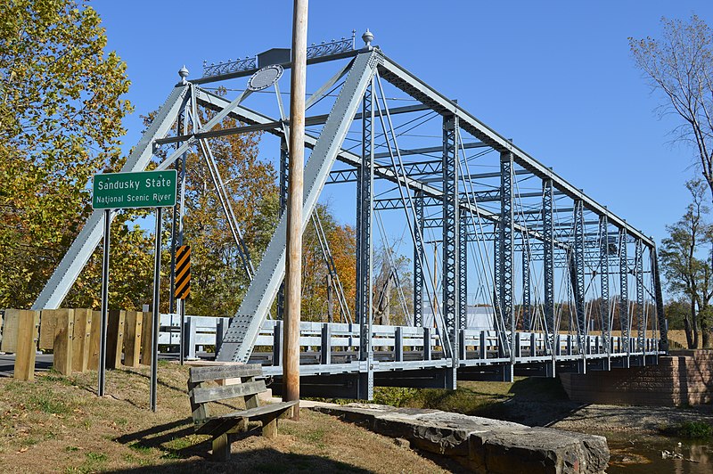
English: Southern side and western portal of the Indian Mill Bridge, which carries County Road 47 over the Sandusky River northeast of Upper Sandusky in Crane Township, Wyandot County, Ohio, United States. The Pratt through truss bridge was built in 1913. |
||
| Date | Taken on 20 October 2015 | ||
| Source | Own work | ||
| Author | Nyttend | ||
| Permission (Reusing this file) |
|
File history
Click on a date/time to view the file as it appeared at that time.
| Date/Time | Thumbnail | Dimensions | User | Comment | |
|---|---|---|---|---|---|
| current | 01:06, 31 October 2015 | | 6,016 × 4,000 (6.27 MB) | Nyttend (talk | contribs) | {{Location|40|51|47.6|N|83|15|14.4|W}} {{Information |Description={{en|Southern side and western portal of the Indian Mill Bridge, which carries County Road 47 over the {{w|Sandusky River}} northeast of {{w|Upper Sandusky, Ohio|Upper Sandusky}} in {{w|... |
You cannot overwrite this file.
File usage on Commons
The following page uses this file: