File:India Orissa location map with names.svg
Jump to navigation
Jump to search

Size of this PNG preview of this SVG file: 679 × 599 pixels. Other resolutions: 272 × 240 pixels | 544 × 480 pixels | 870 × 768 pixels | 1,160 × 1,024 pixels | 2,321 × 2,048 pixels.
Original file (SVG file, nominally 800 × 706 pixels, file size: 152 KB)
Captions
Captions
Add a one-line explanation of what this file represents
Summary[edit]
| Description |
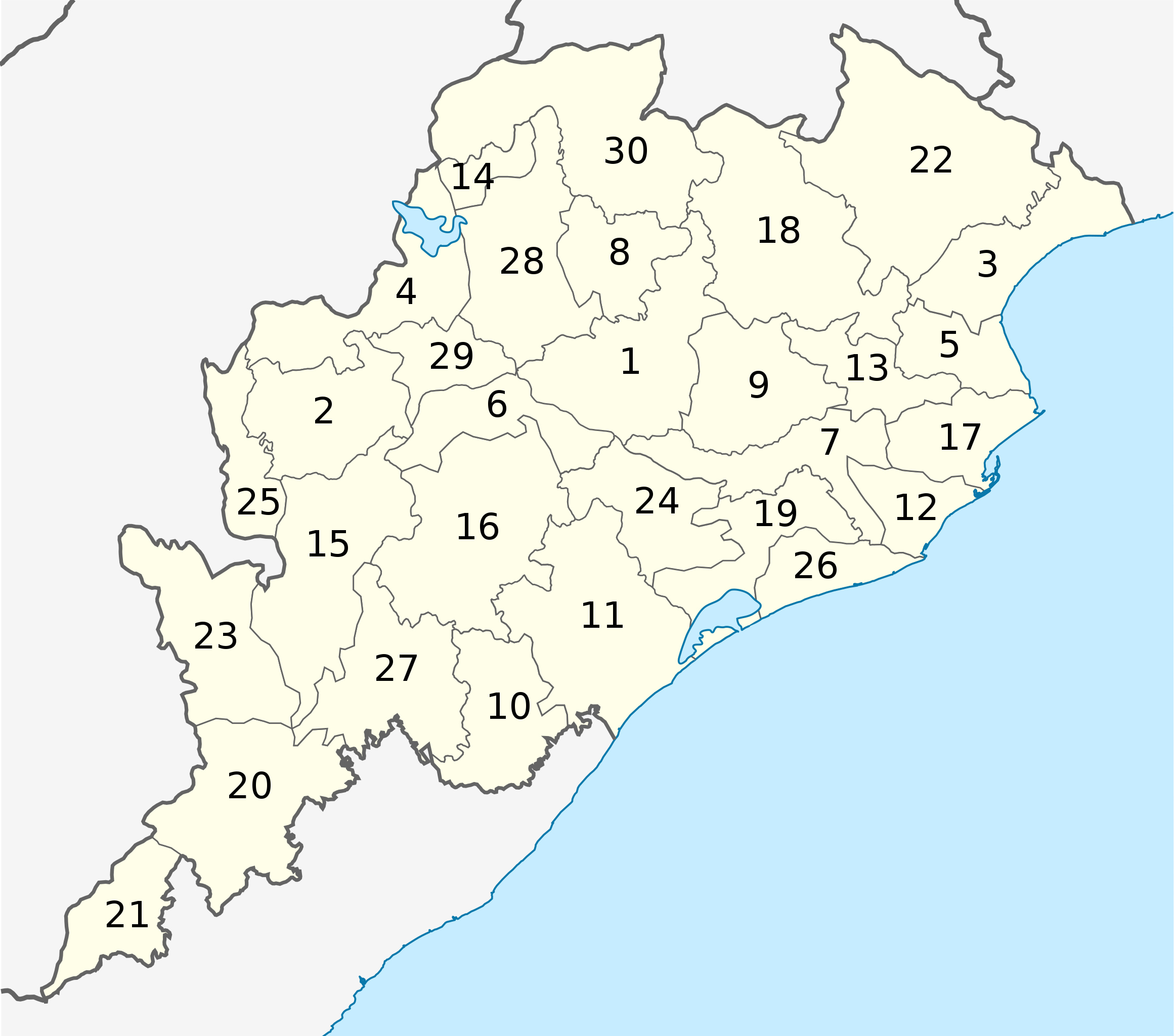
Deutsch: Distrikte von Odisha mit Nummerierung.
1 Angul English: Districts of Odisha with numbers. |
||
| Date | |||
| Source |
This file was derived from: India Odisha location map.svg This vector image includes elements that have been taken or adapted from this file: |
||
| Author | Furfur | ||
| Permission (Reusing this file) |
I, the copyright holder of this work, hereby publish it under the following licenses:
This file is licensed under the Creative Commons Attribution-Share Alike 4.0 International license.
You may select the license of your choice. |
||
| Other versions |
|
||
| SVG development | This vector image was created with Adobe Illustrator. |


File history
Click on a date/time to view the file as it appeared at that time.
| Date/Time | Thumbnail | Dimensions | User | Comment | |
|---|---|---|---|---|---|
| current | 12:13, 2 April 2017 | | 800 × 706 (152 KB) | Furfur (talk | contribs) | == {{int:filedesc}} == {{Information |Description={{User:Medium69/Traduction}} {{de|1=Distrikte von Odisha mit Nummerierung. <div class="references-small" style="-moz-column-count:3; column-count:3;"> 1 Angul<br /> 2 Balangir<br /> 3 Baleswar<br /> 4 B... |
You cannot overwrite this file.
File usage on Commons
The following 4 pages use this file:
File usage on other wikis
The following other wikis use this file:
- Usage on de.wikipedia.org