File:India-map-ta.svg
Jump to navigation
Jump to search

Size of this PNG preview of this SVG file: 529 × 599 pixels. Other resolutions: 212 × 240 pixels | 424 × 480 pixels | 678 × 768 pixels | 904 × 1,024 pixels | 1,809 × 2,048 pixels | 1,490 × 1,687 pixels.
Original file (SVG file, nominally 1,490 × 1,687 pixels, file size: 283 KB)
Captions
Captions
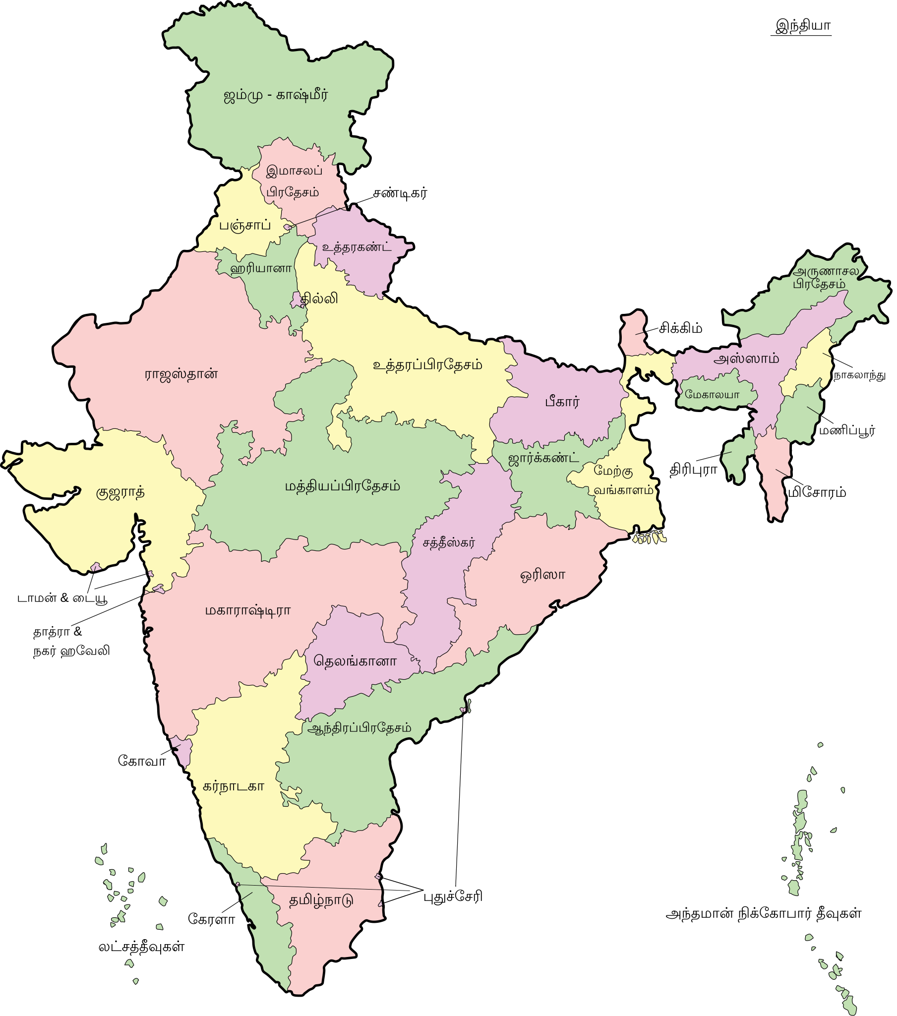
India-map in Tamil
Summary[edit]
| Description |
English: Map of India - states and union territories marked मराठी: भारताचा नकाशा हिन्दी : भारत का मानचित्र - राज्य और केंद्रशासित प्रदेश चिह्नित हैं বাংলা : ভারত দেশের মানচিত্র ਪੰਜਾਬੀ : ਭਾਰਤ ਦਾ ਨਕਸ਼ਾ ગુજરાતી : ભારતનો નકશો : રાજ્ય અને કેન્દ્રશાસિત પ્રદેશો ଓଡ଼ିଆ : ଭାରତ ମାନଚିତ୍ର தமிழ் : இந்தியாவின் வரைபடம் - மாநிலங்கள் மற்றும் யூனியன் பிரதேசங்கள் குறிக்கப்பட்டுள்ளன ಕನ್ನಡ : ಭಾರತದ ಭೂಪಟ മലയാളം : ഇന്ത്യയുടെ ഭൂപടം - സംസ്ഥാനങ്ങളും കേന്ദ്രഭരണപ്രദേശങ്ങളും അടയാളപ്പെടുത്തിയിരിക്കുന്നു اردو : بھارت کا نقشہ |
||
| Date | |||
| Source | File:India-map-en.svg | ||
| Author | Translated into Tamil by User:PJeganathan | ||
| Other versions |
[]
|


Licensing[edit]
This file is licensed under the Creative Commons Attribution-Share Alike 4.0 International license.
- You are free:
- to share – to copy, distribute and transmit the work
- to remix – to adapt the work
- Under the following conditions:
- attribution – You must give appropriate credit, provide a link to the license, and indicate if changes were made. You may do so in any reasonable manner, but not in any way that suggests the licensor endorses you or your use.
- share alike – If you remix, transform, or build upon the material, you must distribute your contributions under the same or compatible license as the original.
File history
Click on a date/time to view the file as it appeared at that time.
| Date/Time | Thumbnail | Dimensions | User | Comment | |
|---|---|---|---|---|---|
| current | 17:44, 30 March 2019 | | 1,490 × 1,687 (283 KB) | PJeganathan (talk | contribs) | User created page with UploadWizard |
You cannot overwrite this file.
File usage on Commons
The following 16 pages use this file:
- File:India-map-en.svg
- File:India-map-gu.svg
- File:India-map-hi.svg
- File:India-map-kn.svg
- File:India-map-mr.svg
- File:India-map-od.svg
- File:India-map-or.svg
- File:India-map-pa.svg
- File:India-map-ta.svg
- File:India-map-te.svg
- File:India-map-ur-amiri.svg
- File:India-map-ur.jpg
- File:India-map-ur.svg
- File:India-map as.svg
- File:India-map ml.svg
- Template:Other versions/India-map