File:Independent State of Croatia location.png
Jump to navigation
Jump to search
Size of this preview: 654 × 600 pixels. Other resolutions: 262 × 240 pixels | 523 × 480 pixels | 837 × 768 pixels | 1,088 × 998 pixels.
Original file (1,088 × 998 pixels, file size: 175 KB, MIME type: image/png)
Captions
Captions
Add a one-line explanation of what this file represents
Summary[edit]
| Description |
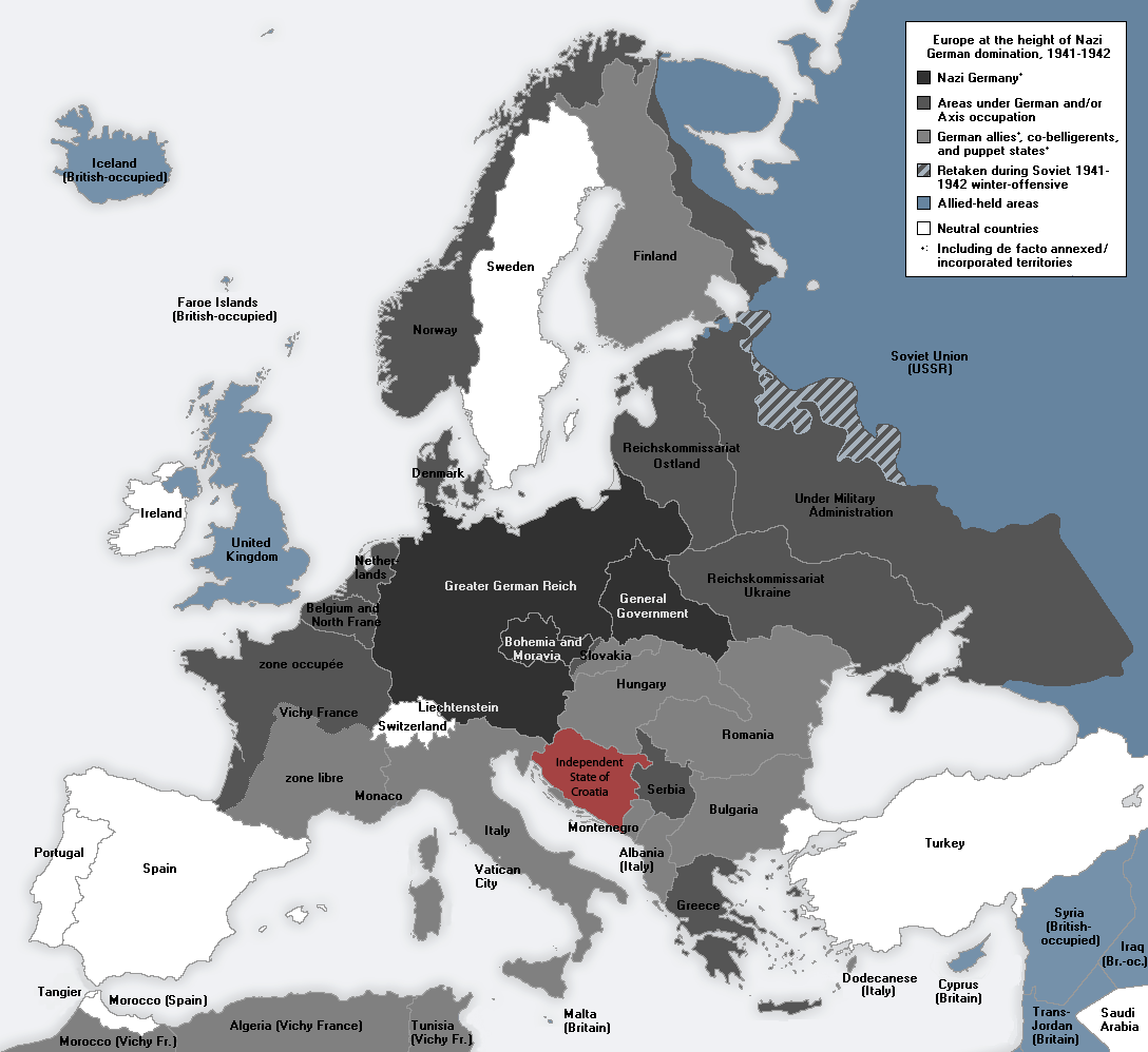
English: Europe at the height of the WWII Axis military conquests in 1941-1942. |
| Date | |
| Source | Own work |
| Author | Morgan Hauser, derived from File:Second world war europe 1943-1945 map en.png and File:Second world war europe 1941-1942 map en.png by users Jarry1250 and ArmadniGeneral, respectively. |
Licensing[edit]
I, the copyright holder of this work, hereby publish it under the following license:
This file is licensed under the Creative Commons Attribution-Share Alike 3.0 Unported license.
- You are free:
- to share – to copy, distribute and transmit the work
- to remix – to adapt the work
- Under the following conditions:
- attribution – You must give appropriate credit, provide a link to the license, and indicate if changes were made. You may do so in any reasonable manner, but not in any way that suggests the licensor endorses you or your use.
- share alike – If you remix, transform, or build upon the material, you must distribute your contributions under the same or compatible license as the original.
File history
Click on a date/time to view the file as it appeared at that time.
| Date/Time | Thumbnail | Dimensions | User | Comment | |
|---|---|---|---|---|---|
| current | 01:03, 9 May 2012 | | 1,088 × 998 (175 KB) | DIREKTOR (talk | contribs) |
You cannot overwrite this file.
File usage on Commons
There are no pages that use this file.
File usage on other wikis
The following other wikis use this file:
- Usage on sr.wikipedia.org