File:ISS015-E-7409 - View of Louisiana.jpg
Jump to navigation
Jump to search
Size of this preview: 800 × 530 pixels. Other resolutions: 320 × 212 pixels | 640 × 424 pixels | 1,024 × 678 pixels | 1,280 × 848 pixels | 3,032 × 2,008 pixels.
Original file (3,032 × 2,008 pixels, file size: 1.32 MB, MIME type: image/jpeg)
Captions
Captions
Add a one-line explanation of what this file represents
Summary[edit]
| Description |
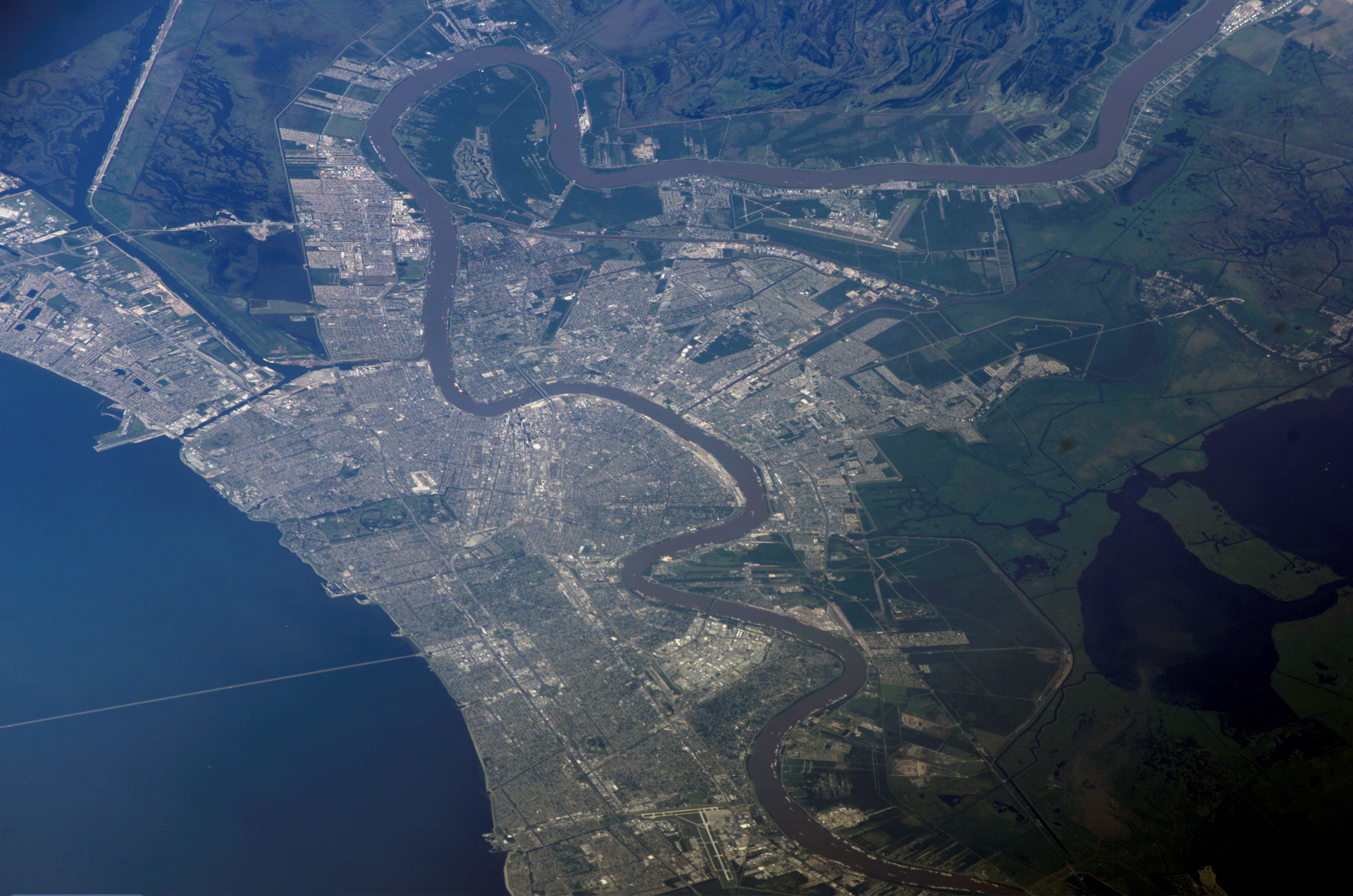
English: View of Louisiana taken during ISS Expedition 15. |
| Date | |
| Source | JSC Gateway to Astronaut Photography of Earth |
| Author | Earth Science and Remote Sensing Unit, Lyndon B. Johnson Space Center |
| Mission | ISS015 |
| Roll | E |
| Frame | 7409 |
| Geographic area | Louisiana |
| Features | NEW ORLEANS, MISSISSIPPI R. |
| Cloud percentage | 10% |
| Altitude | 176 nautical miles (326 km) |
| Look angle | HO |
| Look direction | SE |
| Sun Azimuth | 261° |
| Sun Elevation | 47° |
| Camera | Kodak DCS760c Electronic Still Camera |
| Focal length | 400 mm |
| Object location | | View this and other nearby images on: OpenStreetMap |
|---|
| Camera location | | View this and other nearby images on: OpenStreetMap |
|---|
This image or video was catalogued by Johnson Space Center of the United States National Aeronautics and Space Administration (NASA) under Photo ID: ISS015-E-7409. This tag does not indicate the copyright status of the attached work. A normal copyright tag is still required. See Commons:Licensing. Other languages:
|
Licensing[edit]
| This file is in the public domain in the United States because it was solely created by NASA. NASA copyright policy states that "NASA material is not protected by copyright unless noted". (See Template:PD-USGov, NASA copyright policy page or JPL Image Use Policy.) | ||
 |
Warnings:
|
| Annotations | This image is annotated: View the annotations at Commons |
File history
Click on a date/time to view the file as it appeared at that time.
| Date/Time | Thumbnail | Dimensions | User | Comment | |
|---|---|---|---|---|---|
| current | 23:41, 30 September 2022 | | 3,032 × 2,008 (1.32 MB) | AskeBot (talk | contribs) | Cropped losslessly - removed unnecessary white bar at image edge with NASA photo ID |
| 13:28, 15 October 2021 |  | 3,032 × 2,064 (1.32 MB) | Askeuhd (talk | contribs) |
You cannot overwrite this file.
File usage on Commons
There are no pages that use this file.