File:IDH Santiago.svg
Jump to navigation
Jump to search

Size of this PNG preview of this SVG file: 600 × 600 pixels. Other resolutions: 240 × 240 pixels | 480 × 480 pixels | 768 × 768 pixels | 1,024 × 1,024 pixels | 2,048 × 2,048 pixels.
Original file (SVG file, nominally 600 × 600 pixels, file size: 61 KB)
Captions
Captions
Add a one-line explanation of what this file represents
| Description |
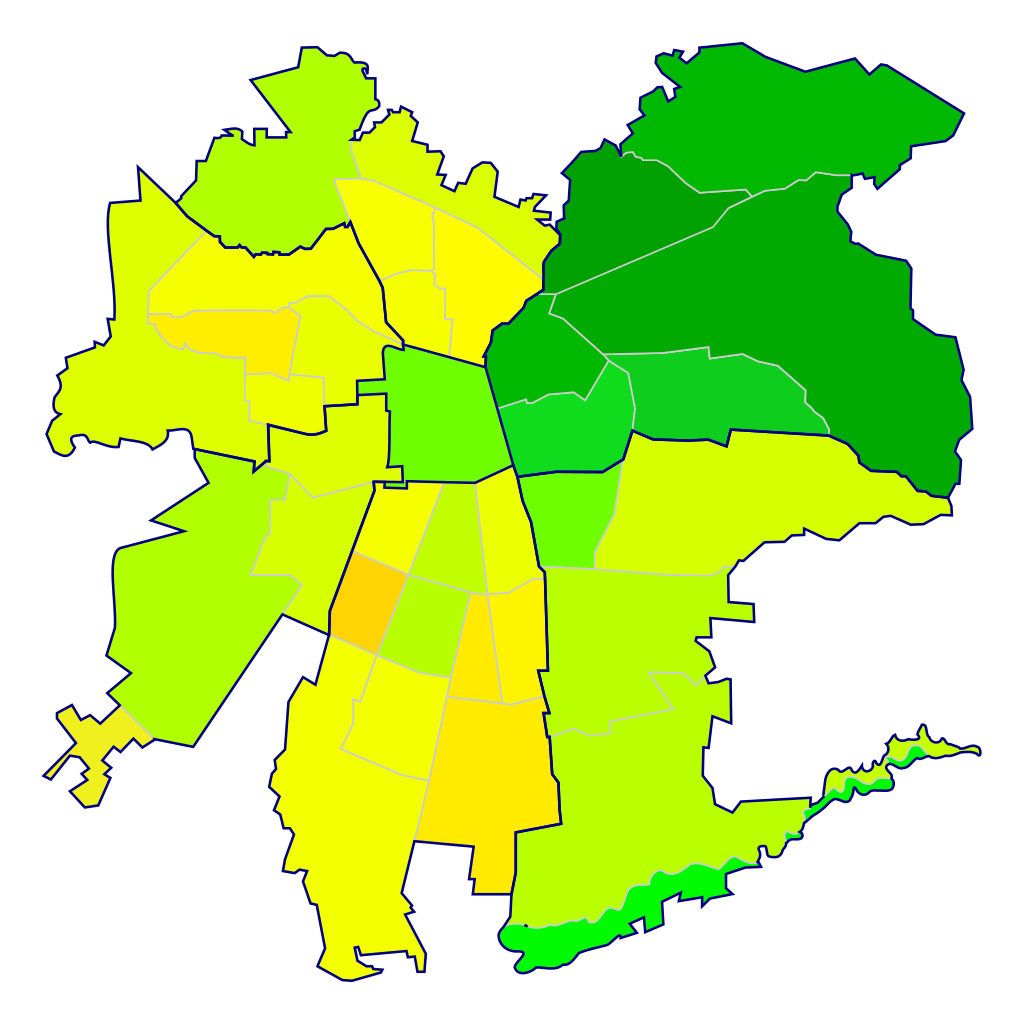
Español: Mapa de las comunas de Santiago de Chile según su Índice de Desarrollo Humano (2006). Además, se agrupan por sectores geográficos (Centro, Nororiente, Suroriente, Sur, Surponiente, Norponiente, Norte).
0,950
0,900
0,850
0,800
0,750
0,700
0,650
0,600 |
||
| Date | |||
| Source |
Mapa obtenido de Image:Comunas de Santiago.svg. Datos obtenidos de Las trayectorias del Desarrollo Humano en las comunas de Chile (1994-2003) (PNUD y Gobierno de Chile)
|
||
| Author | Osmar Valdebenito | ||
| Permission (Reusing this file) |
Osmar Valdebenito, the copyright holder of this work, hereby publishes it under the following license: This file is licensed under the Creative Commons Attribution-Share Alike 2.5 Generic license. Attribution: Osmar Valdebenito
|
File history
Click on a date/time to view the file as it appeared at that time.
| Date/Time | Thumbnail | Dimensions | User | Comment | |
|---|---|---|---|---|---|
| current | 02:56, 20 August 2007 | | 600 × 600 (61 KB) | B1mbo (talk | contribs) | {{Information |Description={{es|Mapa de las comunas de Santiago de Chile según su Índice de Desarrollo Humano (2006). Además, se agrupan por sectores geográficos (Centro, Nororiente, Suroriente, Sur, Surponiente, Norponiente, Norte). {{legend|#00A |
You cannot overwrite this file.
File usage on Commons
The following page uses this file: