File:Hurricane Gustav 11 sept 2002 1800Z.jpg
Jump to navigation
Jump to search

Size of this preview: 780 × 600 pixels. Other resolutions: 312 × 240 pixels | 624 × 480 pixels | 999 × 768 pixels | 1,280 × 985 pixels | 2,560 × 1,969 pixels | 7,800 × 6,000 pixels.
Original file (7,800 × 6,000 pixels, file size: 8.29 MB, MIME type: image/jpeg)
Captions
Captions
Add a one-line explanation of what this file represents
Summary[edit]
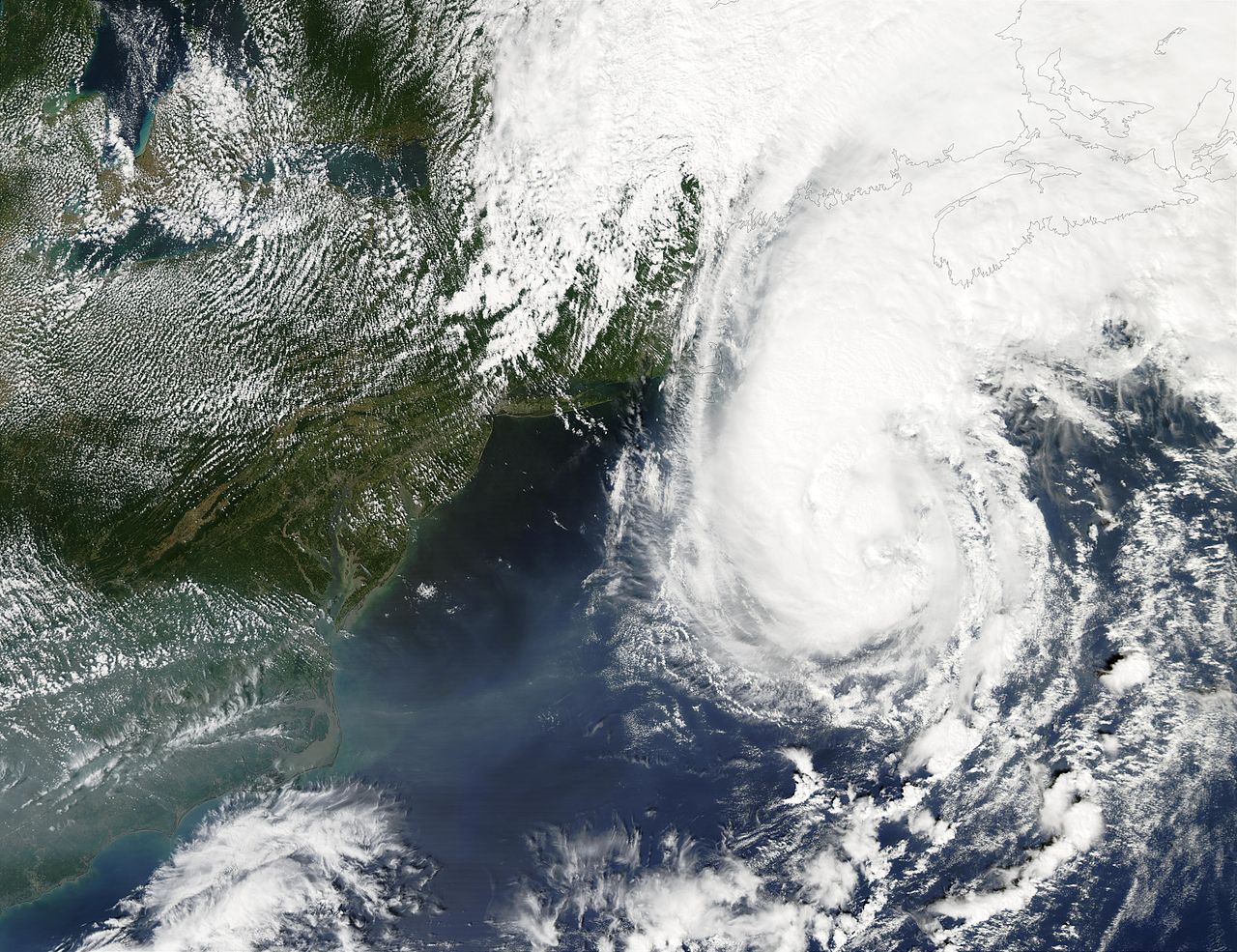
| Description | After hugging the Eastern seaboard for several days as a tropical storm, the storm called Gustav finally made Hurricane status on September 11, 2002, as it moved away from the Maryland and Delaware coasts. The storm eventually made landfall in southwestern Newfoundland on September 12, 2002. This image was acquired by the Moderate Resolution Imaging Spectroradiometer (MODIS) instrument on the Aqua satellite. | |||||
| Date | ||||||
| Source | http://visibleearth.nasa.gov/view_rec.php?id=3888 | |||||
| Author | Jacques Descloitres, MODIS Land Rapid Response Team, NASA/GSFC | |||||
| Permission (Reusing this file) |
|
|||||
| Other versions | Image:HR Gustav 2002.jpg |

File history
Click on a date/time to view the file as it appeared at that time.
| Date/Time | Thumbnail | Dimensions | User | Comment | |
|---|---|---|---|---|---|
| current | 16:52, 10 November 2006 | | 7,800 × 6,000 (8.29 MB) | Good kitty (talk | contribs) | == Summary == {{Information |Description=After hugging the Eastern seaboard for several days as a tropical storm, the storm called Gustav finally made Hurricane status on September 11, 2002, as it moved away from the Maryland and Delaware coasts. The stor |
You cannot overwrite this file.
File usage on Commons
The following page uses this file: