File:Hungary map ES.png
Jump to navigation
Jump to search
Size of this preview: 800 × 577 pixels. Other resolutions: 320 × 231 pixels | 640 × 462 pixels | 1,023 × 738 pixels.
Original file (1,023 × 738 pixels, file size: 69 KB, MIME type: image/png)
Captions
Captions
Add a one-line explanation of what this file represents
| Description |
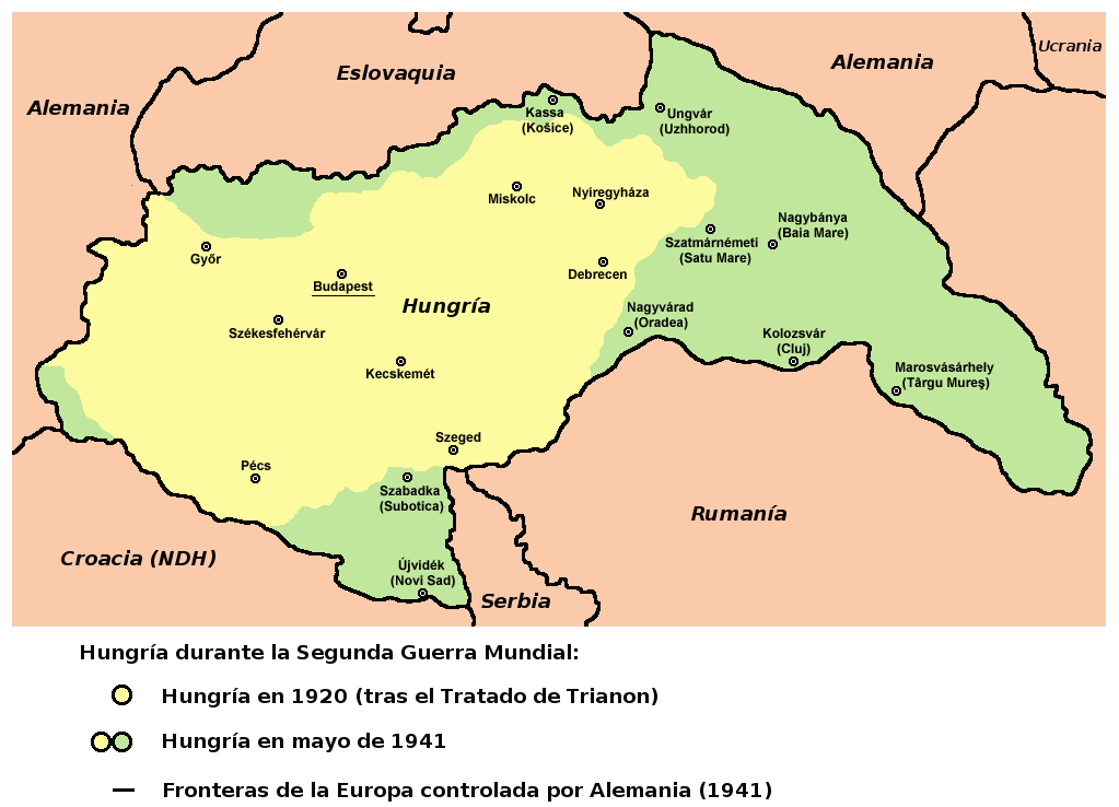
English: Hungary in 1920 and in 1941.
Español: Hungría en entreguerras, cambios territoriales, adaptado del mapa del usuario Panonian. |
| Date | (UTC) |
| Source | |
| Author |
|
References[edit]
- The Times History of Europe, Times Books, London, 2002.
- Richard Overy, The Times History of the 20th Century, Times Books, London, 2004.
- Peter Rokai - Zoltan Đere - Tibor Pal - Aleksandar Kasaš, Istorija Mađara, Beograd, 2002.
- http://terkepek.adatbank.transindex.ro/kepek/netre/224.gif
- http://www.hunmagyar.org/tor/terkep.jpg
- http://www.map.hu/galeria/orig/1426_hu_in_maps_fig_12_states_1648-2009.jpg archive copy at the Wayback Machine
| This is a retouched picture, which means that it has been digitally altered from its original version. Modifications: Spanish version. Countries and legend in Spanish. The original can be viewed here: Hungary map.png:
|
Licensing[edit]
| This work has been released into the public domain by its author, Rowanwindwhistler. This applies worldwide. In some countries this may not be legally possible; if so: |
Original upload log[edit]
This image is a derivative work of the following images:
- File:Hungary_map.png licensed with PD-user
- 2009-12-16T19:28:22Z PANONIAN 1023x738 (70714 Bytes) Reverted to version as of 19:23, 16 December 2009 - fixing thumbnail problem
- 2009-12-16T19:26:17Z PANONIAN 800x540 (15951 Bytes) Reverted to version as of 23:57, 23 December 2006 - fixing thumbnail problem
- 2009-12-16T19:23:07Z PANONIAN 1023x738 (70714 Bytes) improved version
- 2006-12-23T23:57:30Z Electionworld 800x540 (15951 Bytes) {{ew|en|PANONIAN}} == Licensing == {{PD-user|PANONIAN}} [[Category:Maps of the history of Hungary]] [[Category:Maps of the history of Romania]]
Uploaded with derivativeFX
File history
Click on a date/time to view the file as it appeared at that time.
| Date/Time | Thumbnail | Dimensions | User | Comment | |
|---|---|---|---|---|---|
| current | 10:53, 1 January 2010 | | 1,023 × 738 (69 KB) | Rowanwindwhistler (talk | contribs) | {{Information |Description={{en|1=Hungary in 1920 and in 1941. * The Times History of Europe, Times Books, London, 2002. * Richard Overy, The Times History of the 20th Century, Times Books, London, 2004. * Peter Rokai - Zoltan Đere - Tibor Pal - Aleksa |
You cannot overwrite this file.
File usage on Commons
There are no pages that use this file.
File usage on other wikis
The following other wikis use this file:
- Usage on gl.wikipedia.org