File:Huchtinger Dorfschaften 1798.jpg
Jump to navigation
Jump to search
Size of this preview: 428 × 600 pixels. Other resolutions: 171 × 240 pixels | 342 × 480 pixels | 548 × 768 pixels | 731 × 1,024 pixels | 1,989 × 2,787 pixels.
Original file (1,989 × 2,787 pixels, file size: 3.99 MB, MIME type: image/jpeg)
Captions
Captions
Add a one-line explanation of what this file represents
Summary[edit]
| Description |
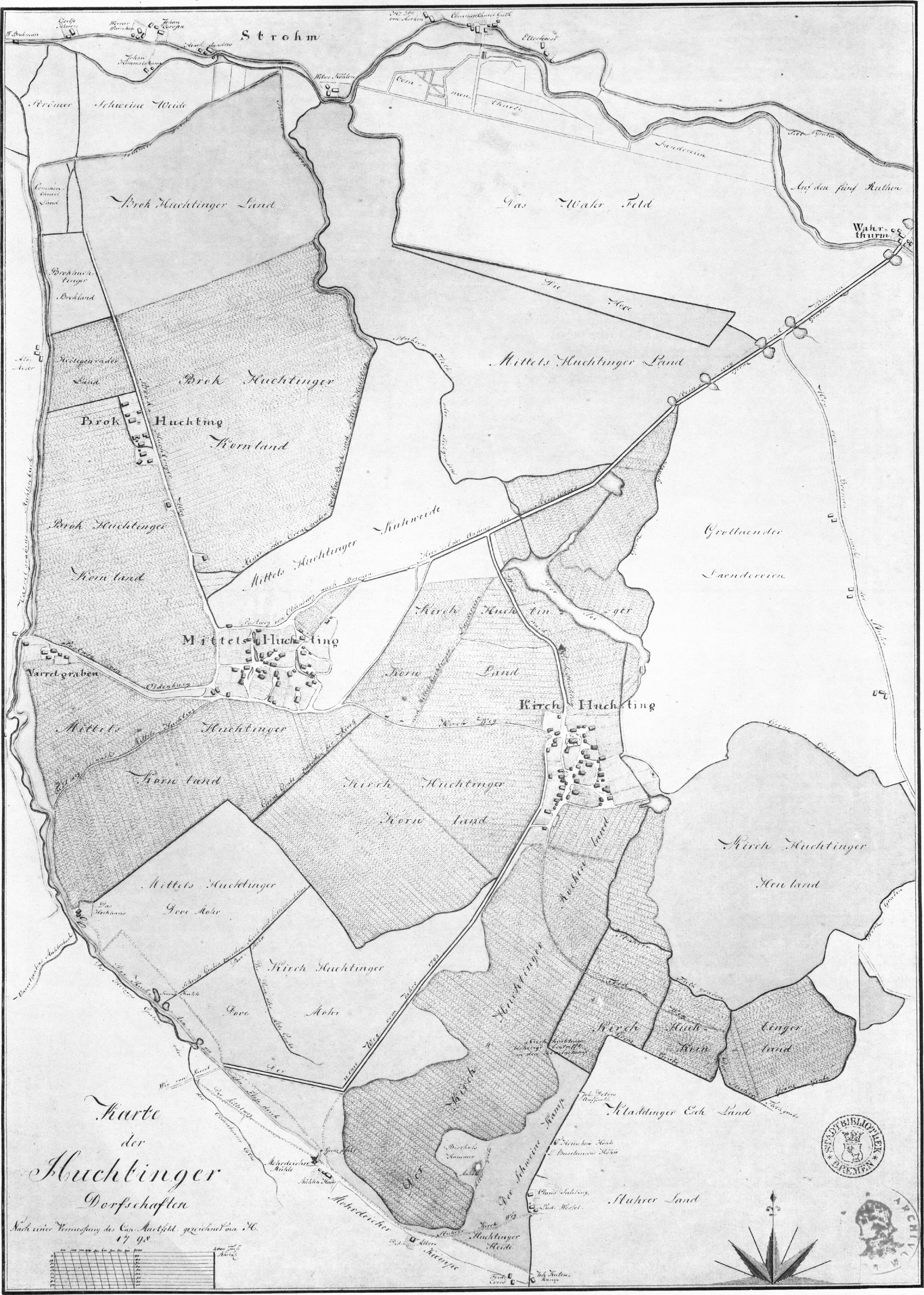
Deutsch: Originaltitel: Karte der Huchtinger Dorfschaften, nach einer Vermessung von Carl Murtfeld gezeichnet von H(einenken) 1798 English: Original title: Map ot the villages of Huchting, surveyed by Carl Murtfeld, drawn by H(eineken) |
| Date | (original map), 2014-12-29 (scan) |
| Source | Scan of a collotype of the original map |
| Author | de:Christian Abraham Heineken, upload Ulamm (talk) 10:38, 30 December 2014 (UTC) |
Licensing[edit]
|
This work is in the public domain in its country of origin and other countries and areas where the copyright term is the author's life plus 100 years or fewer. | |
| This file has been identified as being free of known restrictions under copyright law, including all related and neighboring rights. | |
File history
Click on a date/time to view the file as it appeared at that time.
| Date/Time | Thumbnail | Dimensions | User | Comment | |
|---|---|---|---|---|---|
| current | 10:38, 30 December 2014 | | 1,989 × 2,787 (3.99 MB) | Ulamm (talk | contribs) | {{Information |Description={{de|1=Originaltitel: Karte der Huchtinger Dorfschaften, nach einer Vermessung von Carl Murtfeld gezeichnet von H(einenken) 1798}}{{en|1=Original title: Map ot the villages of Huchting, surveyed by Carl Murtfeld, drawn by H(e... |
You cannot overwrite this file.
File usage on Commons
There are no pages that use this file.
File usage on other wikis
The following other wikis use this file:
- Usage on de.wikipedia.org
- Usage on www.wikidata.org