File:Houmas House Plantation 01.jpg
Jump to navigation
Jump to search

Size of this preview: 780 × 599 pixels. Other resolutions: 313 × 240 pixels | 625 × 480 pixels | 945 × 726 pixels.
Original file (945 × 726 pixels, file size: 231 KB, MIME type: image/jpeg)
Captions
Captions
Add a one-line explanation of what this file represents
| Description |
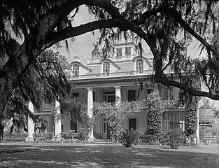
English: Houmas House Plantation, listed by the HABS as Burnside Plantation, State Highway 1, Burnside, Ascension Parish, LA. FRONT ELEVATION. |
|||||
| Date | ||||||
| Source |
Historic American Buildings Survey, Library of Congress, Prints & Photographs Division, HABS [or HAER or HALS], Reproduction number "HABS LA,3-BURSI,1-1"
|
|||||
| Author | Richard Koch | |||||
| Permission (Reusing this file) |
|


| Camera location | | View this and other nearby images on: OpenStreetMap |
|---|
File history
Click on a date/time to view the file as it appeared at that time.
| Date/Time | Thumbnail | Dimensions | User | Comment | |
|---|---|---|---|---|---|
| current | 21:17, 2 February 2011 | | 945 × 726 (231 KB) | Altairisfar (talk | contribs) | {{Information |Description={{en|Houmas House Plantation, listed by the HABS as Burnside Plantation, State Highway 1, Burnside, Ascension Parish, LA. FRONT ELEVATION.}} |Source= Historic American Buildings Survey, Library of Congress, Prints & Photographs |
You cannot overwrite this file.
File usage on Commons
There are no pages that use this file.
File usage on other wikis
The following other wikis use this file:
- Usage on fr.wikipedia.org