File:Horn of Africa (MODIS 2015-12-21).jpg

Original file (6,372 × 7,736 pixels, file size: 8.7 MB, MIME type: image/jpeg)
Captions
Captions
Summary[edit]
.jpg&action=edit§ion=1)
| Description |
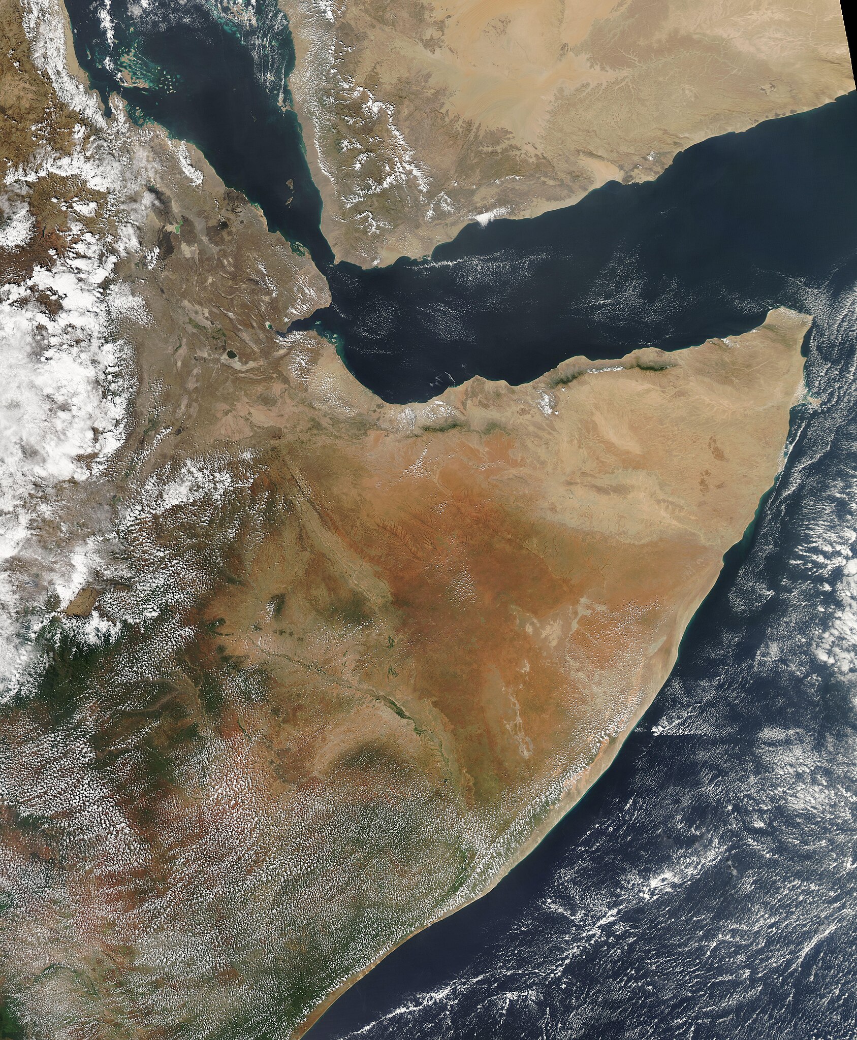
English: On December 10, 2015, the Moderate Resolution Imaging Spectroradiometer (MODIS) aboard NASA�s Aqua satellite passed over the Horn of Africa, acquiring this beautiful true-color image.
The Horn of Africa is the easternmost projection of the African continent, with the Indian Ocean on its east, the Gulf of Aden to the northeast, and the Red Sea along the northwest coast. It contains the countries of Eritrea, Djibouti, Ethiopia and Somalia, and covers about 2,000,000 square kilometers. Eritrea sits along the coast of the Red Sea, Djibouti at the Bab al-Mandab Strait, and Somalia forms the shape of a �7�, with coastline along the Aden Sea and Indian Ocean. Ethiopia lies inland and, in this image, is covered by scattered clouds. The arid country north of the Gulf of Aden is Yemen. The region is said to be �Horn of Africa� because the peninsula�s projection into the Gulf of Aden resembles the horn of a Black Rhinoceros � a critically endangered species that once lived here. Much of the Horn of Africa is an arid region, but it also contains lakes, rivers, forests and many untapped natural resources. Unfortunately, long periods of drought interspersed with heavy flooding, along with intense and prolonged conflict, has brought famine and devastation to much of the region. |
||
| Date | Taken on 10 December 2015 | ||
| Source |
|
||
| Author | Jeff Schmaltz, MODIS Land Rapid Response Team, NASA GSFC |
| This media is a product of the Aqua mission Credit and attribution belongs to the mission team, if not already specified in the "author" row |
Licensing[edit]
.jpg&action=edit§ion=2)
| This file is in the public domain in the United States because it was solely created by NASA. NASA copyright policy states that "NASA material is not protected by copyright unless noted". (See Template:PD-USGov, NASA copyright policy page or JPL Image Use Policy.) | ||
 |
Warnings:
|
File history
Click on a date/time to view the file as it appeared at that time.
| Date/Time | Thumbnail | Dimensions | User | Comment | |
|---|---|---|---|---|---|
| current | 09:46, 15 February 2024 | | 6,372 × 7,736 (8.7 MB) | OptimusPrimeBot (talk | contribs) | #Spacemedia - Upload of http://modis.gsfc.nasa.gov/gallery/images/image12212015_250m.jpg via Commons:Spacemedia |
You cannot overwrite this file.
File usage on Commons
There are no pages that use this file.
.jpg&oldid=851908577)