File:Hochschule für Technik (HFT) Stuttgart - Neubau 2016 01.jpg
Jump to navigation
Jump to search
Size of this preview: 800 × 533 pixels. Other resolutions: 320 × 213 pixels | 640 × 427 pixels | 1,024 × 683 pixels | 1,280 × 853 pixels | 2,560 × 1,707 pixels | 6,000 × 4,000 pixels.
Original file (6,000 × 4,000 pixels, file size: 11.64 MB, MIME type: image/jpeg)
Captions
Captions
Add a one-line explanation of what this file represents
Summary[edit]
_Stuttgart_-_Neubau_2016_01.jpg&action=edit§ion=1)
| Description |
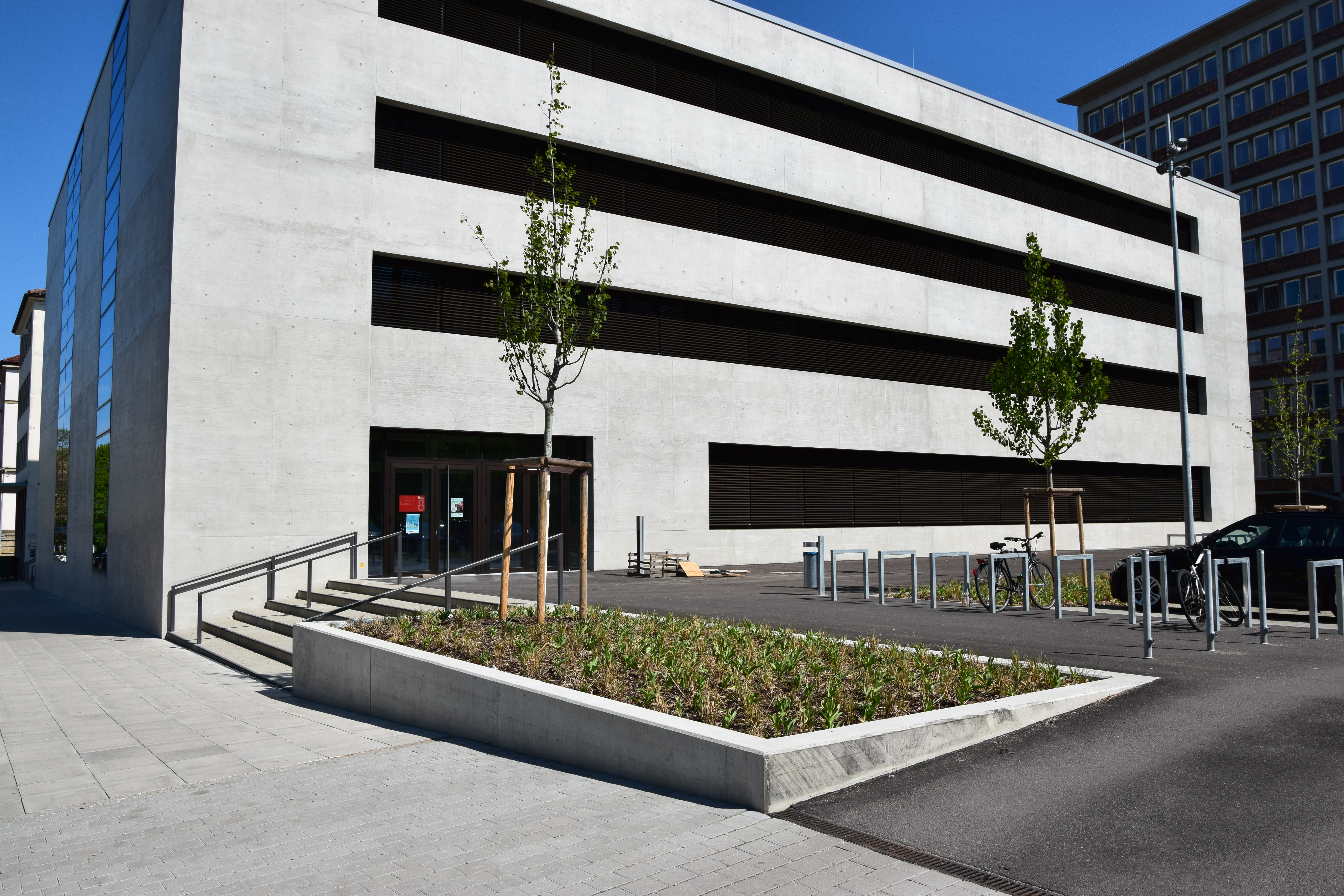
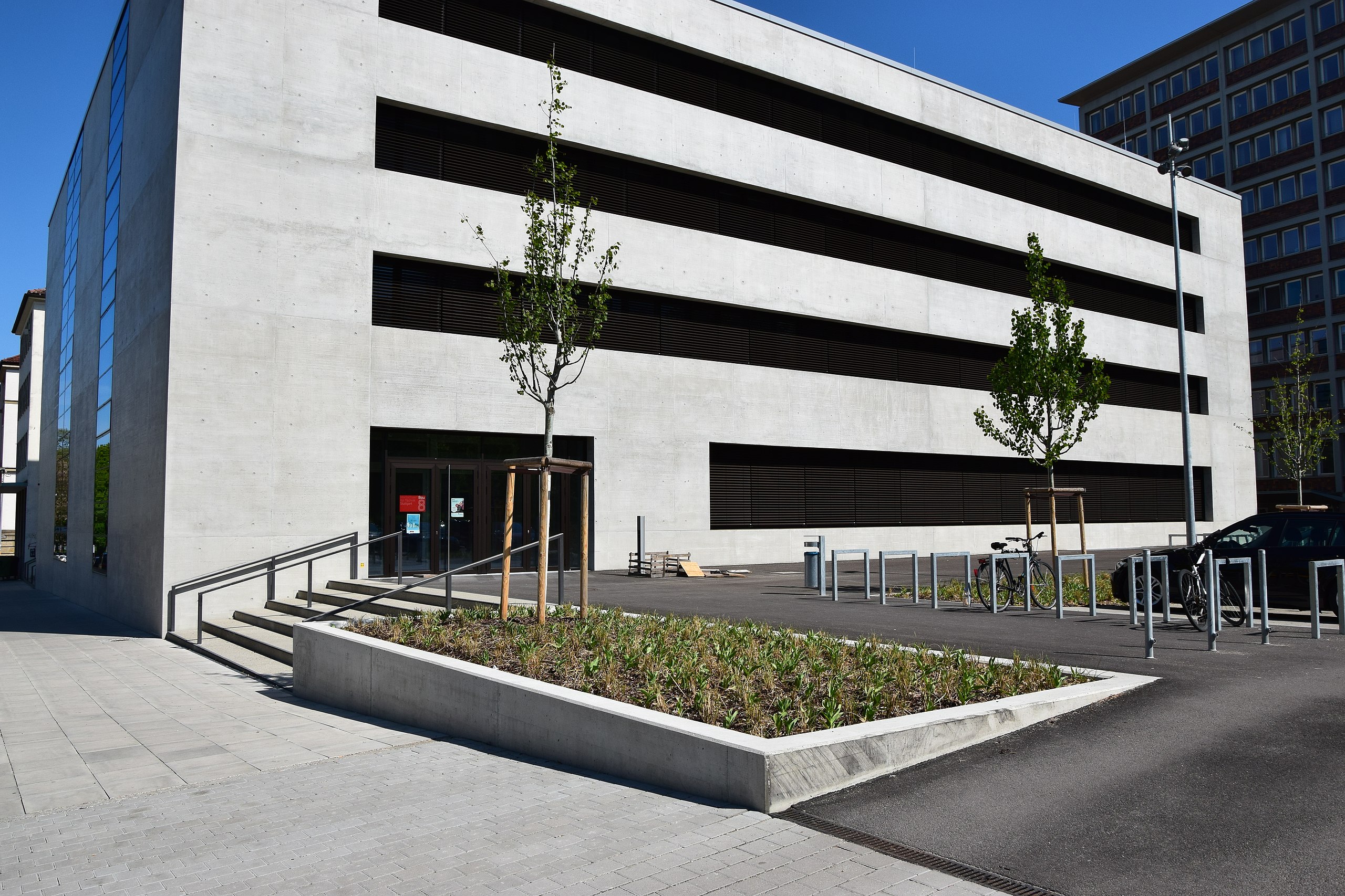
Deutsch: Neubau der Hochschule für Technik Stuttgart für die Fakultät Architektur und Gestaltung in Stuttgart, Baden-Württemberg, Deutschland. Errichtet wurde das Gebäude 2012 bis 2016.
English: New building of the college for technology Stuttgart for the faculty architecture and creation in Stuttgart, Baden-Wurttemberg, Germany. The building was established from 2012 to 2016.
Français : Immeuble neuf de la grande école pour la technique Stuttgart pour la faculté l'architecture et organisation à Stuttgart, le Baden-Wurtemberg, l'Allemagne. Le bâtiment était construit de 2012 à 2016.
Italiano: Nuova costruzione dell'istituto superiore per tecnologia Stoccarda per l'architettura di facoltà e la creazione in Stoccarda, Baden-Wurttemberg, la Germania. L'edificio fu istituito a partire dal 2012 a 2016.
Português: Novo edifício do colégio de tecnologia Stuttgart da arquitetura de faculdade e criação em Stuttgart, Baden-Wurttemberg, a Alemanha. O edifício foi estabelecido desde 2012 para 2016.
Español: Nueva construcción de la escuela superior para la técnica Stuttgart para la facultad la arquitectura y organización en Stuttgart, el Baden-Wurtemberg, Alemania. El edificio era erigido de 2012 a 2016.
Русский: Новостройка института для техники Штутгарт для факультета архитектуру и оформление в Штутгарте, Баден-Вюртемберге, Германии. Здание сооружалось с 2012 по 2016.
| ||
| Address |
|
||
| Date | |||
| Source | Own work | ||
| Author | MSeses | ||
| Attribution (required by the license) | © MSeses / Wikimedia Commons / | ||
| Object location | | View this and other nearby images on: OpenStreetMap |
|---|
_Stuttgart_-_Neubau_2016_01.jpg¶ms=048.779983_N_0009.171197_E_globe:Earth_class:object_type:object__&language=en)
Licensing[edit]
_Stuttgart_-_Neubau_2016_01.jpg&action=edit§ion=2)
I, the copyright holder of this work, hereby publish it under the following license:
This file is licensed under the Creative Commons Attribution-Share Alike 4.0 International license.
- You are free:
- to share – to copy, distribute and transmit the work
- to remix – to adapt the work
- Under the following conditions:
- attribution – You must give appropriate credit, provide a link to the license, and indicate if changes were made. You may do so in any reasonable manner, but not in any way that suggests the licensor endorses you or your use.
- share alike – If you remix, transform, or build upon the material, you must distribute your contributions under the same or compatible license as the original.
File history
Click on a date/time to view the file as it appeared at that time.
| Date/Time | Thumbnail | Dimensions | User | Comment | |
|---|---|---|---|---|---|
| current | 09:04, 18 June 2017 | | 6,000 × 4,000 (11.64 MB) | MSeses (talk | contribs) | User created page with UploadWizard |
You cannot overwrite this file.
File usage on Commons
The following page uses this file:
File usage on other wikis
The following other wikis use this file:
- Usage on de.wikipedia.org
_Stuttgart_-_Neubau_2016_01.jpg&oldid=545445835)