File:Helsingfors svatlas.jpg
Original file (775 × 779 pixels, file size: 203 KB, MIME type: image/jpeg)
Captions
Captions
| Description |
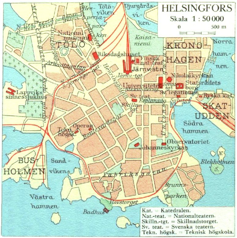
English: Map of central Helsinki, Finland, in 1930. |
|||||||||
| Date | ||||||||||
| Source | Svensk världsatlas (1930), page 42 | |||||||||
| Creator |
unknown cartographer |
|||||||||
| Permission (Reusing this file) |
|
|||||||||
| Geotemporal data | ||||||||||
| Bounding box |
|
|||||||||
| Georeferencing | ||||||||||
File history
Click on a date/time to view the file as it appeared at that time.
| Date/Time | Thumbnail | Dimensions | User | Comment | |
|---|---|---|---|---|---|
| current | 21:15, 29 October 2009 | | 775 × 779 (203 KB) | LA2 (talk | contribs) | {{Information |Description=Map of central Helsinki, Finland, in 1930. |Source=[http://runeberg.org/svatlas/0050.html Svensk världsatlas (1930), page 42] |Date=1930 |Author=unknown cartographer |Permission={{PD-old}} |other_versions= }} [[Category:Maps of |
You cannot overwrite this file.
File usage on Commons
There are no pages that use this file.
File usage on other wikis
The following other wikis use this file:
- Usage on en.wikipedia.org
- Usage on fi.wikipedia.org
- Usage on fr.wikipedia.org
- Usage on sv.wikipedia.org