File:Harzgerode in Harzgerode.svg
Jump to navigation
Jump to search

Size of this PNG preview of this SVG file: 800 × 566 pixels. Other resolutions: 320 × 226 pixels | 640 × 453 pixels | 1,024 × 724 pixels | 1,280 × 905 pixels | 2,560 × 1,810 pixels | 1,052 × 744 pixels.
Original file (SVG file, nominally 1,052 × 744 pixels, file size: 130 KB)
Captions
Captions
Add a one-line explanation of what this file represents
Summary[edit]
| Description |
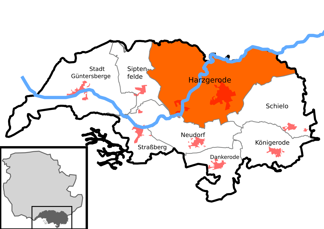
Deutsch: Lage von Harzgerode in der Stadt Harzgerode im Landkreis Harz in Sachsen-Anhalt, Deutschland.
English: Location of Harzgerode in the municipality Harzgerode in Landkreis Harz in Saxony-Anhalt, Germany.
This SVG file was uploaded with Commonist. |
||
| Date | |||
| Source |
Own work, with Data by Openstreetmap Contributors, This W3C-unspecified vector image was created with QGIS. This W3C-unspecified vector image was created with Inkscape . |
||
| Author | Pomfuttge |
Licensing[edit]
I, the copyright holder of this work, hereby publish it under the following license:
This file is licensed under the Creative Commons Attribution-Share Alike 4.0 International license.
- You are free:
- to share – to copy, distribute and transmit the work
- to remix – to adapt the work
- Under the following conditions:
- attribution – You must give appropriate credit, provide a link to the license, and indicate if changes were made. You may do so in any reasonable manner, but not in any way that suggests the licensor endorses you or your use.
- share alike – If you remix, transform, or build upon the material, you must distribute your contributions under the same or compatible license as the original.
File history
Click on a date/time to view the file as it appeared at that time.
| Date/Time | Thumbnail | Dimensions | User | Comment | |
|---|---|---|---|---|---|
| current | 10:07, 31 October 2023 | | 1,052 × 744 (130 KB) | Pomfuttge (talk | contribs) | corr. strokes |
| 16:37, 25 April 2021 |  | 1,052 × 744 (119 KB) | Pomfuttge (talk | contribs) | Güntersberge without h | |
| 16:21, 25 April 2021 |  | 1,052 × 744 (119 KB) | Pomfuttge (talk | contribs) | == {{int:filedesc}} == {{Information |Description={{User:Pomfuttge/KB|Ortschaft = Harzgerode |de-Link=Harzgerode |en-Link=Harzgerode |LK=HZ |Fluss =Selke |Stadt=Stadt}} |Source={{own}}, with Data by Openstreetmap Contributors, {{Created with QGIS}}{{Created with Inkscape}} |Author=Pomfuttge |Date=2021-04-25 |other fields= |other_versions= }} == {{int:license-header}} == {{self|cc-by-sa-4.0}} [[Category:Maps of the districts of Harzger... |
You cannot overwrite this file.
File usage on Commons
The following 2 pages use this file: