File:Harta raionul Ismail.svg
Jump to navigation
Jump to search

Size of this PNG preview of this SVG file: 420 × 599 pixels. Other resolutions: 168 × 240 pixels | 336 × 480 pixels | 538 × 768 pixels | 717 × 1,024 pixels | 1,435 × 2,048 pixels | 2,056 × 2,934 pixels.
Original file (SVG file, nominally 2,056 × 2,934 pixels, file size: 31.58 MB)
Captions
Captions
Add a one-line explanation of what this file represents
Summary
[edit]| Description |
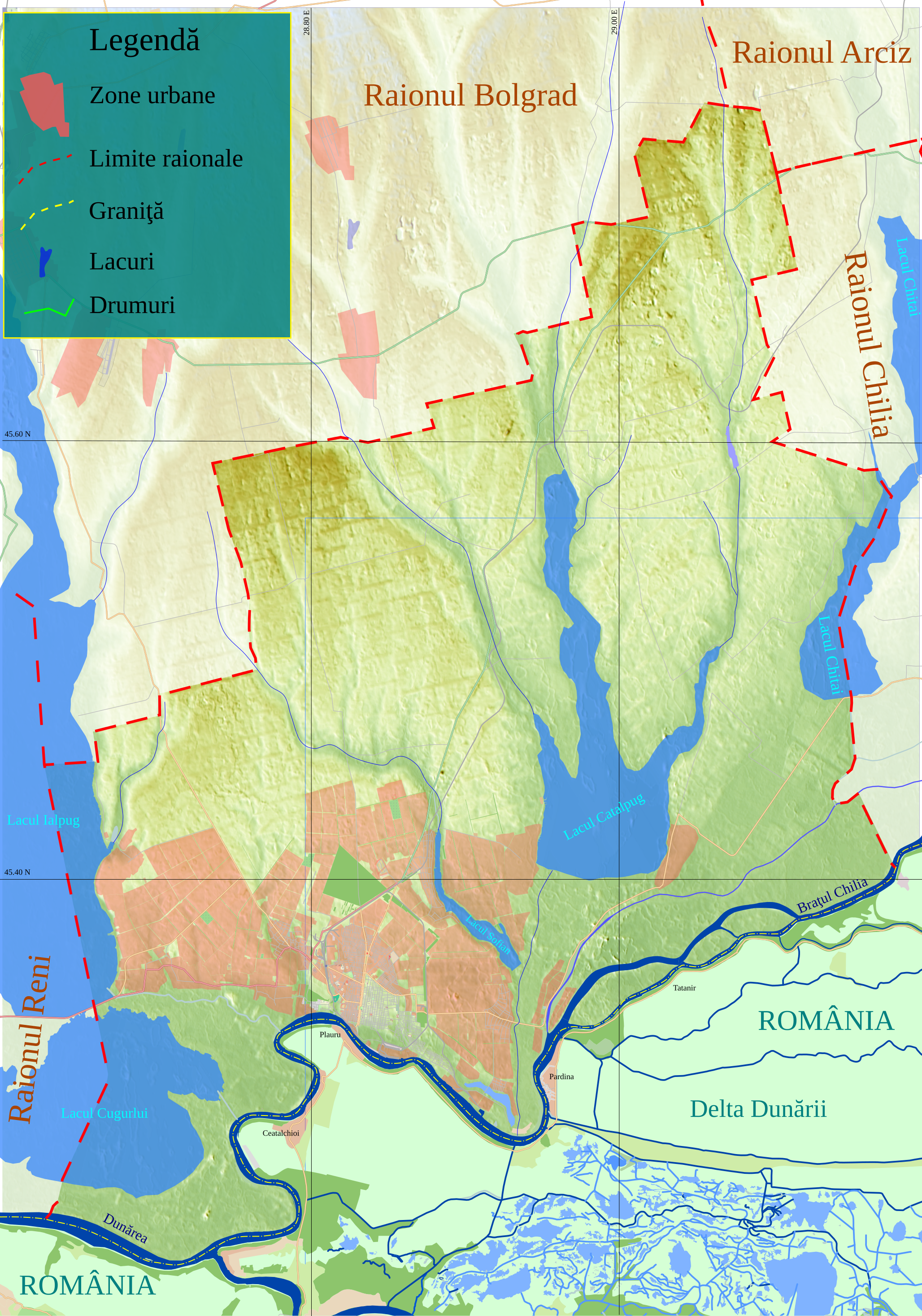
Harta raionului Ismail. Top:45.8N Bottom:45.2N Left:28.6E Right:29.199E |
| Date | |
| Source |
|
| Author | Asybaris01 (talk) 17:54, 16 February 2013 (UTC) |
| Other versions |
|


Licensing
[edit]
| This file is in the public domain in the United States because it was solely created by NASA. NASA copyright policy states that "NASA material is not protected by copyright unless noted". (See Template:PD-USGov, NASA copyright policy page or JPL Image Use Policy.) | ||
 |
Warnings:
|
File history
Click on a date/time to view the file as it appeared at that time.
| Date/Time | Thumbnail | Dimensions | User | Comment | |
|---|---|---|---|---|---|
| current | 17:54, 16 February 2013 | | 2,056 × 2,934 (31.58 MB) | Asybaris01 (talk | contribs) | {{Information |Description=Harta raionul Ismail. |Source= *{{own}} *Date SRTM furnizate liber de NASA si openstreetmaps. Programe utilizate: 3DEM, Inkscape, CorelDraw. |Date=2013-02 |Author=~~~~ |Permission= |other_versions= }} [[Category:Raionul Isma... |
You cannot overwrite this file.
File usage on Commons
The following page uses this file:
File usage on other wikis
The following other wikis use this file:
- Usage on zh.wikipedia.org