File:Harta de localizare Moldova Transnistria.jpg
Jump to navigation
Jump to search

Size of this preview: 406 × 599 pixels. Other resolutions: 163 × 240 pixels | 325 × 480 pixels | 978 × 1,442 pixels.
Original file (978 × 1,442 pixels, file size: 578 KB, MIME type: image/jpeg)
Captions
Captions
Add a one-line explanation of what this file represents
Summary[edit]
| Description |
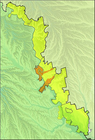
Română: Harta de localizare Moldova Transnistria |
| Date | |
| Source | Date SRTM furnizate liber de NASA, OpenStreetMaps, 3DEM, Inkscape |
| Author | Asybaris01 |
Licensing[edit]
| This file is in the public domain in the United States because it was solely created by NASA. NASA copyright policy states that "NASA material is not protected by copyright unless noted". (See Template:PD-USGov, NASA copyright policy page or JPL Image Use Policy.) | ||
 |
Warnings:
|
File history
Click on a date/time to view the file as it appeared at that time.
| Date/Time | Thumbnail | Dimensions | User | Comment | |
|---|---|---|---|---|---|
| current | 21:44, 31 March 2014 | | 978 × 1,442 (578 KB) | Spiridon Ion Cepleanu (talk | contribs) | International border thicker, only UTSN borders & raions in black. |
| 07:38, 8 March 2012 |  | 978 × 1,442 (884 KB) | Asybaris01 (talk | contribs) | color | |
| 07:15, 8 March 2012 |  | 978 × 1,442 (893 KB) | Asybaris01 (talk | contribs) | enclava | |
| 18:43, 5 March 2012 |  | 979 × 1,443 (902 KB) | Asybaris01 (talk | contribs) | {{Information |Description ={{ro|1=Harta de localizare Moldova Transnistria}} |Source =Date SRTM furnizate liber de NASA, OpenStreetMaps, 3DEM, Inkscape |Author =Asybaris01 |Date =mar 2012 |Permission ... |
You cannot overwrite this file.
File usage on Commons
There are no pages that use this file.
File usage on other wikis
The following other wikis use this file:
- Usage on arz.wikipedia.org
- Usage on fr.wikipedia.org
- Usage on ro.wikipedia.org
- Dubăsari
- Camenca
- Slobozia, Moldova
- Grigoriopol
- Afanasievca, Stînga Nistrului
- Alexandrovca Nouă, Stînga Nistrului
- Andreevca, Stînga Nistrului
- Andriașevca Nouă, Stînga Nistrului
- Andriașevca Veche, Stînga Nistrului
- Basarabca, Stînga Nistrului
- Bosca, Stînga Nistrului
- Bruslachi, Stînga Nistrului
- Buschi, Stînga Nistrului
- Calinovca, Stînga Nistrului
- Cernița, Stînga Nistrului
- Chirov, Stînga Nistrului
- Cobasna, Stînga Nistrului
- Coicova, Stînga Nistrului
- Coșnița Nouă, Stînga Nistrului
- Crasnaia Gorca, Stînga Nistrului
- Crasnoe
- Doibani II, Stînga Nistrului
- Frunzăuca, Stînga Nistrului
- Gherșunovca, Stînga Nistrului
- Goian, Stînga Nistrului
- Goianul Nou, Stînga Nistrului
- Iagorlîc, Stînga Nistrului
- Iantarnoe, Stînga Nistrului
- Lîsaia Gora, Stînga Nistrului
- Lunga Nouă, Stînga Nistrului
- Marian, Stînga Nistrului
- Mihailovca Nouă, Stînga Nistrului
- Mocearovca, Stînga Nistrului
- Mocreachi, Stînga Nistrului
- Molochișul Mic, Stînga Nistrului
- Nicolscoe, Stînga Nistrului
- Novaia Jizni, Stînga Nistrului
- Novocotovsc, Stînga Nistrului
- Novosavițcaia (stație c.f.), Stînga Nistrului
- Novovladimirovca, Stînga Nistrului
- Pîcalova, Stînga Nistrului
- Podoimița, Stînga Nistrului
- Pohrebea, Dubăsari
- Pohrebea Nouă, Stînga Nistrului
- Rașcov, Stînga Nistrului
- Sadchi, Stînga Nistrului
- Sărăței, Stînga Nistrului
View more global usage of this file.