File:Harpers Ferry National Park map.svg
Jump to navigation
Jump to search

Size of this PNG preview of this SVG file: 465 × 263 pixels. Other resolutions: 320 × 181 pixels | 640 × 362 pixels | 1,024 × 579 pixels | 1,280 × 724 pixels | 2,560 × 1,448 pixels.
Original file (SVG file, nominally 465 × 263 pixels, file size: 124 KB)
Captions
Captions
Add a one-line explanation of what this file represents
Summary[edit]
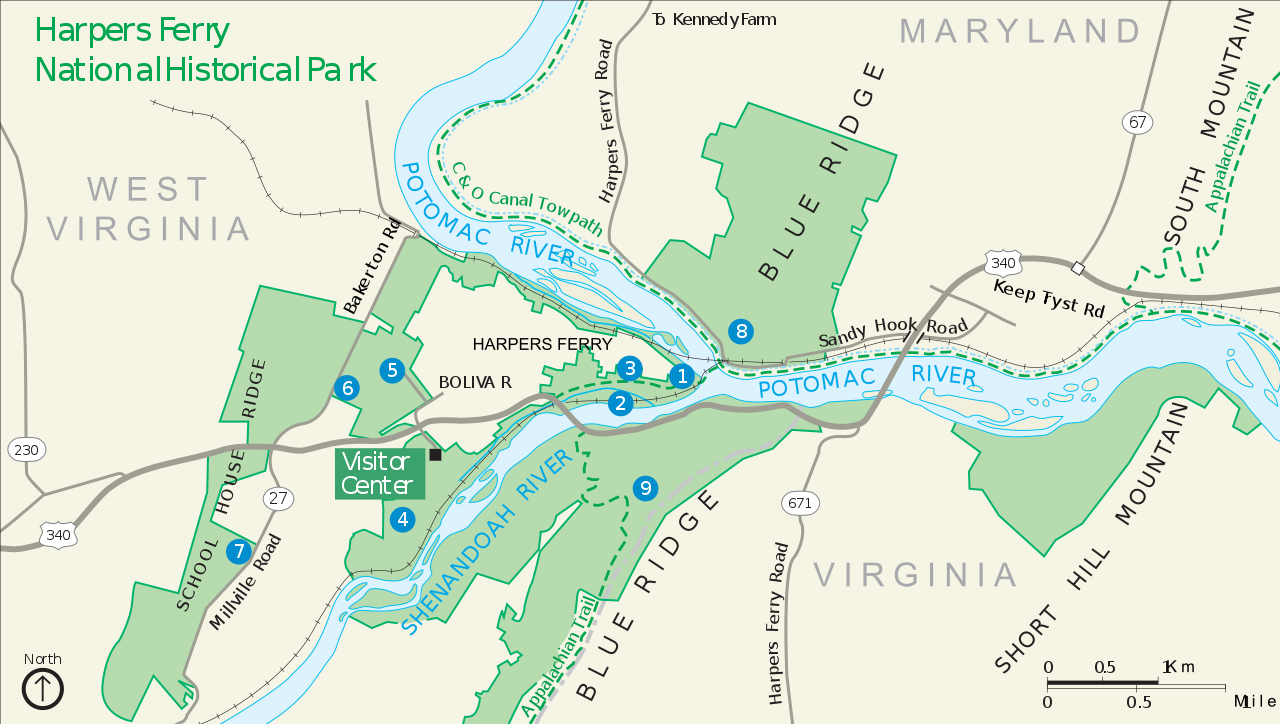
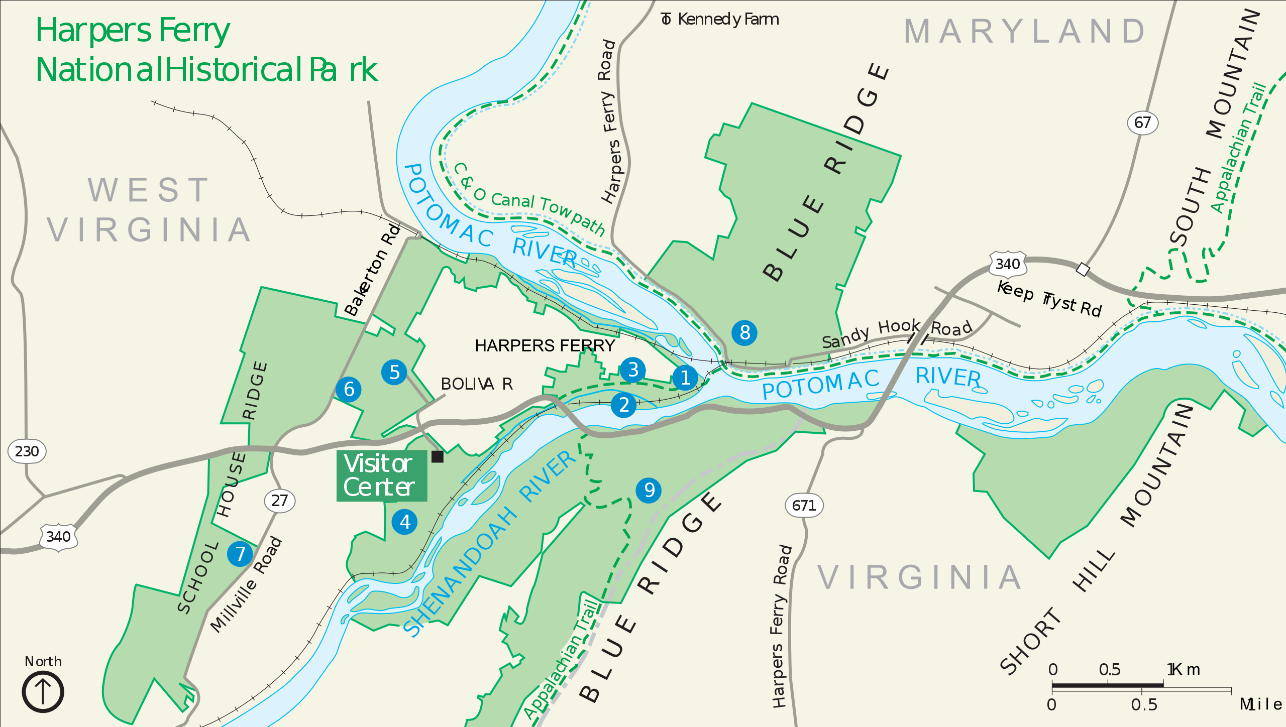
National Park Service map of Harpers Ferry, West Virginia. U.S. Government document from http://www.nps.gov/hafe/planyourvisit/upload/HAFEmap1.pdf
Licensing[edit]
| This image or media file contains material based on a work of a National Park Service employee, created as part of that person's official duties. As a work of the U.S. federal government, such work is in the public domain in the United States. See the NPS website and NPS copyright policy for more information. |
File history
Click on a date/time to view the file as it appeared at that time.
| Date/Time | Thumbnail | Dimensions | User | Comment | |
|---|---|---|---|---|---|
| current | 16:32, 21 April 2011 | | 465 × 263 (124 KB) | Liandrei (talk | contribs) | Fixes |
| 16:23, 21 April 2011 |  | 465 × 263 (110 KB) | Liandrei (talk | contribs) | ==Summary== National Park Service map of Harpers Ferry, West Virginia. U.S. Government document from http://www.nps.gov/hafe/planyourvisit/upload/HAFEmap1.pdf == Licensing == {{PD-USGov-NPS}} Category:Harpers Ferry |
You cannot overwrite this file.
File usage on Commons
The following 2 pages use this file:
File usage on other wikis
The following other wikis use this file:
- Usage on en.wikipedia.org