File:Harmony Township from I-70.jpg
Jump to navigation
Jump to search

Size of this preview: 800 × 600 pixels. Other resolutions: 320 × 240 pixels | 640 × 480 pixels | 1,024 × 768 pixels | 1,280 × 960 pixels | 2,560 × 1,920 pixels | 2,816 × 2,112 pixels.
Original file (2,816 × 2,112 pixels, file size: 1.05 MB, MIME type: image/jpeg)
Captions
Captions
Add a one-line explanation of what this file represents
| Camera location | | View this and other nearby images on: OpenStreetMap |
|---|
| Description |
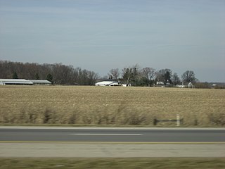
English: Countryside in far western Harmony Township, Clark County, Ohio, United States. Picture was taken looking to the northwest from the eastbound lanes of Interstate 70, just west of the Plattsburg Road overpass. |
||
| Date | Taken on 18 March 2009 | ||
| Source | Own work | ||
| Author | Nyttend | ||
| Permission (Reusing this file) |
|
File history
Click on a date/time to view the file as it appeared at that time.
| Date/Time | Thumbnail | Dimensions | User | Comment | |
|---|---|---|---|---|---|
| current | 12:47, 25 September 2009 | | 2,816 × 2,112 (1.05 MB) | Nyttend (talk | contribs) | {{Location|39|55|0|N|83|41|46.212|W}} {{Information |Description={{en|Countryside in far western {{w|Harmony Township, Clark County, Ohio|Harmony Township}}, {{w|Clark County, Ohio|Clark County}}, {{w|Ohio}}, {{w|United States}}. Picture was taken lookin |
You cannot overwrite this file.
File usage on Commons
The following page uses this file:
File usage on other wikis
The following other wikis use this file:
- Usage on de.wikipedia.org
- Usage on en.wikipedia.org
- Usage on eu.wikipedia.org
- Usage on fa.wikipedia.org
- Usage on pt.wikipedia.org
- Usage on ur.wikipedia.org
- Usage on vi.wikipedia.org
- Usage on www.wikidata.org
- Usage on zh.wikipedia.org