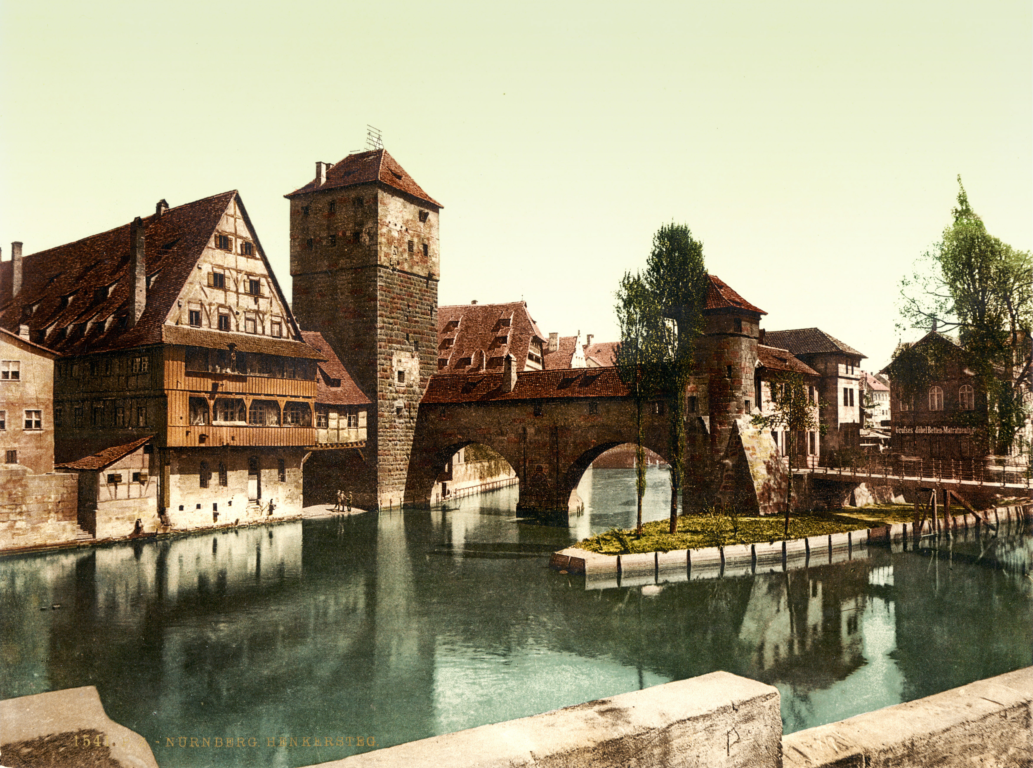
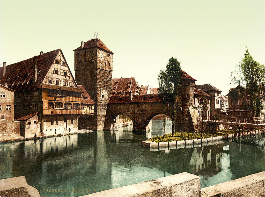
File:Hangman Bridge, Nuremberg, Bavaria, 1890s.jpg
Original file (3,504 × 2,604 pixels, file size: 3.16 MB, MIME type: image/jpeg)
Captions
Captions
Summary[edit]
| Description |
Hangman's Bridge (Henkersteg), Nuremberg (Nürnberg), Bavaria, Germany. 1 photomechanical print : photochrom, color. From www.nuernberg.de/internet/portal_e/reiseziel/ctz_2004.html: "The Hangman's Bridge (Henkersteg) was constructed in 1457 as a wooden bridge. Between the 16th and the 19th century, the Nuremberg hangman lived in the tower and the roofed walk above the river Pegnitz. After the flood of 1595, three arches of the town wall bridging the southern arm of the river Pegnitz were demolished and replaced by the wooden Hangman's Bridge with its tiled roof (reconstructed in 1954). The executioner had to live in segregated accommodation within the city, since his trade was considered "dishonest". Up until the Age of Enlightenment, citizens avoided any physical contact with the hangman, in order not to be excluded from the Christian community." |
||
| Date | between 1890 and 1900 | ||
| Source |
|
||
| Author | Photoglob Zürich, reprinted by Detroit Publishing Co. |

| Camera location | | View this and other nearby images on: OpenStreetMap |
|---|
Licensing[edit]
The author of this image from Switzerland is unknown, and the image was published at least 70 years ago. It is therefore in the public domain in Switzerland by virtue of Art. 31 of the Swiss Copyright Act.
|
 |
File history
Click on a date/time to view the file as it appeared at that time.
| Date/Time | Thumbnail | Dimensions | User | Comment | |
|---|---|---|---|---|---|
| current | 16:13, 12 August 2010 | | 3,504 × 2,604 (3.16 MB) | BotMultichillT (talk | contribs) | {{Information |Description=Hangman Bridge (Henkersteg), Nuremberg (Nürnberg), Bavaria, Germany. Photochrom print by [http://en.wikipedia.org/wiki/Photochrom Photoglob Zürich], between 1890 and 1900. From [http://www.nuernberg.de/internet/portal_e/reise |
You cannot overwrite this file.
File usage on Commons
The following 2 pages use this file:
.jpg&redirect=no)
File usage on other wikis
The following other wikis use this file:
- Usage on en.wikipedia.org
- Usage on es.wikipedia.org
- Usage on pl.wikipedia.org