File:Handy Farmhouse, Cynthiana.jpg
Jump to navigation
Jump to search
Size of this preview: 800 × 532 pixels. Other resolutions: 320 × 213 pixels | 640 × 426 pixels | 1,024 × 681 pixels | 1,280 × 851 pixels | 2,560 × 1,702 pixels | 6,016 × 4,000 pixels.
Original file (6,016 × 4,000 pixels, file size: 6.97 MB, MIME type: image/jpeg)
Captions
Captions
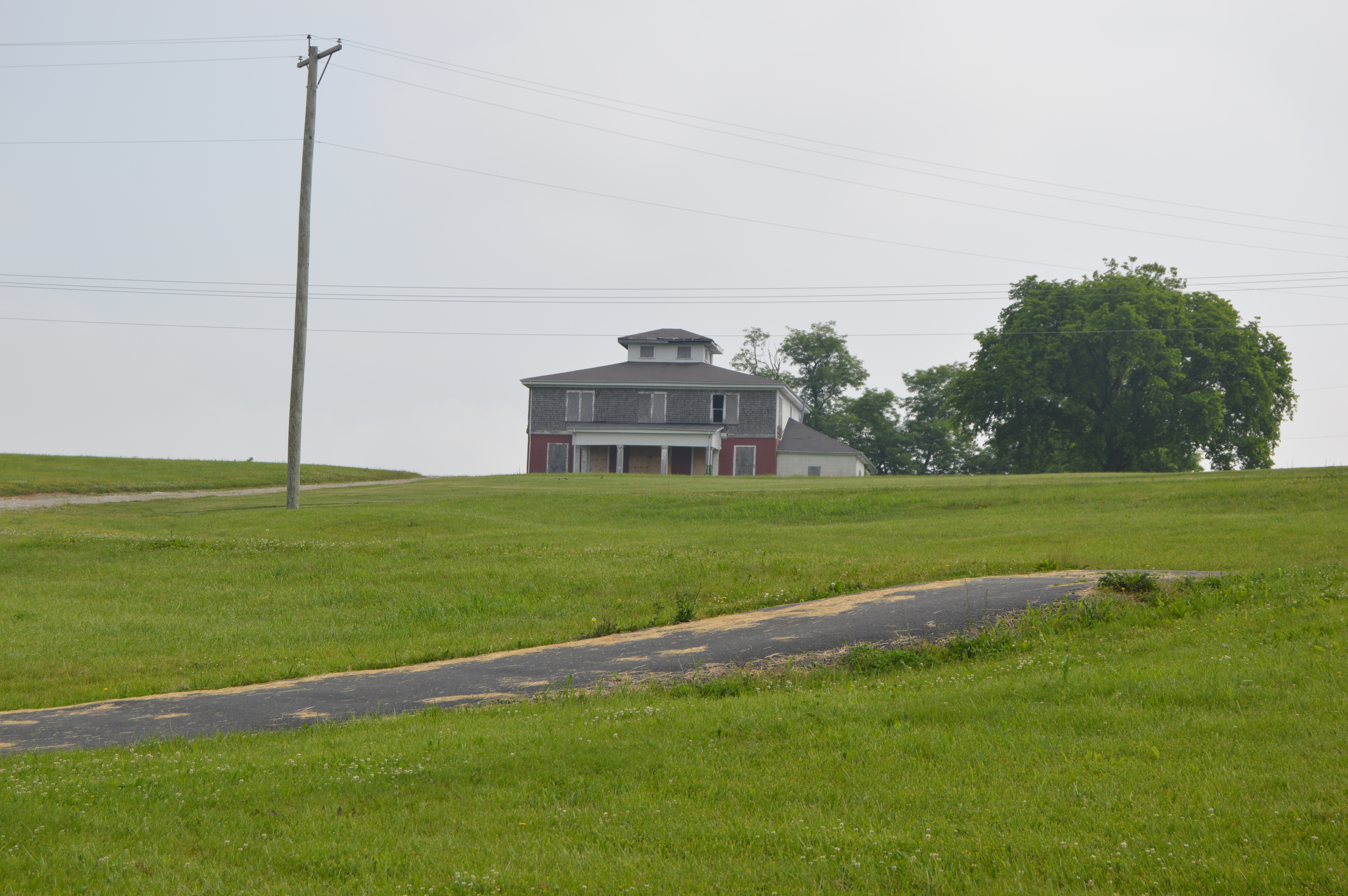
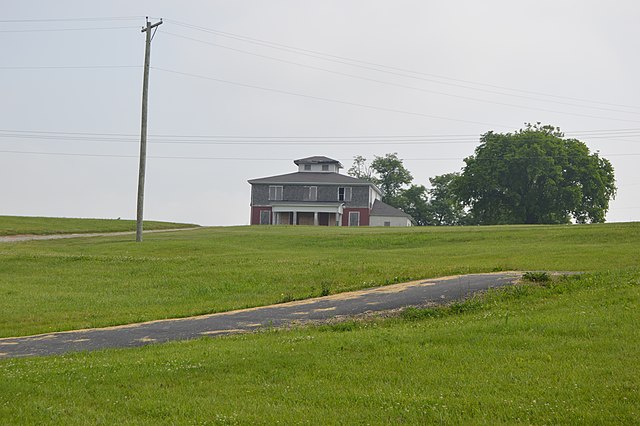
The house is no longer standing.
|
This is an image of a place or building that is listed on the National Register of Historic Places in the United States of America. Its reference number is 05001316. |
| Camera location | | View this and other nearby images on: OpenStreetMap |
|---|
| Description |
English: Front of the Handy Farmhouse, located in Veterans Memorial Park off Oddville Pike ((U.S. Route 62) in Cynthiana, Kentucky, United States. The house and adjoining farm buildings are listed together on the National Register of Historic Places. |
||
| Date | Taken on 30 May 2014 | ||
| Source | Own work | ||
| Author | Nyttend | ||
| Permission (Reusing this file) |
|
File history
Click on a date/time to view the file as it appeared at that time.
| Date/Time | Thumbnail | Dimensions | User | Comment | |
|---|---|---|---|---|---|
| current | 01:38, 12 June 2014 | | 6,016 × 4,000 (6.97 MB) | Nyttend (talk | contribs) | {{NRHP|05001316}} {{Location|38|23|54|N|84|17|8|W}} {{Information |Description={{en|Front of the {{w|Handy Farm|Handy Farmhouse}}, located in Veterans Memorial Park off Oddville Pike (({{w|U.S. Route 62}}) in {{w|Cynthiana, Kentucky|Cynthiana}}, {{w|Ke... |
You cannot overwrite this file.
File usage on Commons
There are no pages that use this file.
File usage on other wikis
The following other wikis use this file:
- Usage on en.wikipedia.org