File:Hadrian's Wall map A.svg
Jump to navigation
Jump to search

Size of this PNG preview of this SVG file: 800 × 453 pixels. Other resolutions: 320 × 181 pixels | 640 × 362 pixels | 1,024 × 579 pixels | 1,280 × 724 pixels | 2,560 × 1,449 pixels | 1,267 × 717 pixels.
Original file (SVG file, nominally 1,267 × 717 pixels, file size: 1.1 MB)
Captions
Captions
Add a one-line explanation of what this file represents
Summary[edit]
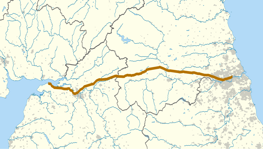
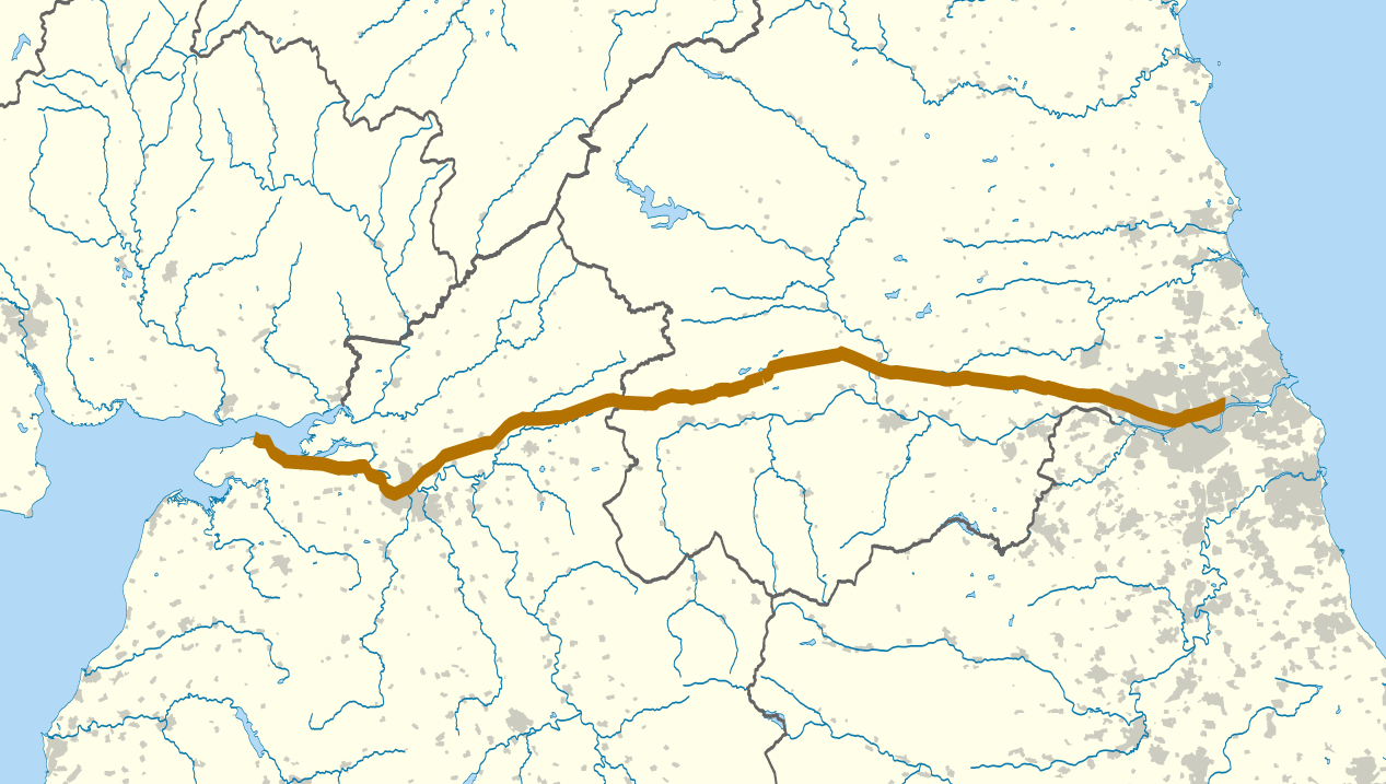
| Description | The route of Hadrian's Wall (in brown) between the Solway Firth and the Tyne. The background map shows counties and urban areas. Equirectangular map projection on WGS 84 datum, with N/S stretched 170% Geographic limits: *West: 3.65W *East: 1.25W *North: 55.4N *South: 54.6N |
| Date | (UTC) |
| Source | |
| Author |
|
| This is a retouched picture, which means that it has been digitally altered from its original version. Modifications: County boundaries. The original can be viewed here: Hadrian's Wall map.svg:
|
Licensing[edit]
I, the copyright holder of this work, hereby publish it under the following license:
This file is licensed under the Creative Commons Attribution-Share Alike 3.0 Unported license.
- You are free:
- to share – to copy, distribute and transmit the work
- to remix – to adapt the work
- Under the following conditions:
- attribution – You must give appropriate credit, provide a link to the license, and indicate if changes were made. You may do so in any reasonable manner, but not in any way that suggests the licensor endorses you or your use.
- share alike – If you remix, transform, or build upon the material, you must distribute your contributions under the same or compatible license as the original.
Original upload log[edit]
This image is a derivative work of the following images:
- File:Hadrian's_Wall_map.svg licensed with Cc-by-sa-3.0
- 2010-09-22T22:06:50Z Nilfanion 1267x717 (1177145 Bytes) darker urban area, wall thicker
- 2010-09-22T22:00:44Z Nilfanion 1267x717 (1177114 Bytes) {{Information |Description=The route of [[w:Hadrian's Wall|Hadrian's Wall]] (in brown) in northern England. The background map shows modern counties and urban areas. Equirectangular map projection on WGS 84 datum, with N/S
Uploaded with derivativeFX
File history
Click on a date/time to view the file as it appeared at that time.
| Date/Time | Thumbnail | Dimensions | User | Comment | |
|---|---|---|---|---|---|
| current | 00:00, 25 November 2011 | | 1,267 × 717 (1.1 MB) | Hogweard (talk | contribs) | == {{int:filedesc}} == {{Information |Description=The route of Hadrian's Wall (in brown) between the Solway Firth and the Tyne. The background map shows counties and urban areas. Equirectangular m |
You cannot overwrite this file.
File usage on Commons
There are no pages that use this file.
File usage on other wikis
The following other wikis use this file:
- Usage on gl.wikipedia.org