File:Gulf of Edremit satellite view.JPG
Jump to navigation
Jump to search
No higher resolution available.
Gulf_of_Edremit_satellite_view.JPG (704 × 450 pixels, file size: 130 KB, MIME type: image/jpeg)
Captions
Captions
Add a one-line explanation of what this file represents
Summary[edit]
| Description |
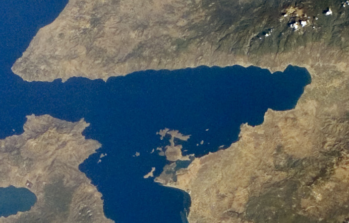
English: Gulf of Edremit, northwest Turkey. NASA satellite view (2005).
Español: Golfo de Edremit en el noroeste de Turquía. Mapa satelital de la Nasa (2005). |
| Date | |
| Source | http://eol.jsc.nasa.gov/scripts/sseop/QuickView.pl?directory=ESC&ID=ISS011-E-13602 |
| Author | NASA |
| Other versions |

Licensing[edit]
This file is in the public domain in the United States because it was created by the Image Science & Analysis Laboratory, of the NASA Johnson Space Center. NASA copyright policy states that "NASA material is not protected by copyright unless noted". (NASA media use guidelines or Conditions of Use of Astronaut Photographs).
Photo source: ISS011-E-13602.
|
File history
Click on a date/time to view the file as it appeared at that time.
| Date/Time | Thumbnail | Dimensions | User | Comment | |
|---|---|---|---|---|---|
| current | 21:55, 7 May 2023 | | 704 × 450 (130 KB) | GrandEscogriffe (talk | contribs) | File:Turkey Western. Lesbos, Dardanelles 1.JPG cropped 65 % horizontally, 85 % vertically using CropTool with lossless mode. |
You cannot overwrite this file.
File usage on Commons
The following page uses this file:
File usage on other wikis
The following other wikis use this file:
- Usage on en.wikipedia.org
- Usage on fr.wikipedia.org
- Usage on www.wikidata.org