File:Guinea-Bissau sectors.png
Jump to navigation
Jump to search

Size of this preview: 800 × 464 pixels. Other resolutions: 320 × 186 pixels | 640 × 372 pixels | 1,025 × 595 pixels.
Original file (1,025 × 595 pixels, file size: 21 KB, MIME type: image/png)
Captions
Captions
Add a one-line explanation of what this file represents
Summary[edit]
| Description |
|
||
| Date | 10 December 2006 (original upload date) | ||
| Source | No machine-readable source provided. Own work assumed (based on copyright claims). | ||
| Author | No machine-readable author provided. Electionworld assumed (based on copyright claims). |

Licensing[edit]
| I, the copyright holder of this work, release this work into the public domain. This applies worldwide. In some countries this may not be legally possible; if so: I grant anyone the right to use this work for any purpose, without any conditions, unless such conditions are required by law. |
File history
Click on a date/time to view the file as it appeared at that time.
| Date/Time | Thumbnail | Dimensions | User | Comment | |
|---|---|---|---|---|---|
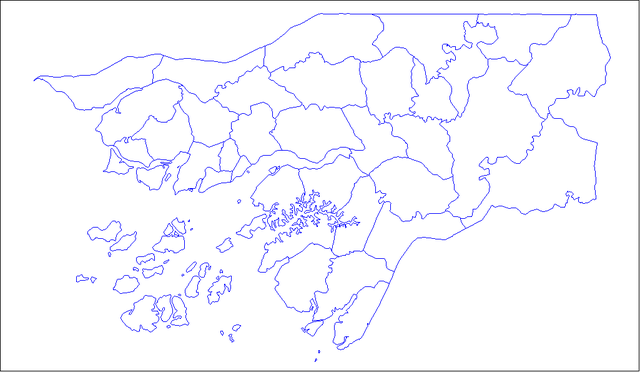
| current | 12:26, 10 December 2006 | | 1,025 × 595 (21 KB) | Electionworld (talk | contribs) | {{ew|en|Rarelibra}} Map of the sectors of Guinea-Bissau. Created by Rarelibra 16:24, 27 April 2006 (UTC) for public domain use. Created using MapInfo Professional v7.5 and various mapping resources. == Licensing == {{PD-self}} |
You cannot overwrite this file.
File usage on Commons
The following page uses this file:
File usage on other wikis
The following other wikis use this file:
- Usage on ca.wikipedia.org
- Usage on en.wikipedia.org
- Usage on es.wikipedia.org
- Usage on fi.wikipedia.org
- Usage on fr.wikipedia.org
- Usage on lt.wikipedia.org
- Usage on tr.wikipedia.org